
LNG IMO
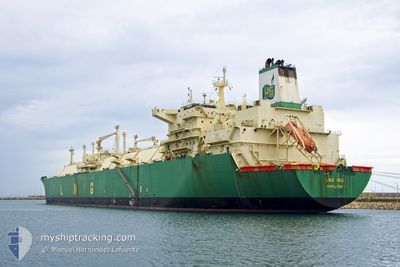
Lng Tanker
Current Trip
| Time Travelled | 3 days |
|---|---|
| Remaining Time | 22 days |
| Distance Travelled | 1302.74 nm |
| Remaining Distance | 8701.07 nm |
| AVG Speed | 14.6 Knots |
| MAX Speed | 17.5 Knots |
| AVG Wind | 23.2 knots |
| MAX Wind | 28.7 knots |
| MIN Temp | 22.3°C / 72.14°F |
| MAX Temp | 26.9°C / 80.42°F |
| Dybgang | 9.5 m |
| Position Modtaget | 3 d siden |
Current Position
| Longitude | --- |
|---|---|
| Latitude | --- |
| Status | Under way using engine |
| Fart | 9.1 Knots |
| Kurs | 263.8° |
| Område | South China Sea |
| Station | T-AIS |
| Position Modtaget | 3 d siden |
Info
Information
The current position of LNG IMO is in South China Sea with coordinates 22.49482° / 119.83201° as reported on 2025-12-03 02:46 by AIS to our vessel tracker app. The vessel's current speed is 9.1 Knots and is heading at the port of BONNY. The estimated time of arrival as calculated by MyShipTracking vessel tracking app is 2025-12-29 12:56 LT
The vessel LNG IMO (IMO: 9311581, MMSI: 310565000) is a Lng Tanker that was built in 2007 ( 18 år gamle ). It's sailing under the flag of [BM] Bermuda.
In this page you can find informations about the vessels current position, last detected port calls, and current voyage information. If the vessels is not in coverage by AIS you will find the latest position.
The current position of LNG IMO is detected by our AIS receivers and we are not responsible for the reliability of the data. The last position was recorded while the vessel was in Coverage by the Ais receivers of our vessel tracking app.
The current draught of LNG IMO as reported by AIS is 9.5 meters
Weather
| Temperature | 26.9°C / 80.42°F |
|---|---|
| Wind Speed | 22 knots |
| Direction | 38° NE |
| Pressure | 1010.4 hPa |
| Humidity | 79.2 % |
| Cloud Coverage | 100 % |
Featured Company
Events
| Tid | Hændelsen | Detaljer | Position / Dest | Info |
|---|---|---|---|---|
| 2025-12-03 02:56 | Status er ændret | Default Under way using engine |
22.49179 / 119.80480
NG BON
|
Fart: 9.1 kn Kurs: 263.8° |
| 2025-12-03 02:46 | Udenfor Dækning |
22.49482 / 119.83201
South China Sea
|
Fart: 9.1 kn Kurs: 263.8° |
|
| 2025-12-03 02:30 | Status er ændret | Under way using engine Default |
22.50099 / 119.87401
NG BON
|
Fart: 10 kn Kurs: 206° |
| 2025-12-03 02:18 | Status er ændret | Default Under way using engine |
22.53077 / 119.89039
NG BON
|
Fart: 11.1 kn Kurs: 206.3° |
| 2025-12-03 02:08 | Status er ændret | Under way using engine Default |
22.55742 / 119.90504
NG BON
|
Fart: 11.2 kn Kurs: 207° |
| 2025-12-03 01:28 | Status er ændret | Default Under way using engine |
22.66880 / 119.96929
NG BON
|
Fart: 11.2 kn Kurs: 207.4° |
| 2025-12-03 01:24 | Status er ændret | Under way using engine Default |
22.67960 / 119.97608
NG BON
|
Fart: 11.4 kn Kurs: 213° |
| 2025-12-03 01:04 | Status er ændret | Default Under way using engine |
22.73358 / 120.00988
NG BON
|
Fart: 11.5 kn Kurs: 214.4° |
| 2025-12-03 00:59 | Status er ændret | Under way using engine Default |
22.74658 / 120.01905
NG BON
|
Fart: 11.2 kn Kurs: 211° |
| 2025-12-03 00:47 | Status er ændret | Default Under way using engine |
22.77853 / 120.04523
NG BON
|
Fart: 11.3 kn Kurs: 211.9° |