
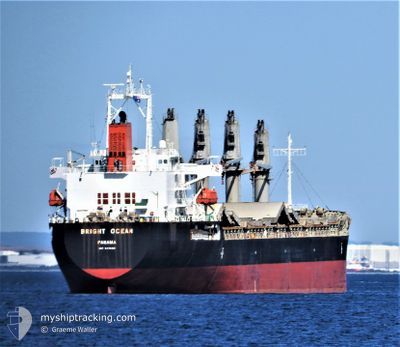
LA LOUISE
Bulk Carrier
Current Trip
PE CLL
| Time Travelled | 12 days |
|---|---|
| Remaining Time | --- |
| Distance Travelled | 227.41 nm |
| Remaining Distance | --- |
| AVG Speed | 10.8 Knop |
| MAX Speed | 12.7 Knop |
| AVG Wind | 9.3 knots |
| MAX Wind | 16.9 knots |
| MIN Temp | 15.7°C / 60.26°F |
| MAX Temp | 17.7°C / 63.86°F |
| Djupgående | 10.4 m |
| Position mottagen | 6 d sen |
Current Position
| Longitud | -77.21353° |
|---|---|
| Latitude | -12.01421° |
| Status | At anchor |
| Fart | 0.1 Knop |
| Kurs | 149° |
| Område | South Pacific Ocean |
| Station | T-AIS |
| Position mottagen | 6 d sen |
Info
Information
The current position of LA LOUISE is in South Pacific Ocean with coordinates -12.01421° / -77.21353° as reported on 2024-05-25 01:43 by AIS to our vessel tracker app. The vessel's current speed is 0.1 Knop
The vessel LA LOUISE (IMO: 9470301, MMSI: 636022685) is a Bulk Carrier that was built in 2012 ( 12 År gammal ). It's sailing under the flag of [LR] Liberia.
In this page you can find informations about the vessels current position, last detected port calls, and current voyage information. If the vessels is not in coverage by AIS you will find the latest position.
The current position of LA LOUISE is detected by our AIS receivers and we are not responsible for the reliability of the data. The last position was recorded while the vessel was in Coverage by the Ais receivers of our vessel tracking app.
The current draught of LA LOUISE as reported by AIS is 10.4 meters
Weather
| Temperature | 16.7°C / 62.06°F |
|---|---|
| Wind Speed | 14 knots |
| Direction | 146° SE |
| Pressure | 1012.1 hPa |
| Humidity | 88.9 % |
| Cloud Coverage | 4 % |
Featured Company
Last Port Calls
| Port | Arrival | Departure | Time In Port |
|---|---|---|---|
| 2024-05-15 14:41 | 2024-05-19 02:23 | 3 d | |
| 2024-04-24 14:10 | 2024-04-27 18:42 | 3 d | |
| 2024-03-19 15:10 | 2024-03-21 04:16 | 1 d | |
| 2024-03-12 21:37 | |||
| 2024-03-01 02:43 |
Last Trips
| Origin | Departure | Destination | Arrival | Distance | |
|---|---|---|---|---|---|
| 2024-04-27 18:42 | 2024-05-15 14:41 | 4370.61 nm | |||
| 2024-03-21 04:16 | 2024-04-24 14:10 | 5611.23 nm | |||
| 2024-03-12 21:37 | 2024-03-19 15:10 | 1694.73 nm | |||
| 2024-02-25 04:50 | 2024-03-01 02:43 | 117.49 nm |
Events
| Tid | Event | Detaljer | Position / Dest | Information |
|---|---|---|---|---|
| 2024-05-31 06:51 | STARTAR förflyttning | 7.72 nm, South East of JOSE OLAYA |
-12.25892 / -76.94511
PE CLL
|
Fart: 5.1 kn Kurs: 223° |
| 2024-05-27 13:40 | STOPPAR förflyttning | 7.7 nm, South East of JOSE OLAYA |
-12.25271 / -76.93918
PE CLL
|
Fart: 0.2 kn Kurs: 215° |
| 2024-05-27 09:46 | STARTAR förflyttning | 4.09 nm, North West of CALLAO |
-12.01903 / -77.21397
PE CLL
|
Fart: 5 kn Kurs: 215° |
| 2024-05-25 01:50 | Status ändrad | Default At anchor |
-12.01421 / -77.21358
PE CLL
|
Fart: 0.1 kn Kurs: 149° |
| 2024-05-25 01:43 | Status ändrad | At anchor Default |
-12.01421 / -77.21353
PE CLL
|
Fart: 0.1 kn Kurs: 150° |
| 2024-05-25 01:43 | UTANFÖR täckningsområde |
-12.01421 / -77.21353
South Pacific Ocean
|
Fart: 0.1 kn Kurs: 58.2° |
|
| 2024-05-25 01:41 | Status ändrad | Default At anchor |
-12.01421 / -77.21352
PE CLL
|
Fart: 0.3 kn Kurs: 145° |
| 2024-05-25 01:35 | Status ändrad | At anchor Default |
-12.01425 / -77.21354
PE CLL
|
Fart: 0.3 kn Kurs: 142° |
| 2024-05-25 01:31 | Status ändrad | Default At anchor |
-12.01430 / -77.21357
PE CLL
|
Fart: 0.1 kn Kurs: 139° |
| 2024-05-25 01:20 | Status ändrad | At anchor Default |
-12.01439 / -77.21367
PE CLL
|
Fart: 0.1 kn Kurs: 143° |