
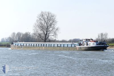
KARIN
Cargo
Current Trip
| Trip Time | 7 days |
|---|---|
| Trip Distance | 152.51 nm |
| AVG Speed | 4.6 Knop |
| MAX Speed | 6.8 Knop |
| Djupgående | 2 m |
| AVG Wind | 7.7 knots |
| MAX Wind | 9 knots |
| MIN Temp | -4.4°C / 24.08°F |
| MAX Temp | 2.4°C / 36.32°F |
| Position mottagen | 3 m sen |
Current Position
| Longitud | --- |
|---|---|
| Latitude | --- |
| Status | Under way using engine |
| Fart | |
| Kurs | --- |
| Område | North Sea |
| Station | T-AIS |
| Position mottagen | 3 m sen |
Info
Information
The current position of KARIN is in North Sea with coordinates 49.01943° / 12.15110° as reported on 2026-01-09 12:23 by AIS to our vessel tracker app. The vessel's current speed is 0 Knop and is currently inside the port of REGENSBURG.
The vessel KARIN (MMSI: 211544880) is a Cargo It's sailing under the flag of [DE] Germany.
In this page you can find informations about the vessels current position, last detected port calls, and current voyage information. If the vessels is not in coverage by AIS you will find the latest position.
The current position of KARIN is detected by our AIS receivers and we are not responsible for the reliability of the data. The last position was recorded while the vessel was in Coverage by the Ais receivers of our vessel tracking app.
The current draught of KARIN as reported by AIS is 2 meters
Weather
| Temperature | 2.1°C / 35.78°F |
|---|---|
| Wind Speed | 4 knots |
| Direction | 133° SE |
| Pressure | 998.2 hPa |
| Humidity | 99.8 % |
| Cloud Coverage | 100 % |
Featured Company
Last Port Calls
| Port | Arrival | Departure | Time In Port |
|---|---|---|---|
| 2026-01-07 14:40 | |||
| 2025-12-31 13:41 | 2025-12-31 14:16 | 34 m | |
| 2025-12-31 12:14 | 2025-12-31 12:39 | 24 m | |
| 2025-12-31 10:56 | 2025-12-31 11:22 | 26 m | |
| 2025-12-30 20:04 | 2025-12-31 07:54 | 11 h | |
| 2025-12-28 17:42 | 2025-12-29 07:26 | 13 h | |
| 2025-12-26 11:10 | 2025-12-28 10:40 | 1 d | |
| 2025-12-25 14:39 | 2025-12-26 07:53 | 17 h | |
| 2025-12-24 14:22 | 2025-12-24 15:41 | 1 h | |
| 2025-12-23 15:28 | 2025-12-24 08:01 | 16 h |
Most Visited Ports (Last year)
| Port | Arrivals | |
|---|---|---|
| 16 | ||
| 16 | ||
| 15 | ||
| 9 | ||
| 6 | ||
| 5 |
Last Trips
| Origin | Departure | Destination | Arrival | Distance | |
|---|---|---|---|---|---|
| 2025-12-31 14:16 | 2026-01-07 14:40 | 152.51 nm | |||
| 2025-12-31 12:39 | 2025-12-31 13:41 | 6.66 nm | |||
| 2025-12-31 11:22 | 2025-12-31 12:14 | 4.81 nm | |||
| 2025-12-31 07:54 | 2025-12-31 10:56 | 12.88 nm | |||
| 2025-12-29 07:26 | 2025-12-30 20:04 | 90.11 nm | |||
| 2025-12-28 10:40 | 2025-12-28 17:42 | 24.59 nm | |||
| 2025-12-26 07:53 | 2025-12-26 11:10 | 18.34 nm | |||
| 2025-12-24 15:41 | 2025-12-25 14:39 | 41.90 nm | |||
| 2025-12-24 08:01 | 2025-12-24 14:22 | 36.64 nm | |||
| 2025-12-20 10:57 | 2025-12-23 15:28 | 215.93 nm |
Events
| Tid | Event | Detaljer | Position / Dest | Information |
|---|---|---|---|---|
| 2026-01-07 13:41 | STOPPAR förflyttning |
49.01949 / 12.15131
[DE] REGENSBURG
|
Fart: 0.3 kn Kurs: 511° |
|
| 2026-01-07 13:40 | ANLÄNDER HAMN |
|
49.01956 / 12.15142
[DE] REGENSBURG
|
Fart: 0.7 kn Kurs: 511° |
| 2026-01-07 13:09 | I täckningsområde |
49.02607 / 12.10235
North Sea
ENNS
|
Fart: 6 kn Kurs: 102° |
|
| 2026-01-04 14:00 | UTANFÖR täckningsområde |
49.61559 / 10.97419
North Sea
ENNS
|
Fart: 4.8 kn Kurs: 199.8° |
|
| 2026-01-04 13:56 | STARTAR förflyttning | 13.56 nm, North of NUREMBERG |
49.62051 / 10.97786
ENNS
|
Fart: 3.4 kn Kurs: 207.2° |
| 2026-01-04 13:47 | STOPPAR förflyttning | 13.7 nm, North of NUREMBERG |
49.62316 / 10.97981
ENNS
|
Fart: Kurs: 511° |
| 2026-01-04 12:27 | STARTAR förflyttning | 13.96 nm, South East of BAMBERG |
49.68318 / 11.03495
ENNS
|
Fart: 3.1 kn Kurs: 216.6° |
| 2026-01-04 11:57 | STOPPAR förflyttning | 13.88 nm, South East of BAMBERG |
49.68550 / 11.03828
ENNS
|
Fart: 0.3 kn Kurs: 511° |
| 2026-01-04 11:34 | I täckningsområde |
49.70638 / 11.05373
North Sea
ENNS
|
Fart: 5.7 kn Kurs: 174.3° |
|
| 2025-12-31 13:22 | UTANFÖR täckningsområde |
50.12750 / 8.90589
North Sea
ENNS
|
Fart: 5.6 kn Kurs: 139.3° |