
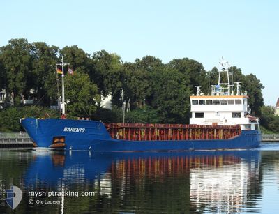
BARENTS
General Cargo
Current Trip
| Time Travelled | 4 days |
|---|---|
| Remaining Time | --- |
| Distance Travelled | 882.50 nm |
| Remaining Distance | --- |
| AVG Speed | 8.4 Knop |
| MAX Speed | 11.7 Knop |
| AVG Wind | 15.2 knots |
| MAX Wind | 25.4 knots |
| MIN Temp | 10.9°C / 51.62°F |
| MAX Temp | 15.4°C / 59.72°F |
| Djupgående | 4.9 m |
| Position mottagen | 2 h, 7 m sen |
Current Position
| Longitud | -10.10746° |
|---|---|
| Latitude | 41.08059° |
| Status | Under way using engine |
| Fart | 9.5 Knop |
| Kurs | 178.5° |
| Område | North Atlantic Ocean |
| Station | T-AIS |
| Position mottagen | 2 h, 7 m sen |
Info
Information
The current position of BARENTS is in North Atlantic Ocean with coordinates 41.08059° / -10.10746° as reported on 2024-05-06 15:28 by AIS to our vessel tracker app. The vessel's current speed is 9.5 Knop and is heading at the port of RAVENNA. The estimated time of arrival as calculated by MyShipTracking vessel tracking app is 2024-05-16 08:00 LT
The vessel BARENTS (IMO: 9356866, MMSI: 305059000) is a General Cargo that was built in 2007 ( 17 År gammal ). It's sailing under the flag of [AG] Antigua Barbuda.
In this page you can find informations about the vessels current position, last detected port calls, and current voyage information. If the vessels is not in coverage by AIS you will find the latest position.
The current position of BARENTS is detected by our AIS receivers and we are not responsible for the reliability of the data. The last position was recorded while the vessel was in Coverage by the Ais receivers of our vessel tracking app.
The current draught of BARENTS as reported by AIS is 4.9 meters
Weather
| Temperature | 14.6°C / 58.28°F |
|---|---|
| Wind Speed | 14 knots |
| Direction | 345° NNW |
| Pressure | 1019.8 hPa |
| Humidity | 73.8 % |
| Cloud Coverage | --- |
Featured Company
Last Port Calls
| Port | Arrival | Departure | Time In Port |
|---|---|---|---|
| 2024-04-30 10:08 | 2024-05-02 14:28 | 2 d | |
| 2024-04-25 07:16 | 2024-04-28 14:07 | 3 d | |
| 2024-04-18 10:12 | 2024-04-21 13:58 | 3 d | |
| 2024-04-16 16:14 | 2024-04-16 16:24 | 9 m | |
| 2024-04-15 03:17 | 2024-04-16 14:28 | 1 d | |
| 2024-04-12 07:54 | 2024-04-12 20:30 | 12 h | |
| 2024-04-09 19:43 | 2024-04-11 19:02 | 1 d | |
| 2024-03-27 12:41 | 2024-03-28 15:16 | 1 d | |
| 2024-03-25 04:09 | 2024-03-25 20:34 | 16 h | |
| 2024-03-18 16:21 | 2024-03-19 13:00 | 20 h |
Most Visited Ports (Last year)
| Port | Arrivals | |
|---|---|---|
| 7 | ||
| 6 | ||
| 3 | ||
| 3 | ||
| 3 | ||
| 2 |
Last Trips
| Origin | Departure | Destination | Arrival | Distance | |
|---|---|---|---|---|---|
| 2024-04-28 16:07 | 2024-04-30 12:08 | 409.64 nm | |||
| 2024-04-21 14:58 | 2024-04-25 09:16 | 424.73 nm | |||
| 2024-04-16 18:24 | 2024-04-18 11:12 | 280.63 nm | |||
| 2024-04-16 16:28 | 2024-04-16 18:14 | 10.74 nm | |||
| 2024-04-12 21:30 | 2024-04-15 05:17 | 218.04 nm | |||
| 2024-04-11 20:02 | 2024-04-12 08:54 | 103.08 nm | |||
| 2024-03-28 16:16 | 2024-04-09 20:43 | 838.28 nm | |||
| 2024-03-25 21:34 | 2024-03-27 13:41 | 217.67 nm | |||
| 2024-03-19 14:00 | 2024-03-25 05:09 | 1238.05 nm | |||
| 2024-03-06 23:53 | 2024-03-18 17:21 | 1355.95 nm |
Events
| Tid | Event | Detaljer | Position / Dest | Information |
|---|---|---|---|---|
| 2024-05-06 15:38 | Status ändrad | Default Under way using engine |
41.04833 / -10.10500
ITRAN
|
Fart: 9.5 kn Kurs: 178.5° |
| 2024-05-06 15:28 | Byter havsområde | Portuguese part of the North Atlantic Ocean French part of the Celtic Sea |
41.08059 / -10.10746
North Atlantic Ocean
ITRAN
|
Fart: 9.5 kn Kurs: 178.5° |
| 2024-05-06 15:28 | Status ändrad | Under way using engine Default |
41.08059 / -10.10746
ITRAN
|
Fart: 9 kn Kurs: 176° |
| 2024-05-06 15:28 | UTANFÖR täckningsområde |
41.08059 / -10.10746
North Atlantic Ocean
ITRAN
|
Fart: 9.5 kn Kurs: 178.5° |
|
| 2024-05-06 15:23 | I täckningsområde |
41.08059 / -10.10746
North Atlantic Ocean
ITRAN
|
Fart: 9.5 kn Kurs: 178.5° |
|
| 2024-05-04 01:35 | Status ändrad | Default Under way using engine |
49.15333 / -5.02500
ITRAN
|
Fart: 9.1 kn Kurs: 240.2° |
| 2024-05-04 01:30 | Byter havsområde | French part of the Celtic Sea French part of the English Channel |
49.15970 / -5.01121
Celtic Sea
ITRAN
|
Fart: 9.1 kn Kurs: 240.2° |
| 2024-05-04 01:30 | UTANFÖR täckningsområde |
49.15970 / -5.01121
Celtic Sea
ITRAN
|
Fart: 9.1 kn Kurs: 240.2° |
|
| 2024-05-04 01:16 | Status ändrad | Under way using engine Default |
49.17795 / -4.96495
ITRAN
|
Fart: 9 kn Kurs: 238° |
| 2024-05-04 01:02 | I täckningsområde |
49.17773 / -4.96549
English Channel
ITRAN
|
Fart: 9.1 kn Kurs: 239.3° |