
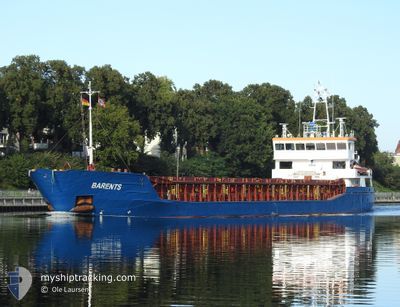
BARENTS
General Cargo
Current Trip
| Time Travelled | 2 days |
|---|---|
| Remaining Time | --- |
| Distance Travelled | 409.48 nm |
| Remaining Distance | --- |
| AVG Speed | 8.6 Knots |
| MAX Speed | 11.9 Knots |
| AVG Wind | 8.9 knots |
| MAX Wind | 13 knots |
| MIN Temp | 5.9°C / 42.62°F |
| MAX Temp | 9.3°C / 48.74°F |
| Dybgang | 5.3 m |
| Position Modtaget | 2 m siden |
Current Position
| Longitude | 9.54343° |
|---|---|
| Latitude | 53.61762° |
| Status | At anchor |
| Fart | |
| Kurs | 150° |
| Område | North Sea |
| Station | T-AIS |
| Position Modtaget | 2 m siden |
Info
Information
The current position of BARENTS is in North Sea with coordinates 53.61762° / 9.54343° as reported on 2024-04-23 16:51 by AIS to our vessel tracker app. The vessel's current speed is 0 Knots
The vessel BARENTS (IMO: 9356866, MMSI: 305059000) is a General Cargo that was built in 2007 ( 17 år gamle ). It's sailing under the flag of [AG] Antigua Barbuda.
In this page you can find informations about the vessels current position, last detected port calls, and current voyage information. If the vessels is not in coverage by AIS you will find the latest position.
The current position of BARENTS is detected by our AIS receivers and we are not responsible for the reliability of the data. The last position was recorded while the vessel was in Coverage by the Ais receivers of our vessel tracking app.
The current draught of BARENTS as reported by AIS is 5.3 meters
Weather
| Temperature | 9°C / 48.2°F |
|---|---|
| Wind Speed | 9 knots |
| Direction | 235° SW |
| Pressure | 1012.5 hPa |
| Humidity | 56.2 % |
| Cloud Coverage | 99 % |
Featured Company
Last Port Calls
| Port | Arrival | Departure | Time In Port |
|---|---|---|---|
| 2024-04-18 10:12 | 2024-04-21 13:58 | 3 d | |
| 2024-04-16 16:14 | 2024-04-16 16:24 | 9 m | |
| 2024-04-15 03:17 | 2024-04-16 14:28 | 1 d | |
| 2024-04-12 07:54 | 2024-04-12 20:30 | 12 h | |
| 2024-04-09 19:43 | 2024-04-11 19:02 | 1 d | |
| 2024-03-27 12:41 | 2024-03-28 15:16 | 1 d | |
| 2024-03-25 04:09 | 2024-03-25 20:34 | 16 h | |
| 2024-03-18 16:21 | 2024-03-19 13:00 | 20 h | |
| 2024-03-03 20:16 | 2024-03-06 22:53 | 3 d | |
| 2024-02-24 06:25 | 2024-02-26 19:25 | 2 d |
Most Visited Ports (Last year)
| Port | Arrivals | |
|---|---|---|
| 8 | ||
| 7 | ||
| 3 | ||
| 3 | ||
| 3 | ||
| 2 |
Last Trips
| Origin | Departure | Destination | Arrival | Distance | |
|---|---|---|---|---|---|
| 2024-04-16 18:24 | 2024-04-18 11:12 | 280.63 nm | |||
| 2024-04-16 16:28 | 2024-04-16 18:14 | 10.74 nm | |||
| 2024-04-12 21:30 | 2024-04-15 05:17 | 218.04 nm | |||
| 2024-04-11 20:02 | 2024-04-12 08:54 | 103.08 nm | |||
| 2024-03-28 16:16 | 2024-04-09 20:43 | 838.28 nm | |||
| 2024-03-25 21:34 | 2024-03-27 13:41 | 217.67 nm | |||
| 2024-03-19 14:00 | 2024-03-25 05:09 | 1238.05 nm | |||
| 2024-03-06 23:53 | 2024-03-18 17:21 | 1355.95 nm | |||
| 2024-02-26 19:25 | 2024-03-03 21:16 | 872.57 nm | |||
| 2024-02-21 06:57 | 2024-02-24 06:25 | 555.44 nm |
Events
| Tid | Hændelsen | Detaljer | Position / Dest | Info |
|---|---|---|---|---|
| 2024-04-23 10:48 | STOP Sejllads | 0.77 nm, South East of STADERSAND |
53.61587 / 9.54671
DEHAM
|
Fart: 0.2 kn Kurs: 325° |
| 2024-04-23 10:48 | Status er ændret | At anchor Under way using engine |
53.61586 / 9.54673
DEHAM
|
Fart: 0.6 kn Kurs: 318° |
| 2024-04-23 05:11 | Status er ændret | Under way using engine Default |
53.95920 / 8.59384
DEHAM
|
Fart: 7.6 kn Kurs: 106° |
| 2024-04-23 05:00 | Status er ændret | Default Under way using engine |
53.96540 / 8.55405
DEHAM
|
Fart: 7.2 kn Kurs: 99.1° |
| 2024-04-23 04:40 | Ændre havområde | German part of the North Sea United Kingdom part of the North Sea |
53.97169 / 8.48839
North Sea
DEHAM
|
Fart: 7.2 kn Kurs: 97.6° |
| 2024-04-23 04:40 | Status er ændret | Under way using engine Default |
53.97169 / 8.48839
DEHAM
|
Fart: 7.1 kn Kurs: 99° |
| 2024-04-23 04:28 | Indenfor Dækning |
53.97169 / 8.48839
North Sea
DEHAM
|
Fart: 7.2 kn Kurs: 97.6° |
|
| 2024-04-22 03:49 | Status er ændret | Default Under way using engine |
54.18333 / 2.02500
DEHAM
|
Fart: 9.5 kn Kurs: 107° |
| 2024-04-22 03:47 | Udenfor Dækning |
54.18614 / 2.01442
North Sea
DEHAM
|
Fart: 9.5 kn Kurs: 107° |
|
| 2024-04-22 03:13 | Status er ændret | Under way using engine Default |
54.21205 / 1.86665
DEHAM
|
Fart: 9 kn Kurs: 101° |