
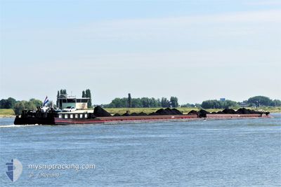
KVB SUNNY & BLACK
Cargo
Current Trip
RHEIN KM 780
| Time Travelled | 5 days |
|---|---|
| Remaining Time | --- |
| Distance Travelled | 266.01 nm |
| Remaining Distance | --- |
| AVG Speed | 6.3 Knop |
| MAX Speed | 10.2 Knop |
| AVG Wind | 5.8 knots |
| MAX Wind | 10.4 knots |
| MIN Temp | 9.8°C / 49.64°F |
| MAX Temp | 25.8°C / 78.44°F |
| Djupgående | 2.7 m |
| Position mottagen | 1 m sen |
Current Position
| Longitud | 8.45387° |
|---|---|
| Latitude | 49.31498° |
| Status | Under way using engine |
| Fart | 9.3 Knop |
| Kurs | 317.7° |
| Område | North Sea |
| Station | T-AIS |
| Position mottagen | 1 m sen |
Info
Information
The current position of KVB SUNNY & BLACK is in North Sea with coordinates 49.31498° / 8.45387° as reported on 2024-05-05 03:26 by AIS to our vessel tracker app. The vessel's current speed is 9.3 Knop
The vessel KVB SUNNY & BLACK (MMSI: 244700031) is a Cargo It's sailing under the flag of [NL] Netherlands.
In this page you can find informations about the vessels current position, last detected port calls, and current voyage information. If the vessels is not in coverage by AIS you will find the latest position.
The current position of KVB SUNNY & BLACK is detected by our AIS receivers and we are not responsible for the reliability of the data. The last position was recorded while the vessel was in Coverage by the Ais receivers of our vessel tracking app.
The current draught of KVB SUNNY & BLACK as reported by AIS is 2.7 meters
Weather
| Temperature | 12.7°C / 54.86°F |
|---|---|
| Wind Speed | 8 knots |
| Direction | 213° SSW |
| Pressure | 1011 hPa |
| Humidity | 95.7 % |
| Cloud Coverage | 100 % |
Featured Company
Last Port Calls
| Port | Arrival | Departure | Time In Port |
|---|---|---|---|
| 2024-04-23 15:09 | 2024-04-29 13:26 | 5 d | |
| 2024-04-14 14:37 | 2024-04-19 12:01 | 4 d | |
| 2024-04-13 18:47 | 2024-04-14 03:25 | 8 h | |
| 2024-04-12 19:09 | 2024-04-13 09:23 | 14 h | |
| 2024-04-12 09:39 | 2024-04-12 10:26 | 46 m | |
| 2024-04-12 04:07 | 2024-04-12 05:15 | 1 h | |
| 2024-04-08 11:51 | |||
| 2024-04-07 17:05 | 2024-04-07 17:52 | 47 m | |
| 2024-04-06 18:06 | 2024-04-07 14:18 | 20 h | |
| 2024-04-05 12:33 | 2024-04-06 05:14 | 16 h |
Most Visited Ports (Last year)
| Port | Arrivals | |
|---|---|---|
| 34 | ||
| 16 | ||
| 11 | ||
| 8 | ||
| 6 | ||
| 6 |
Last Trips
| Origin | Departure | Destination | Arrival | Distance | |
|---|---|---|---|---|---|
| 2024-04-19 14:01 | 2024-04-23 17:09 | 3.55 nm | |||
| 2024-04-14 05:25 | 2024-04-14 16:37 | 59.13 nm | |||
| 2024-04-13 11:23 | 2024-04-13 20:47 | 62.26 nm | |||
| 2024-04-12 12:26 | 2024-04-12 21:09 | 86.71 nm | |||
| 2024-04-12 07:15 | 2024-04-12 11:39 | 34.26 nm | |||
| 2024-04-07 19:52 | 2024-04-12 06:07 | 101.83 nm | |||
| 2024-04-07 19:52 | 2024-04-08 13:51 | 97.10 nm | |||
| 2024-04-07 16:18 | 2024-04-07 19:05 | 25.37 nm | |||
| 2024-04-06 07:14 | 2024-04-06 20:06 | 122.57 nm | |||
| 2024-04-05 13:11 | 2024-04-05 14:33 | 1.18 nm |
Events
| Tid | Event | Detaljer | Position / Dest | Information |
|---|---|---|---|---|
| 2024-05-05 02:20 | STARTAR förflyttning | 1.89 nm, South of GERMERSHEIM |
49.19268 / 8.38210
RHEIN KM 780
|
Fart: 3.3 kn Kurs: 5.6° |
| 2024-05-05 02:19 | Status ändrad | Under way using engine Moored |
49.19209 / 8.38199
RHEIN KM 780
|
Fart: Kurs: 511° |
| 2024-05-04 20:41 | Status ändrad | Moored Under way using engine |
49.19151 / 8.38221
RHEIN KM 780
|
Fart: Kurs: 511° |
| 2024-05-04 20:18 | STOPPAR förflyttning | 2.01 nm, South of GERMERSHEIM |
49.19077 / 8.38233
RHEIN KM 780
|
Fart: Kurs: 511° |
| 2024-05-04 18:07 | Destination ändrad | RHEIN KM 780 BREISACH |
48.89926 / 8.14346
RHEIN KM 780
|
Fart: 9.9 kn Kurs: 32.1° |
| 2024-05-04 18:07 | ETA ändrat | 2024/05/07 05:52 2024/05/02 09:33 |
48.89926 / 8.14346
RHEIN KM 780
|
Fart: 9.9 kn Kurs: 32.1° |
| 2024-05-04 17:44 | STARTAR förflyttning | 4.69 nm, South of MUNCHHAUSEN |
48.84275 / 8.11569
BREISACH
|
Fart: 6.1 kn Kurs: 12.2° |
| 2024-05-04 16:57 | STOPPAR förflyttning | 5.67 nm, South of MUNCHHAUSEN |
48.82670 / 8.11104
BREISACH
|
Fart: Kurs: 511° |
| 2024-05-04 16:01 | I täckningsområde |
48.79080 / 8.04382
North Sea
|
Fart: 8.2 kn Kurs: 86.9° |
|
| 2024-05-02 05:36 | UTANFÖR täckningsområde |
48.78150 / 8.02540
North Sea
BREISACH
|
Fart: 8.4 kn Kurs: 189.7° |