
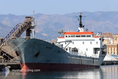
ISLAS DOS
General Cargo
Current Trip
| Time Travelled | 14 h, 54 mins |
|---|---|
| Remaining Time | 1 day |
| Distance Travelled | 163.81 nm |
| Remaining Distance | 543.34 nm |
| AVG Speed | 11.1 Knop |
| MAX Speed | 11.6 Knop |
| AVG Wind | 5.3 knots |
| MAX Wind | 10 knots |
| MIN Temp | 19.1°C / 66.38°F |
| MAX Temp | 20.6°C / 69.08°F |
| Djupgående | 4.6 m |
| Position mottagen | 45 m sen |
Current Position
| Longitud | --- |
|---|---|
| Latitude | --- |
| Status | Under way using engine |
| Fart | 11.3 Knop |
| Kurs | 35.9° |
| Område | North Atlantic Ocean |
| Station | T-AIS |
| Position mottagen | 45 m sen |
Info
Information
The current position of ISLAS DOS is in North Atlantic Ocean with coordinates 30.53793° / -11.98382° as reported on 2025-12-08 13:00 by AIS to our vessel tracker app. The vessel's current speed is 11.3 Knop and is heading at the port of MALAGA. The estimated time of arrival as calculated by MyShipTracking vessel tracking app is 2025-12-10 14:36 LT
The vessel ISLAS DOS (IMO: 7391783, MMSI: 351774000) is a General Cargo that was built in 1975 ( 50 År gammal ). It's sailing under the flag of [PA] Panama.
In this page you can find informations about the vessels current position, last detected port calls, and current voyage information. If the vessels is not in coverage by AIS you will find the latest position.
The current position of ISLAS DOS is detected by our AIS receivers and we are not responsible for the reliability of the data. The last position was recorded while the vessel was in Coverage by the Ais receivers of our vessel tracking app.
The current draught of ISLAS DOS as reported by AIS is 4.6 meters
Weather
| Temperature | 19.9°C / 67.82°F |
|---|---|
| Wind Speed | 4 knots |
| Direction | 143° SE |
| Pressure | 1020.8 hPa |
| Humidity | 56.9 % |
| Cloud Coverage | 97 % |
Featured Company
Last Port Calls
| Port | Arrival | Departure | Time In Port |
|---|---|---|---|
| 2025-12-06 19:29 | 2025-12-07 22:51 | 1 d | |
| 2025-12-03 07:16 | 2025-12-06 04:39 | 2 d | |
| 2025-11-30 16:16 | 2025-12-02 18:52 | 2 d | |
| 2025-11-26 14:42 | 2025-11-30 02:36 | 3 d | |
| 2025-11-24 08:17 | 2025-11-25 18:59 | 1 d | |
| 2025-11-21 00:21 | 2025-11-23 13:15 | 2 d | |
| 2025-11-19 07:31 | 2025-11-20 12:04 | 1 d | |
| 2025-11-15 22:45 | 2025-11-18 16:18 | 2 d | |
| 2025-11-14 09:04 | 2025-11-15 19:44 | 1 d | |
| 2025-11-10 15:24 | 2025-11-13 18:27 | 3 d |
Most Visited Ports (Last year)
| Port | Arrivals | |
|---|---|---|
| 17 | ||
| 13 | ||
| 11 | ||
| 6 | ||
| 6 | ||
| 3 |
Last Trips
| Origin | Departure | Destination | Arrival | Distance | |
|---|---|---|---|---|---|
| 2025-12-06 04:39 | 2025-12-06 19:29 | 29.84 nm | |||
| 2025-12-02 18:52 | 2025-12-03 07:16 | 121.19 nm | |||
| 2025-11-30 02:36 | 2025-11-30 16:16 | 150.96 nm | |||
| 2025-11-25 18:59 | 2025-11-26 14:42 | 160.80 nm | |||
| 2025-11-23 13:15 | 2025-11-24 08:17 | 151.01 nm | |||
| 2025-11-20 12:04 | 2025-11-21 00:21 | 129.26 nm | |||
| 2025-11-18 16:18 | 2025-11-19 07:31 | 132.72 nm | |||
| 2025-11-15 19:44 | 2025-11-15 22:45 | 32.81 nm | |||
| 2025-11-13 18:27 | 2025-11-14 09:04 | 150.38 nm | |||
| 2025-11-10 15:21 | 2025-11-10 15:24 | 0.19 nm |
Events
| Tid | Event | Detaljer | Position / Dest | Information |
|---|---|---|---|---|
| 2025-12-08 13:07 | Status ändrad | Default Under way using engine |
30.55368 / -11.96872
ESAGP
|
Fart: 11.3 kn Kurs: 35.9° |
| 2025-12-08 12:36 | Status ändrad | Under way using engine Default |
30.47614 / -12.03705
ESAGP
|
Fart: 11.3 kn Kurs: 37° |
| 2025-12-08 12:36 | I täckningsområde |
30.47614 / -12.03705
North Atlantic Ocean
ESAGP
|
Fart: 11.3 kn Kurs: 35.8° |
|
| 2025-12-08 10:35 | Status ändrad | Default Under way using engine |
30.16572 / -12.29402
ESAGP
|
Fart: 10.8 kn Kurs: 37.5° |
| 2025-12-08 10:29 | UTANFÖR täckningsområde |
30.15095 / -12.30630
North Atlantic Ocean
ESAGP
|
Fart: 10.8 kn Kurs: 37.5° |
|
| 2025-12-08 09:47 | Status ändrad | Under way using engine Default |
30.04887 / -12.40123
ESAGP
|
Fart: 11.3 kn Kurs: 39° |
| 2025-12-08 09:38 | Status ändrad | Default Under way using engine |
30.02568 / -12.42378
ESAGP
|
Fart: 11.3 kn Kurs: 45° |
| 2025-12-08 09:33 | Status ändrad | Under way using engine Default |
30.01500 / -12.43548
ESAGP
|
Fart: 11.3 kn Kurs: 45° |
| 2025-12-08 09:18 | I täckningsområde |
30.01500 / -12.43548
North Atlantic Ocean
ESAGP
|
Fart: 11.3 kn Kurs: 45° |
|
| 2025-12-08 07:47 | UTANFÖR täckningsområde |
29.75292 / -12.65718
North Atlantic Ocean
ESAGP
|
Fart: 10.8 kn Kurs: 36.5° |