
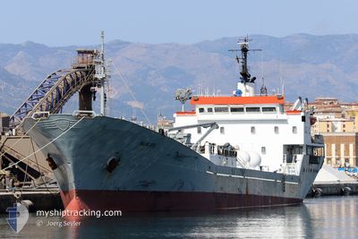
ISLAS DOS
General Cargo
Current Trip
PTCNL
| Time Travelled | 3 days |
|---|---|
| Remaining Time | --- |
| Distance Travelled | 684.12 nm |
| Remaining Distance | --- |
| AVG Speed | 11 Knopen |
| MAX Speed | 13.3 Knopen |
| AVG Wind | 17 knots |
| MAX Wind | 30.5 knots |
| MIN Temp | 16.3°C / 61.34°F |
| MAX Temp | 19.9°C / 67.82°F |
| Diepgang | 6.8 M |
| Positie ontvangen | 1 d geleden |
Current Position
| Lengtegraad | -12.21827° |
|---|---|
| Breedtegraat | 34.08453° |
| Status | Under way using engine |
| Snelheid | 11.3 Knopen |
| Koers | 247.3° |
| Gebied | North Atlantic Ocean |
| Station | T-AIS |
| Positie ontvangen | 1 d geleden |
Info
Information
The current position of ISLAS DOS is in North Atlantic Ocean with coordinates 34.08453° / -12.21827° as reported on 2024-05-11 09:30 by AIS to our vessel tracker app. The vessel's current speed is 11.3 Knopen
The vessel ISLAS DOS (IMO: 7391783, MMSI: 351774000) is a General Cargo that was built in 1975 ( 49 Jaar oud ). It's sailing under the flag of [PA] Panama.
In this page you can find informations about the vessels current position, last detected port calls, and current voyage information. If the vessels is not in coverage by AIS you will find the latest position.
The current position of ISLAS DOS is detected by our AIS receivers and we are not responsible for the reliability of the data. The last position was recorded while the vessel was in Coverage by the Ais receivers of our vessel tracking app.
The current draught of ISLAS DOS as reported by AIS is 6.8 meters
Weather
| Temperature | 19.5°C / 67.1°F |
|---|---|
| Wind Speed | 16 knots |
| Direction | 22° NNE |
| Pressure | 1021.7 hPa |
| Humidity | 74 % |
| Cloud Coverage | 100 % |
Featured Company
Last Port Calls
| Port | Arrival | Departure | Time In Port |
|---|---|---|---|
| 2024-05-05 23:10 | 2024-05-09 21:00 | 3 d | |
| 2024-05-01 07:36 | 2024-05-03 01:17 | 1 d | |
| 2024-04-29 11:26 | 2024-04-30 18:06 | 1 d | |
| 2024-04-27 19:07 | 2024-04-29 01:34 | 1 d | |
| 2024-04-27 06:31 | 2024-04-27 16:34 | 10 h | |
| 2024-04-25 04:56 | 2024-04-26 21:13 | 1 d | |
| 2024-04-21 17:38 | 2024-04-24 17:30 | 2 d | |
| 2024-04-18 09:41 | 2024-04-21 05:54 | 2 d | |
| 2024-04-13 21:12 | 2024-04-17 17:51 | 3 d | |
| 2024-03-23 16:00 | 2024-04-13 17:54 | 21 d |
Most Visited Ports (Last year)
| Port | Arrivals | |
|---|---|---|
| 32 | ||
| 24 | ||
| 23 | ||
| 9 | ||
| 7 | ||
| 2 |
Last Trips
| Origin | Departure | Destination | Arrival | Distance | |
|---|---|---|---|---|---|
| 2024-05-03 01:17 | 2024-05-05 23:10 | 843.73 nm | |||
| 2024-04-30 18:06 | 2024-05-01 07:36 | 140.47 nm | |||
| 2024-04-29 01:34 | 2024-04-29 11:26 | 118.95 nm | |||
| 2024-04-27 16:34 | 2024-04-27 19:07 | 8.32 nm | |||
| 2024-04-26 21:13 | 2024-04-27 06:31 | 19.06 nm | |||
| 2024-04-24 17:30 | 2024-04-25 04:56 | 119.40 nm | |||
| 2024-04-21 05:54 | 2024-04-21 17:38 | 148.86 nm | |||
| 2024-04-17 17:51 | 2024-04-18 09:41 | 151.57 nm | |||
| 2024-04-13 17:54 | 2024-04-13 21:12 | 41.16 nm | |||
| 2024-03-23 03:27 | 2024-03-23 16:00 | 116.06 nm |
Events
| Tijd | Evenement | Details | Positie / Bestemming | Info |
|---|---|---|---|---|
| 2024-05-11 09:37 | Status Changed | Default Under way using engine |
34.07643 / -12.24343
PTCNL
|
Snelheid: 11.3 kn Koers: 247.3° |
| 2024-05-11 09:30 | Status Changed | Under way using engine Default |
34.08453 / -12.21827
PTCNL
|
Snelheid: 11.2 kn Koers: 250° |
| 2024-05-11 09:30 | Buitenbereik |
34.08453 / -12.21827
North Atlantic Ocean
|
Snelheid: 11.3 kn Koers: 247.3° |
|
| 2024-05-11 08:55 | Status Changed | Default Under way using engine |
34.12382 / -12.09493
PTCNL
|
Snelheid: 11.2 kn Koers: 252° |
| 2024-05-11 08:13 | Status Changed | Under way using engine Default |
34.17027 / -11.94453
PTCNL
|
Snelheid: 11.5 kn Koers: 247° |
| 2024-05-11 07:42 | Status Changed | Default Under way using engine |
34.20717 / -11.83305
PTCNL
|
Snelheid: 11.5 kn Koers: 247.8° |
| 2024-05-11 07:06 | Status Changed | Under way using engine Default |
34.25274 / -11.70488
PTCNL
|
Snelheid: 11.3 kn Koers: 247° |
| 2024-05-11 07:00 | Binnenbereik |
34.25274 / -11.70488
North Atlantic Ocean
|
Snelheid: 11.5 kn Koers: 245.8° |
|
| 2024-05-11 06:00 | Status Changed | Default Under way using engine |
34.32250 / -11.46936
PTCNL
|
Snelheid: 11.2 kn Koers: 249.6° |
| 2024-05-11 05:55 | Buitenbereik |
34.32824 / -11.45168
North Atlantic Ocean
|
Snelheid: 11.2 kn Koers: 249.6° |