
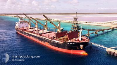
GAT FEELING
Bulk Carrier
Current Trip
| Trip Time | 10 days |
|---|---|
| Trip Distance | 2655.69 nm |
| AVG Speed | 11.3 Knop |
| MAX Speed | 17.3 Knop |
| Djupgående | 9.2 m |
| AVG Wind | 14.2 knots |
| MAX Wind | 41.9 knots |
| MIN Temp | -1.3°C / 29.66°F |
| MAX Temp | 28.6°C / 83.48°F |
| Position mottagen | 1 d sen |
Current Position
| Longitud | -73.60000° |
|---|---|
| Latitude | 19.72170° |
| Status | Under way using engine |
| Fart | 11 Knop |
| Kurs | 178° |
| Område | Caribbean Sea |
| Station | T-AIS |
| Position mottagen | 1 d sen |
Info
Information
The current position of GAT FEELING is in Caribbean Sea with coordinates 19.72170° / -73.60000° as reported on 2024-05-03 00:07 by AIS to our vessel tracker app. The vessel's current speed is 11 Knop and is currently inside the port of PORT AU PRINCE.
The vessel GAT FEELING (IMO: 9467615, MMSI: 538005074) is a Bulk Carrier that was built in 2013 ( 11 År gammal ). It's sailing under the flag of [MH] Marshall Is.
In this page you can find informations about the vessels current position, last detected port calls, and current voyage information. If the vessels is not in coverage by AIS you will find the latest position.
The current position of GAT FEELING is detected by our AIS receivers and we are not responsible for the reliability of the data. The last position was recorded while the vessel was in Coverage by the Ais receivers of our vessel tracking app.
The current draught of GAT FEELING as reported by AIS is 9.2 meters
Weather
| Temperature | 27.4°C / 81.32°F |
|---|---|
| Wind Speed | 4 knots |
| Direction | 3° N |
| Pressure | 1012.3 hPa |
| Humidity | 59.2 % |
| Cloud Coverage | 6 % |
Featured Company
Last Port Calls
| Port | Arrival | Departure | Time In Port |
|---|---|---|---|
| 2024-05-03 22:29 | |||
| 2024-04-21 09:04 | 2024-04-23 19:47 | 2 d | |
| 2024-04-03 00:09 | 2024-04-03 01:27 | 1 h | |
| 2024-03-29 17:26 | 2024-03-29 22:20 | 4 h | |
| 2024-03-03 05:53 | 2024-03-03 15:23 | 9 h |
Most Visited Ports (Last year)
| Port | Arrivals | |
|---|---|---|
| 2 | ||
| 2 | ||
| 2 | ||
| 1 | ||
| 1 | ||
| 1 |
Last Trips
| Origin | Departure | Destination | Arrival | Distance | |
|---|---|---|---|---|---|
| 2024-04-23 15:47 | 2024-05-03 18:29 | 2655.69 nm | |||
| 2024-04-02 20:27 | 2024-04-21 05:04 | 3312.94 nm | |||
| 2024-03-29 17:20 | 2024-04-02 19:09 | 72.37 nm | |||
| 2024-02-25 11:12 | 2024-03-29 12:26 | 7848.04 nm | |||
| 2024-02-25 11:12 | 2024-03-03 07:53 | 1083.32 nm |
Events
| Tid | Event | Detaljer | Position / Dest | Information |
|---|---|---|---|---|
| 2024-05-03 22:45 | STOPPAR förflyttning |
18.57718 / -72.35426
[HT] PORT AU PRINCE
|
Fart: 0.2 kn Kurs: 180° |
|
| 2024-05-03 22:29 | ANLÄNDER HAMN |
|
18.57667 / -72.35500
[HT] PORT AU PRINCE
|
Fart: 5.7 kn Kurs: 93° |
| 2024-05-03 22:09 | STARTAR förflyttning | 2.09 nm, North West of PORT AU PRINCE |
18.57333 / -72.39500
LAST UPDATE TIME
|
Fart: 6 kn Kurs: 81° |
| 2024-05-03 15:32 | STOPPAR förflyttning | 2.56 nm, North West of PORT AU PRINCE |
18.57074 / -72.40594
LAST UPDATE TIME
|
Fart: 0.3 kn Kurs: 121° |
| 2024-05-03 14:25 | STARTAR förflyttning | 7.11 nm, North West of PORT AU PRINCE |
18.59952 / -72.47983
LAST UPDATE TIME
|
Fart: 3.4 kn Kurs: 91° |
| 2024-05-03 11:39 | STOPPAR förflyttning | 5.42 nm, West of PORT AU PRINCE |
18.58667 / -72.45333
LAST UPDATE TIME
|
Fart: Kurs: -1° |
| 2024-05-03 00:21 | Status ändrad | Default Under way using engine |
19.66333 / -73.59834
LAST UPDATE TIME
|
Fart: 11 kn Kurs: 178° |
| 2024-05-03 00:09 | ETA ändrat | 2024/05/03 00:07 2024/05/03 00:03 |
19.72170 / -73.60000
LAST UPDATE TIME
|
Fart: 11 kn Kurs: 178° |
| 2024-05-03 00:07 | Byter havsområde | Haitian part of the Caribbean Sea Haitian part of the North Atlantic Ocean |
19.72170 / -73.60000
Caribbean Sea
LAST UPDATE TIME
|
Fart: 11 kn Kurs: 178° |
| 2024-05-03 00:07 | UTANFÖR täckningsområde |
19.72170 / -73.60000
Caribbean Sea
LAST UPDATE TIME
|
Fart: 11 kn Kurs: 178° |