
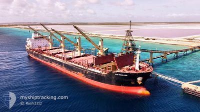
GAT FEELING
Bulk Carrier
Current Trip
| Time Travelled | 16 days |
|---|---|
| Remaining Time | --- |
| Distance Travelled | 3283.97 nm |
| Remaining Distance | --- |
| AVG Speed | 12 Knots |
| MAX Speed | 16.6 Knots |
| AVG Wind | 14.8 knots |
| MAX Wind | 42.9 knots |
| MIN Temp | -1.5°C / 29.3°F |
| MAX Temp | 24.5°C / 76.1°F |
| Draught | 6.3 m |
| Position Received | 1 m ago |
Current Position
| Longitude | -73.16188° |
|---|---|
| Latitude | 46.03233° |
| Status | At anchor |
| Speed | |
| Course | 192° |
| Area | Gulf of St-Lawrence |
| Station | T-AIS |
| Position Received | 1 m ago |
Info
Information
The current position of GAT FEELING is in Gulf of St-Lawrence with coordinates 46.03233° / -73.16188° as reported on 2024-04-19 13:34 by AIS to our vessel tracker app. The vessel's current speed is 0 Knots
The vessel GAT FEELING (IMO: 9467615, MMSI: 538005074) is a Bulk Carrier that was built in 2013 ( 11 years old ). It's sailing under the flag of [MH] Marshall Is.
In this page you can find informations about the vessels current position, last detected port calls, and current voyage information. If the vessels is not in coverage by AIS you will find the latest position.
The current position of GAT FEELING is detected by our AIS receivers and we are not responsible for the reliability of the data. The last position was recorded while the vessel was in Coverage by the Ais receivers of our vessel tracking app.
The current draught of GAT FEELING as reported by AIS is 6.3 meters
Weather
| Temperature | 7.1°C / 44.78°F |
|---|---|
| Wind Speed | 6 knots |
| Direction | 155° SSE |
| Pressure | 1017.7 hPa |
| Humidity | 87 % |
| Cloud Coverage | 100 % |
Featured Company
Last Port Calls
| Port | Arrival | Departure | Time In Port |
|---|---|---|---|
| 2024-04-03 00:09 | 2024-04-03 01:27 | 1 h | |
| 2024-03-29 17:26 | 2024-03-29 22:20 | 4 h | |
| 2024-03-03 05:53 | 2024-03-03 15:23 | 9 h | |
| 2024-02-10 11:44 | 2024-02-25 08:12 | 14 d | |
| 2024-02-05 06:18 | 2024-02-05 15:36 | 9 h |
Most Visited Ports (Last year)
| Port | Arrivals | |
|---|---|---|
| 2 | ||
| 2 | ||
| 2 | ||
| 1 | ||
| 1 | ||
| 1 |
Last Trips
| Origin | Departure | Destination | Arrival | Distance | |
|---|---|---|---|---|---|
| 2024-03-29 17:20 | 2024-04-02 19:09 | 72.37 nm | |||
| 2024-02-25 11:12 | 2024-03-29 12:26 | 7848.04 nm | |||
| 2024-02-25 11:12 | 2024-03-03 07:53 | 1083.32 nm | |||
| 2024-01-10 19:39 | 2024-02-10 14:44 | 8068.95 nm | |||
| 2024-01-10 19:39 | 2024-02-05 08:18 | 6957.95 nm |
Events
| Time | Event | Details | Position / Dest | Info |
|---|---|---|---|---|
| 2024-04-18 01:55 | Status Changed | At anchor Default |
46.03213 / -73.16191
BSPFO>>CAMTR
|
Speed: Course: -1° |
| 2024-04-18 01:50 | Status Changed | Default At anchor |
46.03167 / -73.16167
BSPFO>>CAMTR
|
Speed: Course: 185° |
| 2024-04-17 13:13 | Status Changed | At anchor Under way using engine |
46.03210 / -73.16166
BSPFO>>CAMTR
|
Speed: 0.2 kn Course: 210° |
| 2024-04-17 12:55 | STOP Moving | 2.25 nm, South West of SOREL |
46.03165 / -73.16325
BSPFO>>CAMTR
|
Speed: 0.3 kn Course: 185° |
| 2024-04-17 10:36 | Status Changed | Under way using engine Default |
46.24061 / -72.75552
BSPFO>>CAMTR
|
Speed: 12 kn Course: 236° |
| 2024-04-17 10:32 | Status Changed | Default Under way using engine |
46.24833 / -72.73666
BSPFO>>CAMTR
|
Speed: 12.3 kn Course: 236.1° |
| 2024-04-17 10:20 | Status Changed | Under way using engine Default |
46.26427 / -72.68872
BSPFO>>CAMTR
|
Speed: 10 kn Course: 263° |
| 2024-04-17 10:02 | IN Coverage |
46.26427 / -72.68872
Gulf of St-Lawrence
|
Speed: 11.9 kn Course: 276.2° |
|
| 2024-04-17 03:53 | Status Changed | Default Under way using engine |
46.73833 / -71.32000
BSPFO>>CAMTR
|
Speed: 12.8 kn Course: 242.5° |
| 2024-04-17 03:45 | OUT of Coverage |
46.74772 / -71.28051
Gulf of St-Lawrence
|
Speed: 12.8 kn Course: 242.5° |