
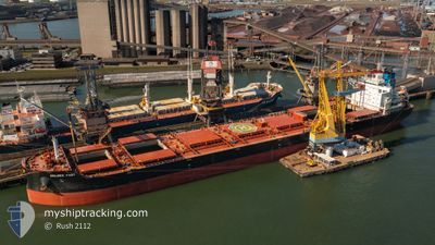
GOLDEN FAST
Cargo
Current Trip
| Time Travelled | 33 days |
|---|---|
| Remaining Time | --- |
| Distance Travelled | 6371.12 nm |
| Remaining Distance | --- |
| AVG Speed | 11.8 Knop |
| MAX Speed | 17.6 Knop |
| AVG Wind | 9.8 knots |
| MAX Wind | 37 knots |
| MIN Temp | 7.2°C / 44.96°F |
| MAX Temp | 33.8°C / 92.84°F |
| Djupgående | 11.5 m |
| Position mottagen | 3 d sen |
Current Position
| Longitud | -50.91203° |
|---|---|
| Latitude | 0.15224° |
| Status | Under way using engine |
| Fart | 11.4 Knop |
| Kurs | 61° |
| Område | North Atlantic Ocean |
| Station | T-AIS |
| Position mottagen | 3 d sen |
Info
Information
The current position of GOLDEN FAST is in North Atlantic Ocean with coordinates 0.15224° / -50.91203° as reported on 2024-04-30 09:52 by AIS to our vessel tracker app. The vessel's current speed is 11.4 Knop and is heading at the port of BARCELONA. The estimated time of arrival as calculated by MyShipTracking vessel tracking app is 2024-05-17 12:00 LT
The vessel GOLDEN FAST (IMO: 9860116, MMSI: 538009293) is a Cargo It's sailing under the flag of [MH] Marshall Is.
In this page you can find informations about the vessels current position, last detected port calls, and current voyage information. If the vessels is not in coverage by AIS you will find the latest position.
The current position of GOLDEN FAST is detected by our AIS receivers and we are not responsible for the reliability of the data. The last position was recorded while the vessel was in Coverage by the Ais receivers of our vessel tracking app.
The current draught of GOLDEN FAST as reported by AIS is 11.5 meters
Weather
| Temperature | 26.7°C / 80.06°F |
|---|---|
| Wind Speed | 15 knots |
| Direction | 68° ENE |
| Pressure | 1011 hPa |
| Humidity | 79.6 % |
| Cloud Coverage | 100 % |
Featured Company
Last Port Calls
| Port | Arrival | Departure | Time In Port |
|---|---|---|---|
| 2024-03-25 14:03 | 2024-03-30 19:30 | 5 d | |
| 2024-03-13 00:27 | 2024-03-14 11:57 | 1 d |
Most Visited Ports (Last year)
| Port | Arrivals | |
|---|---|---|
| 2 | ||
| 2 | ||
| 1 | ||
| 1 | ||
| 1 | ||
| 1 |
Last Trips
| Origin | Departure | Destination | Arrival | Distance | |
|---|---|---|---|---|---|
| 2024-03-14 07:57 | 2024-03-25 15:03 | 2824.35 nm | |||
| 2024-02-28 05:37 | 2024-03-12 20:27 | 518.14 nm |
Events
| Tid | Event | Detaljer | Position / Dest | Information |
|---|---|---|---|---|
| 2024-04-30 17:08 | STARTAR förflyttning |
.85964 / -49.90339
BARCELONA
|
Fart: 6.9 kn Kurs: 94° |
|
| 2024-04-30 16:30 | STOPPAR förflyttning |
.85975 / -49.90974
BARCELONA
|
Fart: 0.1 kn Kurs: 69° |
|
| 2024-04-30 09:57 | Status ändrad | Default Under way using engine |
.15887 / -50.89958
BARCELONA
|
Fart: 11.4 kn Kurs: 61° |
| 2024-04-30 09:52 | UTANFÖR täckningsområde |
.15224 / -50.91203
North Atlantic Ocean
BARCELONA
|
Fart: 11.4 kn Kurs: 61° |
|
| 2024-04-30 08:40 | Byter havsområde | Brazilian part of the North Atlantic Ocean Brazilian part of the South Atlantic Ocean |
.00124 / -51.00635
North Atlantic Ocean
BARCELONA
|
Fart: 9 kn Kurs: 19.6° |
| 2024-04-30 06:15 | ETA ändrat | 2024/05/17 12:00 2024/05/15 12:00 |
-.44965 / -51.31109
BARCELONA
|
Fart: 16 kn Kurs: 78° |
| 2024-04-30 06:05 | Status ändrad | Under way using engine Default |
-.45758 / -51.35399
BARCELONA
|
Fart: 16.3 kn Kurs: 81° |
| 2024-04-30 05:44 | Status ändrad | Default Under way using engine |
-.47972 / -51.44283
BARCELONA
|
Fart: 16.7 kn Kurs: 51.5° |
| 2024-04-30 05:37 | Status ändrad | Under way using engine Default |
-.49831 / -51.46440
BARCELONA
|
Fart: 16.5 kn Kurs: 48° |
| 2024-04-30 05:25 | I täckningsområde |
-.49831 / -51.46440
South Atlantic Ocean
BARCELONA
|
Fart: 16.7 kn Kurs: 51.5° |