
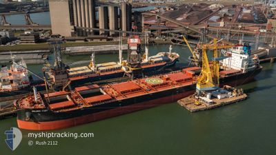
GOLDEN FAST
Cargo
Current Trip
| Time Travelled | 26 days |
|---|---|
| Remaining Time | --- |
| Distance Travelled | 5038.25 nm |
| Remaining Distance | --- |
| AVG Speed | 11.2 Knots |
| MAX Speed | 15.9 Knots |
| AVG Wind | 10.9 knots |
| MAX Wind | 37 knots |
| MIN Temp | 6.5°C / 43.7°F |
| MAX Temp | 30.2°C / 86.36°F |
| Draught | 7.5 m |
| Position Received | 1 d ago |
Current Position
| Longitude | -58.57406° |
|---|---|
| Latitude | -3.32467° |
| Status | Under way using engine |
| Speed | 11.3 Knots |
| Course | 213.4° |
| Area | South Atlantic Ocean |
| Station | T-AIS |
| Position Received | 1 d ago |
Info
Information
The current position of GOLDEN FAST is in South Atlantic Ocean with coordinates -3.32467° / -58.57406° as reported on 2024-04-24 07:44 by AIS to our vessel tracker app. The vessel's current speed is 11.3 Knots and is heading at the port of ITACOATIARA. The estimated time of arrival as calculated by MyShipTracking vessel tracking app is 2024-04-24 04:00 LT
The vessel GOLDEN FAST (IMO: 9860116, MMSI: 538009293) is a Cargo It's sailing under the flag of [MH] Marshall Is.
In this page you can find informations about the vessels current position, last detected port calls, and current voyage information. If the vessels is not in coverage by AIS you will find the latest position.
The current position of GOLDEN FAST is detected by our AIS receivers and we are not responsible for the reliability of the data. The last position was recorded while the vessel was in Coverage by the Ais receivers of our vessel tracking app.
The current draught of GOLDEN FAST as reported by AIS is 7.5 meters
Weather
| Temperature | 24.8°C / 76.64°F |
|---|---|
| Wind Speed | 2 knots |
| Direction | 36° NE |
| Pressure | 1010 hPa |
| Humidity | 94.8 % |
| Cloud Coverage | 100 % |
Featured Company
Last Port Calls
| Port | Arrival | Departure | Time In Port |
|---|---|---|---|
| 2024-03-25 14:03 | 2024-03-30 19:30 | 5 d | |
| 2024-03-13 00:27 | 2024-03-14 11:57 | 1 d | |
| 2024-02-25 00:50 | 2024-02-28 10:37 | 3 d | |
| 2024-02-05 03:13 | 2024-02-08 18:31 | 3 d |
Most Visited Ports (Last year)
| Port | Arrivals | |
|---|---|---|
| 2 | ||
| 2 | ||
| 1 | ||
| 1 | ||
| 1 | ||
| 1 |
Last Trips
| Origin | Departure | Destination | Arrival | Distance | |
|---|---|---|---|---|---|
| 2024-03-14 07:57 | 2024-03-25 15:03 | 2824.35 nm | |||
| 2024-02-28 05:37 | 2024-03-12 20:27 | 518.14 nm | |||
| 2024-02-08 18:31 | 2024-02-24 19:50 | 4014.37 nm | |||
| 2024-01-03 23:15 | 2024-02-05 03:13 | 4284.65 nm |
Events
| Time | Event | Details | Position / Dest | Info |
|---|---|---|---|---|
| 2024-04-24 10:51 | STOP Moving |
-3.23228 / -58.99959
ITACOATIARA
|
Speed: 0.1 kn Course: 281° |
|
| 2024-04-24 07:49 | Status Changed | Default Under way using engine |
-3.33555 / -58.58390
ITACOATIARA
|
Speed: 11.3 kn Course: 213.4° |
| 2024-04-24 07:44 | OUT of Coverage |
-3.32467 / -58.57406
South Atlantic Ocean
ITACOATIARA
|
Speed: 11.3 kn Course: 213.4° |
|
| 2024-04-24 04:26 | Status Changed | Under way using engine Default |
-3.21491 / -58.23063
ITACOATIARA
|
Speed: 11.4 kn Course: 227° |
| 2024-04-24 03:50 | Status Changed | Default Under way using engine |
-3.13328 / -58.16825
ITACOATIARA
|
Speed: 9.8 kn Course: 175.5° |
| 2024-04-24 02:43 | Status Changed | Under way using engine Default |
-2.95314 / -58.15076
ITACOATIARA
|
Speed: 10 kn Course: 201° |
| 2024-04-24 02:35 | Status Changed | Default Under way using engine |
-2.93156 / -58.14411
ITACOATIARA
|
Speed: 9.7 kn Course: 200.3° |
| 2024-04-24 01:54 | Status Changed | Under way using engine Default |
-2.83454 / -58.09063
ITACOATIARA
|
Speed: 9.6 kn Course: 241° |
| 2024-04-24 01:54 | IN Coverage |
-2.83775 / -58.09372
South Atlantic Ocean
ITACOATIARA
|
Speed: 9.6 kn Course: 224.8° |
|
| 2024-04-23 11:07 | OUT of Coverage |
-2.17116 / -56.18586
South Atlantic Ocean
ITACOATIARA
|
Speed: 11 kn Course: 234.9° |