
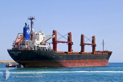
FRIENDLY ISLANDS
Bulk Carrier
Current Trip
ID AMA
| Time Travelled | 53 days |
|---|---|
| Remaining Time | --- |
| Distance Travelled | 7971.51 nm |
| Remaining Distance | --- |
| AVG Speed | 11.9 Knop |
| MAX Speed | 14.7 Knop |
| AVG Wind | 9.1 knots |
| MAX Wind | 36.8 knots |
| MIN Temp | 16°C / 60.8°F |
| MAX Temp | 32.5°C / 90.5°F |
| Djupgående | 5.7 m |
| Position mottagen | 22 d sen |
Current Position
| Longitud | 127.71749° |
|---|---|
| Latitude | -2.12857° |
| Status | Under way using engine |
| Fart | 13.3 Knop |
| Kurs | 98.9° |
| Område | Ceram Sea |
| Station | T-AIS |
| Position mottagen | 22 d sen |
Info
Information
The current position of FRIENDLY ISLANDS is in Ceram Sea with coordinates -2.12857° / 127.71749° as reported on 2024-04-21 06:10 by AIS to our vessel tracker app. The vessel's current speed is 13.3 Knop
The vessel FRIENDLY ISLANDS (IMO: 9615042, MMSI: 636015708) is a Bulk Carrier that was built in 2012 ( 12 År gammal ). It's sailing under the flag of [LR] Liberia.
In this page you can find informations about the vessels current position, last detected port calls, and current voyage information. If the vessels is not in coverage by AIS you will find the latest position.
The current position of FRIENDLY ISLANDS is detected by our AIS receivers and we are not responsible for the reliability of the data. The last position was recorded while the vessel was in Coverage by the Ais receivers of our vessel tracking app.
The current draught of FRIENDLY ISLANDS as reported by AIS is 5.7 meters
Weather
| Temperature | 17.1°C / 62.78°F |
|---|---|
| Wind Speed | 30 knots |
| Direction | 7° N |
| Pressure | 1011.9 hPa |
| Humidity | 70.3 % |
| Cloud Coverage | 100 % |
Featured Company
Last Port Calls
| Port | Arrival | Departure | Time In Port |
|---|---|---|---|
| 2024-03-18 10:32 | 2024-03-21 09:24 | 2 d |
Last Trips
| Origin | Departure | Destination | Arrival | Distance | |
|---|---|---|---|---|---|
| 2024-02-20 08:26 | 2024-03-18 10:32 | 3922.95 nm |
Events
| Tid | Event | Detaljer | Position / Dest | Information |
|---|---|---|---|---|
| 2024-05-12 23:15 | STARTAR förflyttning |
33.22952 / 135.10269
ID AMA
|
Fart: 5.2 kn Kurs: 113° |
|
| 2024-05-12 11:47 | STOPPAR förflyttning |
33.00002 / 135.11694
ID AMA
|
Fart: 0.2 kn Kurs: 168° |
|
| 2024-05-12 10:01 | STARTAR förflyttning |
33.24314 / 135.09274
ID AMA
|
Fart: 3.3 kn Kurs: 182° |
|
| 2024-05-12 00:04 | STOPPAR förflyttning |
33.12886 / 135.28073
ID AMA
|
Fart: 0.3 kn Kurs: 168° |
|
| 2024-05-10 22:49 | STARTAR förflyttning |
33.20618 / 135.16183
ID AMA
|
Fart: 3.8 kn Kurs: 153° |
|
| 2024-05-10 18:21 | STOPPAR förflyttning |
33.19595 / 135.15747
ID AMA
|
Fart: 0.3 kn Kurs: 74° |