
FLAG LAMA
Cargo
Current Trip
| Time Travelled | 7 days |
|---|---|
| Remaining Time | --- |
| Distance Travelled | 1737.76 nm |
| Remaining Distance | --- |
| AVG Speed | 10.3 Knop |
| MAX Speed | 14.2 Knop |
| AVG Wind | 9.4 knots |
| MAX Wind | 18 knots |
| MIN Temp | 24.1°C / 75.38°F |
| MAX Temp | 29°C / 84.2°F |
| Djupgående | 7.1 m |
| Position mottagen | 3 d sen |
Current Position
| Longitud | --- |
|---|---|
| Latitude | --- |
| Status | Under way using engine |
| Fart | 10.5 Knop |
| Kurs | 311.4° |
| Område | Malacca Strait |
| Station | T-AIS |
| Position mottagen | 3 d sen |
Info
Information
The current position of FLAG LAMA is in Malacca Strait with coordinates 2.18205° / 101.99863° as reported on 2025-12-31 21:07 by AIS to our vessel tracker app. The vessel's current speed is 10.5 Knop and is heading at the port of TERNEUZEN. The estimated time of arrival as calculated by MyShipTracking vessel tracking app is 2026-01-30 13:00 LT
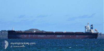
The vessel FLAG LAMA (IMO: 9474711, MMSI: 538006963) is a Cargo It's sailing under the flag of [MH] Marshall Is.
In this page you can find informations about the vessels current position, last detected port calls, and current voyage information. If the vessels is not in coverage by AIS you will find the latest position.
The current position of FLAG LAMA is detected by our AIS receivers and we are not responsible for the reliability of the data. The last position was recorded while the vessel was in Coverage by the Ais receivers of our vessel tracking app.
The current draught of FLAG LAMA as reported by AIS is 7.1 meters
Weather
| Temperature | 27.3°C / 81.14°F |
|---|---|
| Wind Speed | 11 knots |
| Direction | 265° W |
| Pressure | 1009.4 hPa |
| Humidity | 79 % |
| Cloud Coverage | 100 % |
Featured Company
Last Port Calls
| Port | Arrival | Departure | Time In Port |
|---|---|---|---|
| 2025-12-18 17:24 | 2025-12-27 20:30 | 9 d | |
| 2025-11-27 09:40 | 2025-12-04 04:28 | 6 d |
Most Visited Ports (Last year)
| Port | Arrivals | |
|---|---|---|
| 1 | ||
| 1 | ||
| 1 | ||
| 1 | ||
| 1 | ||
| 1 |
Last Trips
| Origin | Departure | Destination | Arrival | Distance | |
|---|---|---|---|---|---|
| 2025-12-04 04:28 | 2025-12-18 17:24 | 3844.71 nm | |||
| 2025-09-06 23:04 | 2025-11-27 09:40 | 12016.20 nm |
Events
| Tid | Event | Detaljer | Position / Dest | Information |
|---|---|---|---|---|
| 2025-12-31 21:13 | Status ändrad | Default Under way using engine |
2.19277 / 101.98608
FOR ORDERS
|
Fart: 10.5 kn Kurs: 311.4° |
| 2025-12-31 21:07 | UTANFÖR täckningsområde |
2.18205 / 101.99863
Malacca Strait
FOR ORDERS
|
Fart: 10.5 kn Kurs: 311.4° |
|
| 2025-12-31 18:46 | Byter havsområde | Malaysian part of the Malacca Strait Malaysian part of the Singapore Strait |
1.90570 / 102.33941
Malacca Strait
FOR ORDERS
|
Fart: 12.2 kn Kurs: 294.5° |
| 2025-12-31 18:46 | Status ändrad | Under way using engine Default |
1.90544 / 102.33998
FOR ORDERS
|
Fart: 12.2 kn Kurs: 295° |
| 2025-12-31 18:45 | Status ändrad | Default Under way using engine |
1.90376 / 102.34361
FOR ORDERS
|
Fart: 12.2 kn Kurs: 294.4° |
| 2025-12-31 18:44 | Status ändrad | Under way using engine Default |
1.90310 / 102.34505
FOR ORDERS
|
Fart: 12.1 kn Kurs: 295° |
| 2025-12-31 18:41 | I täckningsområde |
1.90570 / 102.33941
Malacca Strait
FOR ORDERS
|
Fart: 12.2 kn Kurs: 294.5° |
|
| 2025-12-31 12:01 | Status ändrad | Default Under way using engine |
1.21311 / 103.53896
FOR ORDERS
|
Fart: 12.1 kn Kurs: 286.9° |
| 2025-12-31 11:58 | UTANFÖR täckningsområde |
1.21042 / 103.54806
Singapore Strait
FOR ORDERS
|
Fart: 12.1 kn Kurs: 286.9° |
|
| 2025-12-31 11:46 | Upptäckt i hav | Malaysian part of the Singapore Strait |
1.19906 / 103.58857
Singapore Strait
|
Fart: 12.2 kn Kurs: 285.5° |