
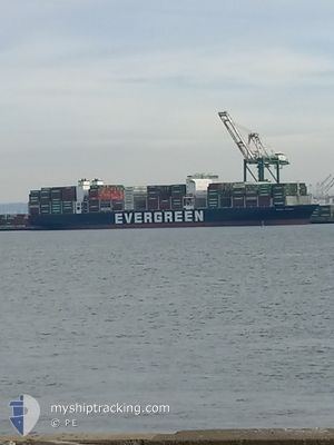
EVER FRONT
Cargo D
Current Trip
| Time Travelled | 1 day |
|---|---|
| Remaining Time | --- |
| Distance Travelled | 637.50 nm |
| Remaining Distance | --- |
| AVG Speed | 14.3 Knop |
| MAX Speed | 18.5 Knop |
| AVG Wind | 10.7 knots |
| MAX Wind | 24.7 knots |
| MIN Temp | 5.6°C / 42.08°F |
| MAX Temp | 9.7°C / 49.46°F |
| Djupgående | 13.9 m |
| Position mottagen | 1 d sen |
Current Position
| Longitud | -126.57643° |
|---|---|
| Latitude | 48.48917° |
| Status | Under way using engine |
| Fart | 14.1 Knop |
| Kurs | 268.4° |
| Område | North Pacific Ocean |
| Station | T-AIS |
| Position mottagen | 1 d sen |
Info
Information
The current position of EVER FRONT is in North Pacific Ocean with coordinates 48.48917° / -126.57643° as reported on 2024-04-28 19:43 by AIS to our vessel tracker app. The vessel's current speed is 14.1 Knop and is heading at the port of TAIPEI. The estimated time of arrival as calculated by MyShipTracking vessel tracking app is 2024-05-15 14:00 LT
The vessel EVER FRONT (IMO: 9850549, MMSI: 373285000) is a Cargo D It's sailing under the flag of [PA] Panama.
In this page you can find informations about the vessels current position, last detected port calls, and current voyage information. If the vessels is not in coverage by AIS you will find the latest position.
The current position of EVER FRONT is detected by our AIS receivers and we are not responsible for the reliability of the data. The last position was recorded while the vessel was in Coverage by the Ais receivers of our vessel tracking app.
The current draught of EVER FRONT as reported by AIS is 13.9 meters
Weather
| Temperature | 7.3°C / 45.14°F |
|---|---|
| Wind Speed | 14 knots |
| Direction | 357° N |
| Pressure | 1022 hPa |
| Humidity | 79 % |
| Cloud Coverage | --- |
Featured Company
Last Port Calls
| Port | Arrival | Departure | Time In Port |
|---|---|---|---|
| 2024-04-26 11:18 | 2024-04-28 04:44 | 1 d | |
| 2024-04-22 12:28 | 2024-04-24 02:20 | 1 d | |
| 2024-04-17 21:25 | 2024-04-21 00:48 | 3 d | |
| 2024-04-02 09:36 | 2024-04-03 17:29 | 1 d | |
| 2024-03-31 03:24 | 2024-04-01 14:37 | 1 d | |
| 2024-03-29 23:16 | 2024-03-30 11:57 | 12 h | |
| 2024-03-23 01:16 | 2024-03-24 03:37 | 1 d | |
| 2024-03-12 16:27 | 2024-03-14 13:22 | 1 d | |
| 2024-02-24 12:03 | 2024-02-26 14:24 | 2 d | |
| 2024-02-19 13:37 | 2024-02-22 01:22 | 2 d |
Last Trips
| Origin | Departure | Destination | Arrival | Distance | |
|---|---|---|---|---|---|
| 2024-04-23 19:20 | 2024-04-26 04:18 | 857.73 nm | |||
| 2024-04-20 17:48 | 2024-04-22 05:28 | 410.93 nm | |||
| 2024-04-04 01:29 | 2024-04-17 14:25 | 6441.35 nm | |||
| 2024-04-01 22:37 | 2024-04-02 17:36 | 343.96 nm | |||
| 2024-03-30 19:57 | 2024-03-31 11:24 | 215.86 nm | |||
| 2024-03-24 11:37 | 2024-03-30 07:16 | 2179.37 nm | |||
| 2024-03-14 21:22 | 2024-03-23 09:16 | 1812.74 nm | |||
| 2024-02-26 06:24 | 2024-03-13 00:27 | 5729.39 nm | |||
| 2024-02-21 17:22 | 2024-02-24 04:03 | 857.60 nm | |||
| 2024-02-17 16:51 | 2024-02-19 05:37 | 395.56 nm |
Events
| Tid | Event | Detaljer | Position / Dest | Information |
|---|---|---|---|---|
| 2024-04-28 19:47 | Status ändrad | Default Under way using engine |
48.48882 / -126.59817
USTIW > TWTPE
|
Fart: 14.1 kn Kurs: 268.4° |
| 2024-04-28 19:43 | UTANFÖR täckningsområde |
48.48917 / -126.57643
North Pacific Ocean
USTIW > TWTPE
|
Fart: 14.1 kn Kurs: 268.4° |
|
| 2024-04-28 15:00 | ETA ändrat | 2024/05/15 14:00 2024/05/15 16:00 |
48.52421 / -124.94085
USTIW > TWTPE
|
Fart: 15 kn Kurs: 269.4° |
| 2024-04-28 14:32 | Byter havsområde | Canadian part of the North Pacific Ocean Canadian part of the The Coastal Waters of Southeast Alaska and British Columbia |
48.52362 / -124.78040
North Pacific Ocean
USTIW > TWTPE
|
Fart: 13.7 kn Kurs: 274.1° |
| 2024-04-28 14:32 | Status ändrad | Under way using engine Default |
48.52355 / -124.77865
USTIW > TWTPE
|
Fart: 13.9 kn Kurs: 280° |
| 2024-04-28 14:18 | Status ändrad | Default Under way using engine |
48.50518 / -124.70225
USTIW > TWTPE
|
Fart: 14.9 kn Kurs: 293.2° |
| 2024-04-28 14:12 | Status ändrad | Under way using engine Default |
48.49548 / -124.66800
USTIW > TWTPE
|
Fart: 14.8 kn Kurs: 293° |
| 2024-04-28 14:12 | I täckningsområde |
48.49548 / -124.66800
The Coastal Waters of Southeast Alaska and British Columbia
USTIW > TWTPE
|
Fart: 14.9 kn Kurs: 293.2° |
|
| 2024-04-28 12:54 | Status ändrad | Default Under way using engine |
48.37245 / -124.22214
USTIW > TWTPE
|
Fart: 14.4 kn Kurs: 291.6° |
| 2024-04-28 12:49 | UTANFÖR täckningsområde |
48.36368 / -124.19010
The Coastal Waters of Southeast Alaska and British Columbia
USTIW > TWTPE
|
Fart: 14.4 kn Kurs: 291.6° |