
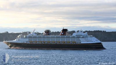
DISNEY MAGIC
Passengers Ship
Current Trip
| Trip Time | 14 h, 6 mins |
|---|---|
| Trip Distance | 160.22 nm |
| AVG Speed | 11.8 Knop |
| MAX Speed | 13.7 Knop |
| Djupgående | 8.3 m |
| AVG Wind | 12.7 knots |
| MAX Wind | 14.9 knots |
| MIN Temp | 25.9°C / 78.62°F |
| MAX Temp | 27.2°C / 80.96°F |
| Position mottagen | 8 h, 39 m sen |
Current Position
| Longitud | -62.51480° |
|---|---|
| Latitude | 17.83893° |
| Status | Under way using engine |
| Fart | 12.5 Knop |
| Kurs | 27.8° |
| Område | Caribbean Sea |
| Station | T-AIS |
| Position mottagen | 8 h, 39 m sen |
Info
Information
The current position of DISNEY MAGIC is in Caribbean Sea with coordinates 17.83893° / -62.51480° as reported on 2024-04-29 05:02 by AIS to our vessel tracker app. The vessel's current speed is 12.5 Knop and is currently inside the port of ST JOHNS.
The vessel DISNEY MAGIC (IMO: 9126807, MMSI: 308516000) is a Passengers Ship that was built in 1998 ( 26 År gammal ). It's sailing under the flag of [BS] Bahamas.
In this page you can find informations about the vessels current position, last detected port calls, and current voyage information. If the vessels is not in coverage by AIS you will find the latest position.
The current position of DISNEY MAGIC is detected by our AIS receivers and we are not responsible for the reliability of the data. The last position was recorded while the vessel was in Coverage by the Ais receivers of our vessel tracking app.
The current draught of DISNEY MAGIC as reported by AIS is 8.3 meters
Weather
| Temperature | 27.4°C / 81.32°F |
|---|---|
| Wind Speed | 10 knots |
| Direction | 83° E |
| Pressure | 1014.5 hPa |
| Humidity | 69.7 % |
| Cloud Coverage | 13 % |
Featured Company
Last Port Calls
| Port | Arrival | Departure | Time In Port |
|---|---|---|---|
| 2024-04-29 11:46 | |||
| 2024-04-28 11:58 | 2024-04-28 21:40 | 9 h | |
| 2024-04-27 09:42 | 2024-04-27 22:13 | 12 h | |
| 2024-04-26 12:07 | 2024-04-26 21:13 | 9 h | |
| 2024-04-25 11:33 | 2024-04-25 21:56 | 10 h | |
| 2024-04-23 11:58 | 2024-04-23 21:10 | 9 h | |
| 2024-04-20 10:58 | 2024-04-20 23:01 | 12 h | |
| 2024-04-18 12:35 | 2024-04-18 21:26 | 8 h | |
| 2024-04-16 13:38 | 2024-04-16 21:22 | 7 h | |
| 2024-04-14 12:08 | 2024-04-14 21:54 | 9 h |
Last Trips
| Origin | Departure | Destination | Arrival | Distance | |
|---|---|---|---|---|---|
| 2024-04-28 17:40 | 2024-04-29 07:46 | 160.22 nm | |||
| 2024-04-27 18:13 | 2024-04-28 07:58 | 238.96 nm | |||
| 2024-04-26 17:13 | 2024-04-27 05:42 | 202.80 nm | |||
| 2024-04-25 17:56 | 2024-04-26 08:07 | 209.19 nm | |||
| 2024-04-23 17:10 | 2024-04-25 07:33 | 558.42 nm | |||
| 2024-04-20 19:01 | 2024-04-23 07:58 | 608.51 nm | |||
| 2024-04-18 16:26 | 2024-04-20 06:58 | 677.64 nm | |||
| 2024-04-16 16:22 | 2024-04-18 07:35 | 571.54 nm | |||
| 2024-04-14 16:54 | 2024-04-16 08:38 | 724.46 nm | |||
| 2024-04-12 20:42 | 2024-04-14 07:08 | 577.72 nm |
Events
| Tid | Event | Detaljer | Position / Dest | Information |
|---|---|---|---|---|
| 2024-04-29 12:06 | STOPPAR förflyttning |
17.12155 / -61.84822
[AG] ST JOHNS
|
Fart: 0.3 kn Kurs: 91° |
|
| 2024-04-29 11:46 | ANLÄNDER HAMN |
|
17.12471 / -61.86092
[AG] ST JOHNS
|
Fart: 8.1 kn Kurs: 113° |
| 2024-04-29 11:31 | STARTAR förflyttning | 2.24 nm, North West of ST JOHNS |
17.13902 / -61.89498
US SJU>KN BAS
|
Fart: 8.6 kn Kurs: 112° |
| 2024-04-29 11:18 | STOPPAR förflyttning | 2.59 nm, North West of ST JOHNS |
17.14159 / -61.90048
US SJU>KN BAS
|
Fart: 0.2 kn Kurs: 101° |
| 2024-04-29 05:08 | Status ändrad | Default Under way using engine |
17.85503 / -62.50501
US SJU>KN BAS
|
Fart: 12.5 kn Kurs: 27.8° |
| 2024-04-29 05:02 | UTANFÖR täckningsområde |
17.83893 / -62.51480
Caribbean Sea
|
Fart: 12.5 kn Kurs: 27.8° |
|
| 2024-04-29 04:53 | Status ändrad | Under way using engine Default |
17.80841 / -62.53174
US SJU>KN BAS
|
Fart: 12.6 kn Kurs: 28° |
| 2024-04-29 04:47 | Status ändrad | Default Under way using engine |
17.79033 / -62.54187
US SJU>KN BAS
|
Fart: 12.6 kn Kurs: 27.2° |
| 2024-04-29 04:44 | Byter havsområde | Saint-Martin part of the Caribbean Sea Saint Kitts and Nevis part of the Caribbean Sea |
17.78038 / -62.54729
Caribbean Sea
|
Fart: 12.8 kn Kurs: 27.6° |
| 2024-04-29 04:44 | Status ändrad | Under way using engine Default |
17.78038 / -62.54729
US SJU>KN BAS
|
Fart: 12.7 kn Kurs: 27° |