
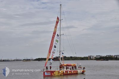
CV30
Sailing
Current Trip
| Trip Time | 22 days |
|---|---|
| Trip Distance | 4726.93 nm |
| AVG Speed | 4.4 Knop |
| MAX Speed | 10.3 Knop |
| Djupgående | --- |
| AVG Wind | 19 knots |
| MAX Wind | 27 knots |
| MIN Temp | 17.8°C / 64.04°F |
| MAX Temp | 20.8°C / 69.44°F |
| Position mottagen | 4 m sen |
Current Position
| Longitud | --- |
|---|---|
| Latitude | --- |
| Status | Default |
| Fart | |
| Kurs | --- |
| Område | Indian Ocean |
| Station | T-AIS |
| Position mottagen | 4 m sen |
Info
Information
The current position of CV30 is in Indian Ocean with coordinates -32.06599° / 115.74620° as reported on 2025-12-16 05:41 by AIS to our vessel tracker app. The vessel's current speed is 0 Knop and is currently inside the port of FREMANTLE.
The vessel CV30 (MMSI: 215255000) is a Sailing It's sailing under the flag of [MT] Malta.
In this page you can find informations about the vessels current position, last detected port calls, and current voyage information. If the vessels is not in coverage by AIS you will find the latest position.
The current position of CV30 is detected by our AIS receivers and we are not responsible for the reliability of the data. The last position was recorded while the vessel was in Coverage by the Ais receivers of our vessel tracking app.
Weather
| Temperature | 24°C / 75.2°F |
|---|---|
| Wind Speed | 10 knots |
| Direction | 244° WSW |
| Pressure | 1007.5 hPa |
| Humidity | 71.5 % |
| Cloud Coverage | 9 % |
Featured Company
Most Visited Ports (Last year)
| Port | Arrivals | |
|---|---|---|
| 23 | ||
| 7 | ||
| 7 | ||
| 5 | ||
| 4 | ||
| 1 |
Last Trips
| Origin | Departure | Destination | Arrival | Distance | |
|---|---|---|---|---|---|
| 2025-11-16 14:12 | 2025-12-09 01:53 | 4726.93 nm | |||
| 2025-11-16 13:44 | 2025-11-16 14:04 | 0.93 nm | |||
| 2025-11-16 12:36 | 2025-11-16 13:40 | 5.32 nm | |||
| 2025-11-11 10:25 | 2025-11-11 15:11 | 13.62 nm | |||
| 2025-08-31 14:55 | 2025-11-05 09:11 | 6.84 nm |
Events
| Tid | Event | Detaljer | Position / Dest | Information |
|---|---|---|---|---|
| 2025-12-16 00:30 | I täckningsområde |
-32.06598 / 115.74620
Indian Ocean
[AU] FREMANTLE
|
Fart: Kurs: 172.7° |
|
| 2025-12-08 18:19 | UTANFÖR täckningsområde |
-32.06601 / 115.74618
Indian Ocean
[AU] FREMANTLE
|
Fart: Kurs: 35.6° |
|
| 2025-12-08 18:04 | STOPPAR förflyttning |
-32.06602 / 115.74619
[AU] FREMANTLE
|
Fart: 0.2 kn Kurs: 511° |
|
| 2025-12-08 17:53 | ANLÄNDER HAMN |
|
-32.06553 / 115.74039
[AU] FREMANTLE
|
Fart: 3.2 kn Kurs: 46.9° |
| 2025-12-08 15:43 | Byter havsområde | Australian part of the Indian Ocean South African part of the South Atlantic Ocean |
-31.97142 / 115.67759
Indian Ocean
|
Fart: 8.8 kn Kurs: 127.4° |
| 2025-12-08 15:41 | I täckningsområde |
-31.97142 / 115.67759
Indian Ocean
|
Fart: 8.8 kn Kurs: 127.4° |