
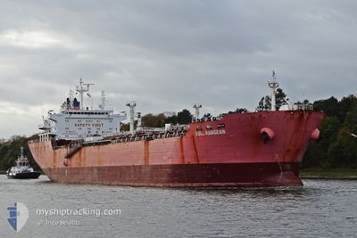
BULL KANGEAN
Oil/Chemical Tanker
Current Trip
| Time Travelled | 17 days |
|---|---|
| Remaining Time | --- |
| Distance Travelled | 2149.34 nm |
| Remaining Distance | --- |
| AVG Speed | 10.2 Knop |
| MAX Speed | 12.8 Knop |
| AVG Wind | 11.3 knots |
| MAX Wind | 34.8 knots |
| MIN Temp | 14.6°C / 58.28°F |
| MAX Temp | 23.3°C / 73.94°F |
| Djupgående | 8.3 m |
| Position mottagen | 1 d sen |
Current Position
| Longitud | 20.96983° |
|---|---|
| Latitude | 36.80074° |
| Status | Restricted manoeuverability |
| Fart | 0.9 Knop |
| Kurs | 309° |
| Område | Ionian Sea |
| Station | T-AIS |
| Position mottagen | 1 d sen |
Info
Information
The current position of BULL KANGEAN is in Ionian Sea with coordinates 36.80074° / 20.96983° as reported on 2024-05-19 19:41 by AIS to our vessel tracker app. The vessel's current speed is 0.9 Knop
The vessel BULL KANGEAN (IMO: 9267027, MMSI: 525107008) is a Oil/Chemical Tanker that was built in 2004 ( 20 År gammal ). It's sailing under the flag of [ID] Indonesia.
In this page you can find informations about the vessels current position, last detected port calls, and current voyage information. If the vessels is not in coverage by AIS you will find the latest position.
The current position of BULL KANGEAN is detected by our AIS receivers and we are not responsible for the reliability of the data. The last position was recorded while the vessel was in Coverage by the Ais receivers of our vessel tracking app.
The current draught of BULL KANGEAN as reported by AIS is 8.3 meters
Weather
| Temperature | 20.4°C / 68.72°F |
|---|---|
| Wind Speed | 14 knots |
| Direction | 154° SSE |
| Pressure | 1010.8 hPa |
| Humidity | 81.9 % |
| Cloud Coverage | 89 % |
Featured Company
Last Port Calls
| Port | Arrival | Departure | Time In Port |
|---|---|---|---|
| 2024-04-29 05:04 | 2024-05-03 15:59 | 4 d | |
| 2024-04-03 11:39 | 2024-04-05 16:11 | 2 d | |
| 2024-03-25 10:56 | 2024-03-26 18:19 | 1 d | |
| 2024-03-18 14:47 | 2024-03-20 14:20 | 1 d |
Most Visited Ports (Last year)
| Port | Arrivals | |
|---|---|---|
| 3 | ||
| 2 | ||
| 2 | ||
| 2 | ||
| 2 | ||
| 1 |
Last Trips
| Origin | Departure | Destination | Arrival | Distance | |
|---|---|---|---|---|---|
| 2024-04-05 16:11 | 2024-04-29 07:04 | 4113.03 nm | |||
| 2024-03-26 18:19 | 2024-04-03 11:39 | 109.47 nm | |||
| 2024-03-20 14:20 | 2024-03-25 10:56 | 373.04 nm | |||
| 2024-02-15 16:57 | 2024-03-18 14:47 | 4733.07 nm |
Events
| Tid | Event | Detaljer | Position / Dest | Information |
|---|---|---|---|---|
| 2024-05-19 19:42 | Status ändrad | Default Restricted manoeuverability |
36.80038 / 20.96944
MALTA
|
Fart: 0.9 kn Kurs: 309° |
| 2024-05-19 19:41 | UTANFÖR täckningsområde |
36.80074 / 20.96983
Ionian Sea
|
Fart: 0.9 kn Kurs: 222.4° |
|
| 2024-05-19 19:35 | Status ändrad | Restricted manoeuverability Default |
36.80166 / 20.97091
MALTA
|
Fart: 0.9 kn Kurs: 304° |
| 2024-05-19 19:18 | I täckningsområde |
36.80166 / 20.97091
Ionian Sea
|
Fart: 0.8 kn Kurs: 218.8° |
|
| 2024-05-18 18:56 | STOPPAR förflyttning |
36.77080 / 21.10229
MALTA
|
Fart: Kurs: 18° |
|
| 2024-05-18 17:50 | STARTAR förflyttning |
36.91213 / 21.03662
MALTA
|
Fart: 3.5 kn Kurs: 158° |
|
| 2024-05-17 19:48 | STOPPAR förflyttning |
36.75667 / 21.02167
MALTA
|
Fart: Kurs: -1° |
|
| 2024-05-17 18:19 | STARTAR förflyttning |
36.97107 / 21.09019
MALTA
|
Fart: 8.9 kn Kurs: 202° |
|
| 2024-05-17 08:51 | STOPPAR förflyttning |
36.84167 / 21.08333
MALTA
|
Fart: Kurs: -1° |
|
| 2024-05-17 00:39 | STARTAR förflyttning |
36.96333 / 21.00500
MALTA
|
Fart: 6 kn Kurs: 165° |