
BOKA GLACIER
Tug
Current Trip
FLUMINENSE FIELD
| Time Travelled | 27 days |
|---|---|
| Remaining Time | --- |
| Distance Travelled | 3754.02 nm |
| Remaining Distance | --- |
| AVG Speed | 7.4 Knop |
| MAX Speed | 14 Knop |
| AVG Wind | 10.8 knots |
| MAX Wind | 22.8 knots |
| MIN Temp | 17.6°C / 63.68°F |
| MAX Temp | 36.6°C / 97.88°F |
| Djupgående | 6.4 m |
| Position mottagen | 6 m sen |
Current Position
| Longitud | -40.46105° |
|---|---|
| Latitude | -22.69353° |
| Status | Under way using engine |
| Fart | 1.6 Knop |
| Kurs | 213° |
| Område | South Atlantic Ocean |
| Station | T-AIS |
| Position mottagen | 6 m sen |
Info
Information
The current position of BOKA GLACIER is in South Atlantic Ocean with coordinates -22.69353° / -40.46105° as reported on 2024-05-12 12:58 by AIS to our vessel tracker app. The vessel's current speed is 1.6 Knop
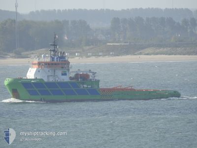
The vessel BOKA GLACIER (IMO: 9344796, MMSI: 248568000) is a Tug that was built in 2006 ( 18 År gammal ). It's sailing under the flag of [MT] Malta.
In this page you can find informations about the vessels current position, last detected port calls, and current voyage information. If the vessels is not in coverage by AIS you will find the latest position.
The current position of BOKA GLACIER is detected by our AIS receivers and we are not responsible for the reliability of the data. The last position was recorded while the vessel was in Coverage by the Ais receivers of our vessel tracking app.
The current draught of BOKA GLACIER as reported by AIS is 6.4 meters
Weather
| Temperature | 26.7°C / 80.06°F |
|---|---|
| Wind Speed | 15 knots |
| Direction | 10° N |
| Pressure | 1013.3 hPa |
| Humidity | 82.8 % |
| Cloud Coverage | --- |
Featured Company
Last Port Calls
| Port | Arrival | Departure | Time In Port |
|---|---|---|---|
| 2024-04-14 12:56 | 2024-04-14 16:05 | 3 h | |
| 2024-04-13 12:28 | 2024-04-14 12:49 | 1 d |
Most Visited Ports (Last year)
| Port | Arrivals | |
|---|---|---|
| 6 | ||
| 1 | ||
| 1 | ||
| 1 |
Last Trips
| Origin | Departure | Destination | Arrival | Distance | |
|---|---|---|---|---|---|
| 2024-04-14 12:49 | 2024-04-14 12:56 | 1.14 nm | |||
| 2024-02-25 11:49 | 2024-04-13 12:28 | 2775.75 nm |
Events
| Tid | Event | Detaljer | Position / Dest | Information |
|---|---|---|---|---|
| 2024-05-12 12:07 | STARTAR förflyttning |
-22.67370 / -40.44530
FLUMINENSE FIELD
|
Fart: 3.8 kn Kurs: 192° |
|
| 2024-05-12 10:48 | Djupgående ändrat | 6.4 6.2 |
-22.69052 / -40.47988
FLUMINENSE FIELD
|
Fart: 1.6 kn Kurs: 59° |
| 2024-05-12 10:48 | Destination ändrad | FLUMINENSE FIELD BRRIO |
-22.69052 / -40.47988
FLUMINENSE FIELD
|
Fart: 1.6 kn Kurs: 59° |
| 2024-05-12 10:48 | ETA ändrat | 2024/05/11 09:00 2024/05/08 09:00 |
-22.69052 / -40.47988
FLUMINENSE FIELD
|
Fart: 1.6 kn Kurs: 59° |
| 2024-05-12 10:34 | Status ändrad | Under way using engine Default |
-22.68791 / -40.47608
BRRIO
|
Fart: 1.6 kn Kurs: 228° |
| 2024-05-12 10:17 | I täckningsområde |
-22.68808 / -40.47657
South Atlantic Ocean
|
Fart: 1.7 kn Kurs: 263° |
|
| 2024-05-12 05:32 | STOPPAR förflyttning |
-22.66833 / -40.42166
BRRIO
|
Fart: Kurs: -1° |
|
| 2024-05-12 04:55 | STARTAR förflyttning |
-22.68486 / -40.44105
BRRIO
|
Fart: 3.3 kn Kurs: 32° |
|
| 2024-05-11 18:56 | STOPPAR förflyttning |
-22.67018 / -40.42977
BRRIO
|
Fart: 0.2 kn Kurs: 259° |
|
| 2024-05-11 18:37 | STARTAR förflyttning |
-22.66960 / -40.42709
BRRIO
|
Fart: 5 kn Kurs: 210° |