
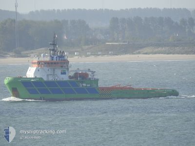
BOKA GLACIER
Tug
Current Trip
| Time Travelled | 9 days |
|---|---|
| Remaining Time | 12 days |
| Distance Travelled | 1103.57 nm |
| Remaining Distance | 2443.55 nm |
| AVG Speed | 8.2 Knots |
| MAX Speed | 9.8 Knots |
| AVG Wind | 11.7 knots |
| MAX Wind | 21.6 knots |
| MIN Temp | 17.6°C / 63.68°F |
| MAX Temp | 27.3°C / 81.14°F |
| Draught | 6.2 m |
| Position Received | 2 d ago |
Current Position
| Longitude | -19.43150° |
|---|---|
| Latitude | 19.50917° |
| Status | Under way using engine |
| Speed | 8.9 Knots |
| Course | 206° |
| Area | North Atlantic Ocean |
| Station | T-AIS |
| Position Received | 2 d ago |
Info
Information
The current position of BOKA GLACIER is in North Atlantic Ocean with coordinates 19.50917° / -19.43150° as reported on 2024-04-21 16:31 by AIS to our vessel tracker app. The vessel's current speed is 8.9 Knots and is heading at the port of RIO DE JANEIRO. The estimated time of arrival as calculated by MyShipTracking vessel tracking app is 2024-05-06 15:13 LT
The vessel BOKA GLACIER (IMO: 9344796, MMSI: 248568000) is a Tug that was built in 2006 ( 18 years old ). It's sailing under the flag of [MT] Malta.
In this page you can find informations about the vessels current position, last detected port calls, and current voyage information. If the vessels is not in coverage by AIS you will find the latest position.
The current position of BOKA GLACIER is detected by our AIS receivers and we are not responsible for the reliability of the data. The last position was recorded while the vessel was in Coverage by the Ais receivers of our vessel tracking app.
The current draught of BOKA GLACIER as reported by AIS is 6.2 meters
Weather
| Temperature | 23.5°C / 74.3°F |
|---|---|
| Wind Speed | 9 knots |
| Direction | 6° N |
| Pressure | 1012.7 hPa |
| Humidity | 77.3 % |
| Cloud Coverage | 100 % |
Featured Company
Last Port Calls
| Port | Arrival | Departure | Time In Port |
|---|---|---|---|
| 2024-04-14 11:56 | 2024-04-14 15:05 | 3 h | |
| 2024-04-13 11:28 | 2024-04-14 11:49 | 1 d | |
| 2024-02-22 09:34 | 2024-02-25 11:49 | 3 d | |
| 2024-02-10 12:55 |
Most Visited Ports (Last year)
| Port | Arrivals | |
|---|---|---|
| 6 | ||
| 1 | ||
| 1 | ||
| 1 |
Last Trips
| Origin | Departure | Destination | Arrival | Distance | |
|---|---|---|---|---|---|
| 2024-04-14 12:49 | 2024-04-14 12:56 | 1.14 nm | |||
| 2024-02-25 11:49 | 2024-04-13 12:28 | 2775.75 nm | |||
| 2024-02-10 12:55 | 2024-02-22 09:34 | 553.92 nm |
Events
| Time | Event | Details | Position / Dest | Info |
|---|---|---|---|---|
| 2024-04-21 16:37 | Status Changed | Default Under way using engine |
19.49333 / -19.43833
BRRIO
|
Speed: 8.9 kn Course: 206° |
| 2024-04-21 16:31 | OUT of Coverage |
19.50917 / -19.43150
North Atlantic Ocean
BRRIO
|
Speed: 8.9 kn Course: 206° |
|
| 2024-04-21 16:20 | Status Changed | Under way using engine Default |
19.53352 / -19.41978
BRRIO
|
Speed: 8.8 kn Course: 207° |
| 2024-04-21 15:43 | Status Changed | Default Under way using engine |
19.61500 / -19.38167
BRRIO
|
Speed: 9 kn Course: 207° |
| 2024-04-21 15:40 | Change Sea Area | Western Saharan part of the North Atlantic Ocean Spanish (Canary Islands) part of the North Atlantic Ocean |
19.62173 / -19.37899
North Atlantic Ocean
BRRIO
|
Speed: 9 kn Course: 207° |
| 2024-04-21 15:40 | Status Changed | Under way using engine Default |
19.62173 / -19.37899
BRRIO
|
Speed: 9 kn Course: 207° |
| 2024-04-21 15:37 | IN Coverage |
19.62173 / -19.37899
North Atlantic Ocean
BRRIO
|
Speed: 9 kn Course: 207° |
|
| 2024-04-19 03:20 | Status Changed | Default Under way using engine |
27.53885 / -15.41319
BRRIO
|
Speed: 9.3 kn Course: 208° |
| 2024-04-19 02:22 | OUT of Coverage |
27.66511 / -15.33487
North Atlantic Ocean
BRRIO
|
Speed: 9.3 kn Course: 208° |
|
| 2024-04-18 23:01 | START Moving | 2.46 nm, South East of LAS PALMAS |
28.09004 / -15.39540
|
Speed: 4.4 kn Course: 85° |