
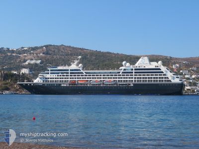
AZAMARA ONWARD
Passengers Ship
Current Trip
NAWVD
| Time Travelled | 2 days |
|---|---|
| Remaining Time | --- |
| Distance Travelled | 1133.05 nm |
| Remaining Distance | --- |
| AVG Speed | 17.2 Knop |
| MAX Speed | 18.4 Knop |
| AVG Wind | 13.2 knots |
| MAX Wind | 18 knots |
| MIN Temp | 14.5°C / 58.1°F |
| MAX Temp | 25.4°C / 77.72°F |
| Djupgående | 5.9 m |
| Position mottagen | 4 d sen |
Current Position
| Longitud | 17.91888° |
|---|---|
| Latitude | -33.73790° |
| Status | Under way using engine |
| Fart | 16.4 Knop |
| Kurs | 341.2° |
| Område | South Atlantic Ocean |
| Station | T-AIS |
| Position mottagen | 4 d sen |
Info
Information
The current position of AZAMARA ONWARD is in South Atlantic Ocean with coordinates -33.73790° / 17.91888° as reported on 2024-05-10 14:59 by AIS to our vessel tracker app. The vessel's current speed is 16.4 Knop
The vessel AZAMARA ONWARD (IMO: 9187887, MMSI: 229765000) is a Passengers Ship that was built in 1999 ( 25 År gammal ). It's sailing under the flag of [MT] Malta.
In this page you can find informations about the vessels current position, last detected port calls, and current voyage information. If the vessels is not in coverage by AIS you will find the latest position.
The current position of AZAMARA ONWARD is detected by our AIS receivers and we are not responsible for the reliability of the data. The last position was recorded while the vessel was in Coverage by the Ais receivers of our vessel tracking app.
The current draught of AZAMARA ONWARD as reported by AIS is 5.9 meters
Weather
| Temperature | 25.3°C / 77.54°F |
|---|---|
| Wind Speed | 12 knots |
| Direction | 135° SE |
| Pressure | 1012.1 hPa |
| Humidity | 76.8 % |
| Cloud Coverage | 93 % |
Featured Company
Last Port Calls
| Port | Arrival | Departure | Time In Port |
|---|---|---|---|
| 2024-05-12 11:31 | 2024-05-12 22:51 | 11 h | |
| 2024-05-09 08:27 | 2024-05-09 12:03 | 3 h | |
| 2024-05-04 08:42 | 2024-05-04 16:23 | 7 h | |
| 2024-04-24 07:19 | 2024-04-24 22:09 | 14 h | |
| 2024-04-21 07:07 | 2024-04-21 22:15 | 15 h | |
| 2024-04-17 04:33 | 2024-04-18 18:32 | 1 d | |
| 2024-04-14 07:07 | 2024-04-15 15:03 | 1 d | |
| 2024-04-12 07:17 | 2024-04-12 18:27 | 11 h | |
| 2024-04-09 06:53 | 2024-04-09 17:00 | 10 h | |
| 2024-04-07 06:57 | 2024-04-07 21:09 | 14 h |
Last Trips
| Origin | Departure | Destination | Arrival | Distance | |
|---|---|---|---|---|---|
| 2024-05-09 12:03 | 2024-05-12 11:31 | 1139.40 nm | |||
| 2024-05-04 16:23 | 2024-05-09 08:27 | 1925.60 nm | |||
| 2024-04-24 22:09 | 2024-05-04 08:42 | 3092.07 nm | |||
| 2024-04-21 22:15 | 2024-04-24 07:19 | 630.26 nm | |||
| 2024-04-18 18:32 | 2024-04-21 07:07 | 850.76 nm | |||
| 2024-04-15 15:03 | 2024-04-17 04:33 | 603.89 nm | |||
| 2024-04-12 18:27 | 2024-04-14 07:07 | 439.25 nm | |||
| 2024-04-09 17:00 | 2024-04-12 07:17 | 851.78 nm | |||
| 2024-04-07 21:09 | 2024-04-09 06:53 | 415.70 nm | |||
| 2024-04-06 17:36 | 2024-04-07 06:57 | 194.74 nm |
Events
| Tid | Event | Detaljer | Position / Dest | Information |
|---|---|---|---|---|
| 2024-05-12 20:51 | AVGÅTT HAMN |
|
-22.92453 / 14.49775
NAWVD
|
Fart: 10.3 kn Kurs: 2° |
| 2024-05-12 20:44 | STARTAR förflyttning |
-22.94493 / 14.49683
[NA] WALVIS BAY
|
Fart: 4.8 kn Kurs: 356° |
|
| 2024-05-12 09:51 | STOPPAR förflyttning |
-22.94962 / 14.49773
[NA] WALVIS BAY
|
Fart: 0.2 kn Kurs: 48° |
|
| 2024-05-12 09:31 | ANLÄNDER HAMN |
|
-22.93393 / 14.49688
[NA] WALVIS BAY
|
Fart: 13.1 kn Kurs: 183° |
| 2024-05-10 15:07 | Status ändrad | Default Under way using engine |
-33.70548 / 17.90240
NAWVD
|
Fart: 16.4 kn Kurs: 341.2° |
| 2024-05-10 14:59 | UTANFÖR täckningsområde |
-33.73790 / 17.91888
South Atlantic Ocean
NAWVD
|
Fart: 16.4 kn Kurs: 341.2° |
|
| 2024-05-10 14:52 | Status ändrad | Under way using engine Default |
-33.76895 / 17.93522
NAWVD
|
Fart: 16.2 kn Kurs: 331° |
| 2024-05-10 14:24 | Status ändrad | Default Under way using engine |
-33.88653 / 17.99670
NAWVD
|
Fart: 17.9 kn Kurs: 338.1° |
| 2024-05-10 14:23 | Status ändrad | Under way using engine Default |
-33.88832 / 17.99765
NAWVD
|
Fart: 17.6 kn Kurs: 328° |
| 2024-05-10 14:19 | Status ändrad | Default Under way using engine |
-33.90512 / 18.00788
NAWVD
|
Fart: 17.9 kn Kurs: 326.5° |