
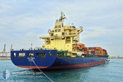
AS CYPRIA
Container Ship
Current Trip
| Time Travelled | 7 days |
|---|---|
| Remaining Time | 1 day |
| Distance Travelled | 2338.29 nm |
| Remaining Distance | 427.32 nm |
| AVG Speed | 13 Knop |
| MAX Speed | 18.7 Knop |
| AVG Wind | 10.7 knots |
| MAX Wind | 24.2 knots |
| MIN Temp | 17.9°C / 64.22°F |
| MAX Temp | 27.6°C / 81.68°F |
| Djupgående | 9.7 m |
| Position mottagen | 23 h, 52 m sen |
Current Position
| Longitud | --- |
|---|---|
| Latitude | --- |
| Status | Under way using engine |
| Fart | 13.3 Knop |
| Kurs | 48° |
| Område | North Atlantic Ocean |
| Station | T-AIS |
| Position mottagen | 23 h, 52 m sen |
Info
Information
The current position of AS CYPRIA is in North Atlantic Ocean with coordinates 27.11755° / -14.56964° as reported on 2026-01-03 04:15 by AIS to our vessel tracker app. The vessel's current speed is 13.3 Knop and is heading at the port of TANGER MED. The estimated time of arrival as calculated by MyShipTracking vessel tracking app is 2026-01-05 12:53 LT
The vessel AS CYPRIA (IMO: 9315812, MMSI: 255806093) is a Container Ship that was built in 2006 ( 20 År gammal ). It's sailing under the flag of [PT] Portugal.
In this page you can find informations about the vessels current position, last detected port calls, and current voyage information. If the vessels is not in coverage by AIS you will find the latest position.
The current position of AS CYPRIA is detected by our AIS receivers and we are not responsible for the reliability of the data. The last position was recorded while the vessel was in Coverage by the Ais receivers of our vessel tracking app.
The current draught of AS CYPRIA as reported by AIS is 9.7 meters
Weather
| Temperature | 17.9°C / 64.22°F |
|---|---|
| Wind Speed | 23 knots |
| Direction | 262° W |
| Pressure | 1003.7 hPa |
| Humidity | 83.2 % |
| Cloud Coverage | --- |
Featured Company
Last Port Calls
| Port | Arrival | Departure | Time In Port |
|---|---|---|---|
| 2025-12-25 20:22 | 2025-12-27 19:18 | 1 d | |
| 2025-12-21 02:36 | 2025-12-22 04:41 | 1 d | |
| 2025-12-03 22:43 | 2025-12-06 04:07 | 2 d | |
| 2025-11-29 11:31 | 2025-11-30 15:40 | 1 d | |
| 2025-11-12 16:02 | 2025-11-13 17:02 | 1 d | |
| 2025-11-08 13:54 | 2025-11-09 17:54 | 1 d |
Last Trips
| Origin | Departure | Destination | Arrival | Distance | |
|---|---|---|---|---|---|
| 2025-12-22 04:41 | 2025-12-25 20:22 | 1218.54 nm | |||
| 2025-12-06 04:07 | 2025-12-21 02:36 | 4378.40 nm | |||
| 2025-11-30 15:40 | 2025-12-03 22:43 | 1213.55 nm | |||
| 2025-11-13 17:02 | 2025-11-29 11:31 | 4296.39 nm | |||
| 2025-11-09 17:54 | 2025-11-12 16:02 | 1209.92 nm | |||
| 2025-10-23 11:54 | 2025-11-08 13:54 | 4470.48 nm |
Events
| Tid | Event | Detaljer | Position / Dest | Information |
|---|---|---|---|---|
| 2026-01-03 04:22 | Status ändrad | Default Under way using engine |
27.13666 / -14.54571
MAPTM
|
Fart: 13.3 kn Kurs: 48° |
| 2026-01-03 04:15 | UTANFÖR täckningsområde |
27.11755 / -14.56964
North Atlantic Ocean
MAPTM
|
Fart: 13.3 kn Kurs: 48° |
|
| 2026-01-03 03:45 | Status ändrad | Under way using engine Default |
27.04204 / -14.65995
MAPTM
|
Fart: 13.2 kn Kurs: 46° |
| 2026-01-03 03:27 | Status ändrad | Default Under way using engine |
26.99548 / -14.71307
MAPTM
|
Fart: 13.1 kn Kurs: 43.9° |
| 2026-01-03 03:19 | Status ändrad | Under way using engine Default |
26.97476 / -14.73667
MAPTM
|
Fart: 13.2 kn Kurs: 48° |
| 2026-01-03 03:06 | Status ändrad | Default Under way using engine |
26.94330 / -14.77319
MAPTM
|
Fart: 13 kn Kurs: 45.3° |
| 2026-01-03 02:43 | Status ändrad | Under way using engine Default |
26.88392 / -14.84164
MAPTM
|
Fart: 13.2 kn Kurs: 46° |
| 2026-01-03 02:38 | I täckningsområde |
26.88392 / -14.84164
North Atlantic Ocean
MAPTM
|
Fart: 13.2 kn Kurs: 44.2° |
|
| 2026-01-01 18:58 | Status ändrad | Default Under way using engine |
20.91268 / -18.30105
MAPTM
|
Fart: 12.7 kn Kurs: 14.6° |
| 2026-01-01 18:52 | UTANFÖR täckningsområde |
20.89203 / -18.30680
North Atlantic Ocean
MAPTM
|
Fart: 12.7 kn Kurs: 14.6° |