
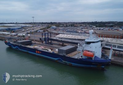
ADRIATIC
Cargo
Current Trip
| Time Travelled | 5 days |
|---|---|
| Remaining Time | --- |
| Distance Travelled | 1521.58 nm |
| Remaining Distance | --- |
| AVG Speed | 12.1 Knop |
| MAX Speed | 14 Knop |
| AVG Wind | 10.6 knots |
| MAX Wind | 27.3 knots |
| MIN Temp | 11.2°C / 52.16°F |
| MAX Temp | 18.1°C / 64.58°F |
| Djupgående | 4.6 m |
| Position mottagen | 50 m sen |
Current Position
| Longitud | --- |
|---|---|
| Latitude | --- |
| Status | Moored |
| Fart | 12.9 Knop |
| Kurs | 262.2° |
| Område | Alboran Sea |
| Station | T-AIS |
| Position mottagen | 50 m sen |
Info
Information
The current position of ADRIATIC is in Alboran Sea with coordinates 36.34551° / -2.76981° as reported on 2025-12-10 17:59 by AIS to our vessel tracker app. The vessel's current speed is 12.9 Knop
The vessel ADRIATIC (IMO: 9944871, MMSI: 246269000) is a Cargo It's sailing under the flag of [NL] Netherlands.
In this page you can find informations about the vessels current position, last detected port calls, and current voyage information. If the vessels is not in coverage by AIS you will find the latest position.
The current position of ADRIATIC is detected by our AIS receivers and we are not responsible for the reliability of the data. The last position was recorded while the vessel was in Coverage by the Ais receivers of our vessel tracking app.
The current draught of ADRIATIC as reported by AIS is 4.6 meters
Weather
| Temperature | 15.9°C / 60.62°F |
|---|---|
| Wind Speed | 18 knots |
| Direction | 296° WNW |
| Pressure | 1020.9 hPa |
| Humidity | 79.9 % |
| Cloud Coverage | 100 % |
Featured Company
Last Port Calls
| Port | Arrival | Departure | Time In Port |
|---|---|---|---|
| 2025-11-30 12:44 | 2025-12-05 13:55 | 5 d | |
| 2025-11-26 13:10 | 2025-11-29 15:11 | 3 d | |
| 2025-11-22 07:07 | 2025-11-25 13:02 | 3 d | |
| 2025-11-19 23:59 | 2025-11-21 15:01 | 1 d | |
| 2025-11-17 07:22 | 2025-11-17 23:39 | 16 h | |
| 2025-11-04 16:48 | 2025-11-05 16:32 | 23 h | |
| 2025-11-03 19:16 | 2025-11-03 19:40 | 23 m | |
| 2025-11-02 14:05 | 2025-11-03 16:21 | 1 d | |
| 2025-10-22 13:18 | 2025-10-31 18:29 | 9 d | |
| 2025-10-19 11:12 | 2025-10-20 16:05 | 1 d |
Last Trips
| Origin | Departure | Destination | Arrival | Distance | |
|---|---|---|---|---|---|
| 2025-11-29 15:11 | 2025-11-30 12:44 | 247.21 nm | |||
| 2025-11-25 13:02 | 2025-11-26 13:10 | 281.92 nm | |||
| 2025-11-21 15:01 | 2025-11-22 07:07 | 178.07 nm | |||
| 2025-11-17 23:39 | 2025-11-19 23:59 | 598.01 nm | |||
| 2025-11-05 16:32 | 2025-11-17 07:22 | 3368.74 nm | |||
| 2025-11-03 19:40 | 2025-11-04 16:48 | 125.26 nm | |||
| 2025-11-03 16:21 | 2025-11-03 19:16 | 29.58 nm | |||
| 2025-10-31 18:29 | 2025-11-02 14:05 | 207.71 nm | |||
| 2025-10-20 16:05 | 2025-10-22 13:18 | 427.62 nm | |||
| 2025-10-18 14:24 | 2025-10-19 11:12 | 248.53 nm |
Events
| Tid | Event | Detaljer | Position / Dest | Information |
|---|---|---|---|---|
| 2025-12-10 18:01 | Status ändrad | Default Moored |
36.34427 / -2.78069
ANTWERPEN
|
Fart: 12.9 kn Kurs: 262.2° |
| 2025-12-10 17:59 | Status ändrad | Moored Default |
36.34551 / -2.76981
ANTWERPEN
|
Fart: 13 kn Kurs: 262° |
| 2025-12-10 17:59 | I täckningsområde |
36.34551 / -2.76981
Alboran Sea
ANTWERPEN
|
Fart: 12.9 kn Kurs: 262.2° |
|
| 2025-12-10 17:59 | Upptäckt i hav | Spanish part of the Alboran Sea |
36.34551 / -2.76981
Alboran Sea
ANTWERPEN
|
Fart: 12.9 kn Kurs: 262.2° |
| 2025-12-10 11:23 | Status ändrad | Default Moored |
36.61602 / -.95026
ANTWERPEN
|
Fart: 13.6 kn Kurs: 261.4° |
| 2025-12-10 11:16 | Status ändrad | Moored Default |
36.62108 / -.91641
ANTWERPEN
|
Fart: 13.6 kn Kurs: 258° |
| 2025-12-10 11:16 | UTANFÖR täckningsområde |
36.62108 / -.91641
Mediterranean Sea - Western Basin
ANTWERPEN
|
Fart: 13.6 kn Kurs: 261.4° |
|
| 2025-12-10 10:55 | Status ändrad | Default Moored |
36.63717 / -.82114
ANTWERPEN
|
Fart: 13.5 kn Kurs: 258.5° |
| 2025-12-10 10:28 | Status ändrad | Moored Default |
36.65824 / -.69763
ANTWERPEN
|
Fart: 13.3 kn Kurs: 258° |
| 2025-12-10 10:27 | Status ändrad | Default Moored |
36.65875 / -.69463
ANTWERPEN
|
Fart: 13.3 kn Kurs: 257.5° |