
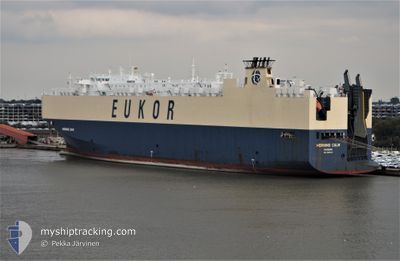
MORNING CALM
Vehicles Carrier
Current Trip
NLRTM
| Time Travelled | 1 day |
|---|---|
| Remaining Time | --- |
| Distance Travelled | 167.86 nm |
| Remaining Distance | --- |
| AVG Speed | 7.2 Knop |
| MAX Speed | 13.8 Knop |
| AVG Wind | 20.4 knots |
| MAX Wind | 35 knots |
| MIN Temp | 6.4°C / 43.52°F |
| MAX Temp | 9.1°C / 48.38°F |
| Djupgående | 9.7 m |
| Position mottagen | 1 d sen |
Current Position
| Longitud | --- |
|---|---|
| Latitude | --- |
| Status | Under way using engine |
| Fart | 7.8 Knop |
| Kurs | 287.5° |
| Område | North Sea |
| Station | T-AIS |
| Position mottagen | 1 d sen |
Info
Information
The current position of MORNING CALM is in North Sea with coordinates 52.03708° / 3.14386° as reported on 2026-03-28 21:38 by AIS to our vessel tracker app. The vessel's current speed is 7.8 Knop
The vessel MORNING CALM (IMO: 9285615, MMSI: 311697000) is a Vehicles Carrier that was built in 2004 ( 22 År gammal ). It's sailing under the flag of [BS] Bahamas.
In this page you can find informations about the vessels current position, last detected port calls, and current voyage information. If the vessels is not in coverage by AIS you will find the latest position.
The current position of MORNING CALM is detected by our AIS receivers and we are not responsible for the reliability of the data. The last position was recorded while the vessel was in Coverage by the Ais receivers of our vessel tracking app.
The current draught of MORNING CALM as reported by AIS is 9.7 meters
Weather
| Temperature | 7.3°C / 45.14°F |
|---|---|
| Wind Speed | 25 knots |
| Direction | 307° NW |
| Pressure | 1016.8 hPa |
| Humidity | 77.6 % |
| Cloud Coverage | 9 % |
Featured Company
Last Port Calls
| Port | Arrival | Departure | Time In Port |
|---|---|---|---|
| 2026-03-28 17:38 | 2026-03-28 18:19 | 41 m | |
| 2026-03-27 04:31 | 2026-03-28 17:37 | 1 d | |
| 2026-03-27 03:03 | 2026-03-27 04:21 | 1 h | |
| 2026-02-13 11:18 | 2026-02-14 01:16 | 13 h | |
| 2026-02-11 00:37 | 2026-02-11 17:33 | 16 h | |
| 2026-02-09 05:14 | 2026-02-09 16:35 | 11 h | |
| 2026-01-03 01:48 | 2026-01-04 14:06 | 1 d |
Most Visited Ports (Last year)
| Port | Arrivals | |
|---|---|---|
| 3 | ||
| 3 | ||
| 2 | ||
| 2 | ||
| 2 | ||
| 2 |
Last Trips
| Origin | Departure | Destination | Arrival | Distance | |
|---|---|---|---|---|---|
| 2026-03-28 17:37 | 2026-03-28 17:38 | 0.05 nm | |||
| 2026-03-27 04:21 | 2026-03-27 04:31 | 0.31 nm | |||
| 2026-02-14 01:16 | 2026-03-27 03:03 | 15121.64 nm | |||
| 2026-02-11 17:33 | 2026-02-13 11:18 | 432.61 nm | |||
| 2026-02-09 16:35 | 2026-02-11 00:37 | 513.14 nm | |||
| 2026-01-04 14:06 | 2026-02-09 05:14 | 12754.89 nm | |||
| 2025-12-26 11:23 | 2026-01-03 01:48 | 436.13 nm |
Events
| Tid | Event | Detaljer | Position / Dest | Information |
|---|---|---|---|---|
| 2026-03-30 00:09 | STARTAR förflyttning | --- |
52.78216 / 3.49717
NLRTM
|
Fart: 3.2 kn Kurs: 199° |
| 2026-03-29 22:51 | STOPPAR förflyttning | --- |
52.76667 / 3.41833
NLRTM
|
Fart: Kurs: -1° |
| 2026-03-29 09:17 | STARTAR förflyttning | --- |
52.66674 / 3.40577
NLRTM
|
Fart: 3.5 kn Kurs: 340° |
| 2026-03-29 06:42 | STOPPAR förflyttning | --- |
52.65500 / 3.40667
NLRTM
|
Fart: Kurs: -1° |
| 2026-03-28 21:45 | Status ändrad | Default Under way using engine |
52.04543 / 3.12185
NLRTM
|
Fart: 7.8 kn Kurs: 287.5° |
| 2026-03-28 21:38 | UTANFÖR täckningsområde |
52.03708 / 3.14386
North Sea
|
Fart: 7.8 kn Kurs: 287.5° |
|
| 2026-03-28 21:36 | Status ändrad | Under way using engine Default |
52.03615 / 3.15039
NLRTM
|
Fart: 8.4 kn Kurs: 273° |
| 2026-03-28 21:34 | Status ändrad | Default Under way using engine |
52.03548 / 3.15986
NLRTM
|
Fart: 9.2 kn Kurs: 263° |
| 2026-03-28 21:27 | Status ändrad | Under way using engine Default |
52.03637 / 3.18480
NLRTM
|
Fart: 9.2 kn Kurs: 264° |
| 2026-03-28 21:25 | Status ändrad | Default Under way using engine |
52.03685 / 3.19229
NLRTM
|
Fart: 9.2 kn Kurs: 264.7° |