
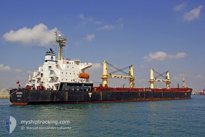
RONG XIANG
Bulk Carrier
Current Trip
NATUNA
| Time Travelled | 15 days |
|---|---|
| Remaining Time | --- |
| Distance Travelled | 2744.53 морская миля |
| Remaining Distance | --- |
| AVG Speed | 10.3 Узлы |
| MAX Speed | 14.2 Узлы |
| AVG Wind | 7.3 knots |
| MAX Wind | 26.6 knots |
| MIN Temp | 24.7°C / 76.46°F |
| MAX Temp | 30.6°C / 87.08°F |
| Осадка | 5.9 м |
| Позиция Получена | 9 d тому назад |
Current Position
| Долгота | 104.25380° |
|---|---|
| Широта | 1.26351° |
| Статус | Under way using engine |
| Скорость | 11.9 Узлы |
| Курс | 86.5° |
| Район | Singapore Strait |
| Станция | T-AIS |
| Позиция Получена | 9 d тому назад |
Info
Information
The current position of RONG XIANG is in Singapore Strait with coordinates 1.26351° / 104.25380° as reported on 2024-05-24 11:41 by AIS to our vessel tracker app. The vessel's current speed is 11.9 Узлы
The vessel RONG XIANG (IMO: 9294197, MMSI: 538007653) is a Bulk Carrier that was built in 2004 ( 20 лет ). It's sailing under the flag of [MH] Marshall Is.
In this page you can find informations about the vessels current position, last detected port calls, and current voyage information. If the vessels is not in coverage by AIS you will find the latest position.
The current position of RONG XIANG is detected by our AIS receivers and we are not responsible for the reliability of the data. The last position was recorded while the vessel was in Coverage by the Ais receivers of our vessel tracking app.
The current draught of RONG XIANG as reported by AIS is 5.9 meters
Weather
| Temperature | 29.9°C / 85.82°F |
|---|---|
| Wind Speed | 13 knots |
| Direction | 212° SSW |
| Pressure | 1010 hPa |
| Humidity | 80.3 % |
| Cloud Coverage | 100 % |
Featured Company
Last Port Calls
| Port | Arrival | Departure | Time In Port |
|---|---|---|---|
| 2024-05-16 04:34 | 2024-05-18 21:23 | 2 d | |
| 2024-05-04 12:50 | 2024-05-07 20:06 | 3 d | |
| 2024-04-22 01:08 | 2024-04-22 17:12 | 16 h | |
| 2024-04-04 01:23 |
Most Visited Ports (Last year)
| Port | Arrivals | |
|---|---|---|
| 4 | ||
| 3 | ||
| 3 | ||
| 1 | ||
| 1 | ||
| 1 |
Events
| Время | Событие | Детали | Позиция / Направление | Информация |
|---|---|---|---|---|
| 2024-05-30 05:33 | Начало движения |
4.21023 / 108.26724
NATUNA
|
Скорость: 6.2 kn Курс: 17° |
|
| 2024-05-26 04:45 | Окончание движения |
4.20575 / 108.26363
NATUNA
|
Скорость: 0.2 kn Курс: 168° |
|
| 2024-05-26 03:49 | Начало движения |
4.21463 / 108.25875
NATUNA
|
Скорость: 3.8 kn Курс: 330° |
|
| 2024-05-25 15:10 | Окончание движения |
4.19157 / 108.26298
NATUNA
|
Скорость: 0.2 kn Курс: 185° |
|
| 2024-05-24 11:45 | Статус изменился | Default Under way using engine |
1.26468 / 104.26486
NATUNA
|
Скорость: 11.9 kn Курс: 86.5° |
| 2024-05-24 11:41 | Вне покрытия |
1.26351 / 104.25380
Singapore Strait
NATUNA
|
Скорость: 11.9 kn Курс: 86.5° |
|
| 2024-05-24 11:14 | Изменение морского района | Malaysian part of the Singapore Strait Indonesian part of the Singapore Strait |
1.25893 / 104.16401
Singapore Strait
NATUNA
|
Скорость: 12 kn Курс: 82.7° |
| 2024-05-24 09:58 | Изменение морского района | Indonesian part of the Singapore Strait Singaporean part of the Singapore Strait |
1.22409 / 103.92651
Singapore Strait
NATUNA
|
Скорость: 9.4 kn Курс: 89° |
| 2024-05-24 09:19 | Статус изменился | Under way using engine At anchor |
1.25378 / 103.87895
NATUNA
|
Скорость: 3.5 kn Курс: 90° |
| 2024-05-24 09:19 | Начало движения | 1.48 nm, East of SINGAPORE |
1.25378 / 103.87895
NATUNA
|
Скорость: 4 kn Курс: 90° |