
RONG XIANG
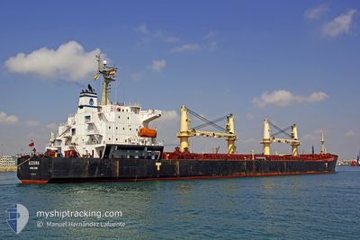
Bulk Carrier
Current Trip
| Time Travelled | 3 days |
|---|---|
| Remaining Time | --- |
| Distance Travelled | 23.16 nm |
| Remaining Distance | 2836.23 nm |
| AVG Speed | 7.3 Knopen |
| MAX Speed | 11.4 Knopen |
| AVG Wind | 11.4 knots |
| MAX Wind | 18 knots |
| MIN Temp | -1.3°C / 29.66°F |
| MAX Temp | 5.8°C / 42.44°F |
| Diepgang | 12.4 M |
| Positie ontvangen | 22 d geleden |
Current Position
| Lengtegraad | --- |
|---|---|
| Breedtegraat | --- |
| Status | Under way using engine |
| Snelheid | 10.6 Knopen |
| Koers | 83.5° |
| Gebied | Singapore Strait |
| Station | T-AIS |
| Positie ontvangen | 22 d geleden |
Info
Information
The current position of RONG XIANG is in Singapore Strait with coordinates 1.26058° / 104.14950° as reported on 2025-12-01 17:07 by AIS to our vessel tracker app. The vessel's current speed is 10.6 Knopen and is heading at the port of SINGAPORE.
The vessel RONG XIANG (IMO: 9294197, MMSI: 538007653) is a Bulk Carrier that was built in 2004 ( 21 Jaar oud ). It's sailing under the flag of [MH] Marshall Is.
In this page you can find informations about the vessels current position, last detected port calls, and current voyage information. If the vessels is not in coverage by AIS you will find the latest position.
The current position of RONG XIANG is detected by our AIS receivers and we are not responsible for the reliability of the data. The last position was recorded while the vessel was in Coverage by the Ais receivers of our vessel tracking app.
The current draught of RONG XIANG as reported by AIS is 12.4 meters
Weather
| Temperature | 3.4°C / 38.12°F |
|---|---|
| Wind Speed | 11 knots |
| Direction | 234° SW |
| Pressure | 1024.6 hPa |
| Humidity | 66 % |
| Cloud Coverage | 6 % |
Featured Company
Last Trips
| Origin | Departure | Destination | Arrival | Distance |
|---|
Events
| Tijd | Evenement | Details | Positie / Bestemming | Info |
|---|---|---|---|---|
| 2025-12-20 23:16 | Stop beweging | 20.82 nm, South East of TIANJIN |
38.83063 / 118.14796
SINGAPORE-PEBGB
|
Snelheid: 0.1 kn Koers: 345° |
| 2025-12-20 20:49 | Vertrekhaven |
|
38.95631 / 117.87726
SINGAPORE-PEBGB
|
Snelheid: 10.6 kn Koers: 98° |
| 2025-12-20 20:22 | Start beweging |
38.96862 / 117.80027
[CN] TIANJIN
|
Snelheid: 3.3 kn Koers: 105° |
|
| 2025-12-19 20:02 | Stop beweging |
38.96584 / 117.79724
[CN] TIANJIN
|
Snelheid: Koers: 282° |
|
| 2025-12-19 19:50 | Aankomsthaven |
|
38.96624 / 117.79784
[CN] TIANJIN
|
Snelheid: 1.3 kn Koers: 281° |
| 2025-12-19 16:10 | Start beweging | 20.95 nm, South West of CAOFEIDIAN |
38.84775 / 118.18774
SINGAPORE-PEBGB
|
Snelheid: 4.2 kn Koers: 91° |
| 2025-12-18 19:25 | Stop beweging | 21.09 nm, South West of CAOFEIDIAN |
38.84774 / 118.18438
SINGAPORE-PEBGB
|
Snelheid: 0.2 kn Koers: 214° |
| 2025-12-18 17:46 | Start beweging | 19.43 nm, West of CAOFEIDIAN |
38.91054 / 118.18797
SINGAPORE-PEBGB
|
Snelheid: 4.4 kn Koers: 135° |
| 2025-12-18 17:10 | Stop beweging | 19.63 nm, West of CAOFEIDIAN |
38.91705 / 118.18071
SINGAPORE-PEBGB
|
Snelheid: 0.3 kn Koers: 132° |
| 2025-12-18 15:30 | Start beweging | 20.52 nm, South East of TIANJIN |
38.84244 / 118.14819
SINGAPORE-PEBGB
|
Snelheid: 3.6 kn Koers: 96° |