
NEW LEGACY
Cargo
Current Trip
| Time Travelled | 39 days |
|---|---|
| Remaining Time | 3 h, 47 mins |
| Distance Travelled | 1798.69 морская миля |
| Remaining Distance | 44.69 морская миля |
| AVG Speed | 5.6 Узлы |
| MAX Speed | 11.4 Узлы |
| AVG Wind | 12 knots |
| MAX Wind | 36.9 knots |
| MIN Temp | 6.7°C / 44.06°F |
| MAX Temp | 18.6°C / 65.48°F |
| Осадка | 8.2 м |
| Позиция Получена | 3 d тому назад |
Current Position
| Долгота | 141.72232° |
|---|---|
| Широта | 38.00521° |
| Статус | Under way using engine |
| Скорость | 1.3 Узлы |
| Курс | 277° |
| Район | North Pacific Ocean |
| Станция | T-AIS |
| Позиция Получена | 3 d тому назад |
Info
Information
The current position of NEW LEGACY is in North Pacific Ocean with coordinates 38.00521° / 141.72232° as reported on 2024-05-10 14:20 by AIS to our vessel tracker app. The vessel's current speed is 1.3 Узлы and is heading at the port of SENDAI. The estimated time of arrival as calculated by MyShipTracking vessel tracking app is 2024-05-15 01:20 LT
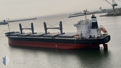
The vessel NEW LEGACY (IMO: 9804942, MMSI: 636018067) is a Cargo It's sailing under the flag of [LR] Liberia.
In this page you can find informations about the vessels current position, last detected port calls, and current voyage information. If the vessels is not in coverage by AIS you will find the latest position.
The current position of NEW LEGACY is detected by our AIS receivers and we are not responsible for the reliability of the data. The last position was recorded while the vessel was in Coverage by the Ais receivers of our vessel tracking app.
The current draught of NEW LEGACY as reported by AIS is 8.2 meters
Weather
| Temperature | 14.4°C / 57.92°F |
|---|---|
| Wind Speed | 5 knots |
| Direction | 68° ENE |
| Pressure | 1020.8 hPa |
| Humidity | 74 % |
| Cloud Coverage | --- |
Featured Company
Last Port Calls
| Port | Arrival | Departure | Time In Port |
|---|---|---|---|
| 2024-04-01 06:37 | 2024-04-05 06:53 | 4 d | |
| 2024-03-11 05:23 | 2024-03-15 20:43 | 4 d | |
| 2024-03-11 04:35 | 2024-03-11 04:57 | 21 m |
Last Trips
| Origin | Departure | Destination | Arrival | Distance | |
|---|---|---|---|---|---|
| 2024-03-15 20:43 | 2024-04-01 06:37 | 3683.14 морская миля | |||
| 2024-03-11 04:57 | 2024-03-11 05:23 | 0.76 морская миля | |||
| 2024-02-20 09:14 | 2024-03-11 04:35 | 4608.17 морская миля |
Events
| Время | Событие | Детали | Позиция / Направление | Информация |
|---|---|---|---|---|
| 2024-05-14 10:12 | Окончание движения |
37.66165 / 141.60324
JPSGM
|
Скорость: 0.2 kn Курс: 177° |
|
| 2024-05-14 07:09 | Начало движения |
37.71611 / 141.65389
JPSGM
|
Скорость: 3.1 kn Курс: 94° |
|
| 2024-05-14 00:51 | Окончание движения |
37.67806 / 141.63689
JPSGM
|
Скорость: 0.2 kn Курс: 303° |
|
| 2024-05-12 05:00 | Окончание движения |
37.61702 / 141.63234
JPSGM
|
Скорость: 0.1 kn Курс: 188° |
|
| 2024-05-10 23:36 | Начало движения | 14.47 nm, South East of AYUKAWA |
38.10355 / 141.69365
JPSGM
|
Скорость: 4.4 kn Курс: 176° |
| 2024-05-10 14:28 | Статус изменился | Default Under way using engine |
38.00767 / 141.72350
JPSGM
|
Скорость: 1.3 kn Курс: 277° |
| 2024-05-10 14:20 | Вне покрытия |
38.00521 / 141.72232
North Pacific Ocean
|
Скорость: 1.3 kn Курс: 19.3° |
|
| 2024-05-10 14:15 | Статус изменился | Under way using engine Default |
38.00344 / 141.72153
JPSGM
|
Скорость: 1.4 kn Курс: 283° |
| 2024-05-10 14:04 | Статус изменился | Default Under way using engine |
37.99974 / 141.72038
JPSGM
|
Скорость: 1.4 kn Курс: 283° |
| 2024-05-10 13:52 | Статус изменился | Under way using engine Default |
37.99525 / 141.71891
JPSGM
|
Скорость: 1.4 kn Курс: 286° |