
LIBERTY I
Other Type
Current Trip
KARISH FIELD
| Time Travelled | --- |
|---|---|
| Remaining Time | --- |
| Distance Travelled | --- |
| Remaining Distance | --- |
| AVG Speed | --- |
| MAX Speed | --- |
| AVG Wind | --- |
| MAX Wind | --- |
| MIN Temp | --- |
| MAX Temp | --- |
| Осадка | 4.2 м |
| Позиция Получена | 15 h, 17 m тому назад |
Current Position
| Долгота | 34.30004° |
|---|---|
| Широта | 33.18193° |
| Статус | Under way using engine |
| Скорость | 0.4 Узлы |
| Курс | 300° |
| Район | Mediterranean Sea - Eastern Basin |
| Станция | T-AIS |
| Позиция Получена | 15 h, 17 m тому назад |
Info
Information
The current position of LIBERTY I is in Mediterranean Sea - Eastern Basin with coordinates 33.18193° / 34.30004° as reported on 2024-04-30 00:24 by AIS to our vessel tracker app. The vessel's current speed is 0.4 Узлы
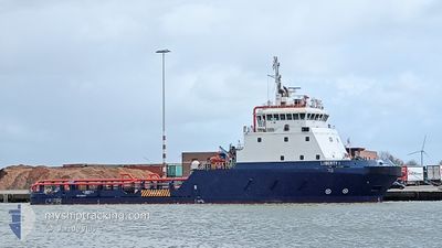
The vessel LIBERTY I (IMO: 9394715, MMSI: 428000411) is a Other Type It's sailing under the flag of [IL] Israel.
In this page you can find informations about the vessels current position, last detected port calls, and current voyage information. If the vessels is not in coverage by AIS you will find the latest position.
The current position of LIBERTY I is detected by our AIS receivers and we are not responsible for the reliability of the data. The last position was recorded while the vessel was in Coverage by the Ais receivers of our vessel tracking app.
The current draught of LIBERTY I as reported by AIS is 4.2 meters
Weather
| Temperature | 20.4°C / 68.72°F |
|---|---|
| Wind Speed | 7 knots |
| Direction | 327° NNW |
| Pressure | 1009.6 hPa |
| Humidity | 82.2 % |
| Cloud Coverage | 67 % |
Featured Company
Most Visited Ports (Last year)
| Port | Arrivals | |
|---|---|---|
| 78 |
Events
| Время | Событие | Детали | Позиция / Направление | Информация |
|---|---|---|---|---|
| 2024-04-30 00:24 | Вне покрытия |
33.18193 / 34.30004
Mediterranean Sea - Eastern Basin
|
Скорость: 0.4 kn Курс: 67.9° |
|
| 2024-04-29 16:36 | Окончание движения |
33.19227 / 34.30374
KARISH FIELD
|
Скорость: 0.3 kn Курс: 280° |
|
| 2024-04-29 15:44 | Начало движения |
33.17408 / 34.30324
KARISH FIELD
|
Скорость: 3.2 kn Курс: 313° |
|
| 2024-04-29 14:02 | В покрытии |
33.18329 / 34.30651
Mediterranean Sea - Eastern Basin
KARISH FIELD
|
Скорость: 0.5 kn Курс: 189° |
|
| 2024-04-29 08:09 | Вне покрытия |
33.81827 / 35.49079
Mediterranean Sea - Eastern Basin
KARISH FIELD
|
Скорость: Курс: 273.6° |
|
| 2024-04-29 06:51 | ETA изменился | 2024/04/29 12:00 2024/04/25 22:00 |
33.81828 / 35.49080
KARISH FIELD
|
Скорость: 0.4 kn Курс: 70° |
| 2024-04-29 06:45 | Пункт назначения изменился | KARISH FIELD ILHFA |
33.81828 / 35.49081
KARISH FIELD
|
Скорость: Курс: 28° |
| 2024-04-29 06:45 | Статус изменился | Under way using engine Moored |
33.81828 / 35.49081
ILHFA
|
Скорость: Курс: 11° |
| 2024-04-29 02:05 | Окончание движения | 6.15 nm, South of BEIRUT |
33.81816 / 35.49075
ILHFA
|
Скорость: Курс: 321° |
| 2024-04-29 02:01 | Начало движения | 6.03 nm, South West of BEIRUT |
33.82085 / 35.48924
ILHFA
|
Скорость: 30.2 kn Курс: 336.7° |