
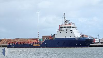
LIBERTY I
Other Type
Current Position
| Lengtegraad | 35.49065° |
|---|---|
| Breedtegraat | 33.81767° |
| Status | Moored |
| Snelheid | 17.9 Knopen |
| Koers | 189.4° |
| Gebied | Mediterranean Sea - Eastern Basin |
| Station | T-AIS |
| Positie ontvangen | 3 m geleden |
Info
Information
The current position of LIBERTY I is in Mediterranean Sea - Eastern Basin with coordinates 33.81767° / 35.49065° as reported on 2024-05-17 14:56 by AIS to our vessel tracker app. The vessel's current speed is 17.9 Knopen
The vessel LIBERTY I (IMO: 9394715, MMSI: 428000411) is a Other Type It's sailing under the flag of [IL] Israel.
In this page you can find informations about the vessels current position, last detected port calls, and current voyage information. If the vessels is not in coverage by AIS you will find the latest position.
The current position of LIBERTY I is detected by our AIS receivers and we are not responsible for the reliability of the data. The last position was recorded while the vessel was in Coverage by the Ais receivers of our vessel tracking app.
The current draught of LIBERTY I as reported by AIS is 4 meters
Weather
| Temperature | 23.3°C / 73.94°F |
|---|---|
| Wind Speed | 4 knots |
| Direction | 239° WSW |
| Pressure | 1018.1 hPa |
| Humidity | 49.6 % |
| Cloud Coverage | 49 % |
Featured Company
Most Visited Ports (Last year)
| Port | Arrivals | |
|---|---|---|
| 80 |
Events
| Tijd | Evenement | Details | Positie / Bestemming | Info |
|---|---|---|---|---|
| 2024-05-17 04:45 | Status Changed | Moored Under way using engine |
33.81824 / 35.49080
ILHFA
|
Snelheid: Koers: 320° |
| 2024-05-17 03:33 | Status Changed | Under way using engine At anchor |
33.81833 / 35.49078
ILHFA
|
Snelheid: Koers: 294° |
| 2024-05-17 02:40 | Binnenbereik |
33.81826 / 35.49081
Mediterranean Sea - Eastern Basin
|
Snelheid: Koers: 226.1° |
|
| 2024-05-17 01:04 | Buitenbereik |
32.84868 / 34.99594
Mediterranean Sea - Eastern Basin
|
Snelheid: 0.2 kn Koers: 20.4° |
|
| 2024-05-16 23:25 | Binnenbereik |
32.84860 / 34.99587
Mediterranean Sea - Eastern Basin
ILHFA
|
Snelheid: 0.2 kn Koers: 126.7° |
|
| 2024-05-16 21:49 | Buitenbereik |
33.81827 / 35.49080
Mediterranean Sea - Eastern Basin
ILHFA
|
Snelheid: Koers: 243.3° |
|
| 2024-05-16 20:37 | Status Changed | At anchor Moored |
33.81829 / 35.49079
ILHFA
|
Snelheid: Koers: 308° |
| 2024-05-16 20:36 | Status Changed | Moored Under way using engine |
33.81829 / 35.49079
ILHFA
|
Snelheid: Koers: 307° |
| 2024-05-16 19:52 | Binnenbereik |
33.81827 / 35.49080
Mediterranean Sea - Eastern Basin
ILHFA
|
Snelheid: Koers: 251.4° |
|
| 2024-05-16 18:16 | Buitenbereik |
32.93706 / 34.77471
Mediterranean Sea - Eastern Basin
ILHFA
|
Snelheid: 8.8 kn Koers: 111° |