
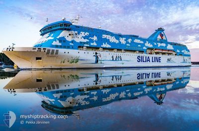
GALAXY
Ro-Ro/Passenger Ship
Current Trip
ITBDS
| Time Travelled | 4 h, 45 mins |
|---|---|
| Remaining Time | --- |
| Distance Travelled | 60.86 морская миля |
| Remaining Distance | --- |
| AVG Speed | 13.2 Узлы |
| MAX Speed | 16.2 Узлы |
| AVG Wind | 7 knots |
| MAX Wind | 11 knots |
| MIN Temp | 16.1°C / 60.98°F |
| MAX Temp | 17.2°C / 62.96°F |
| Осадка | 5.2 м |
| Позиция Получена | 1 h, 31 m тому назад |
Current Position
| Долгота | 18.91917° |
|---|---|
| Широта | 40.53451° |
| Статус | Under way using engine |
| Скорость | 13.1 Узлы |
| Курс | 105.5° |
| Район | Adriatic Sea |
| Станция | T-AIS |
| Позиция Получена | 1 h, 31 m тому назад |
Info
Information
The current position of GALAXY is in Adriatic Sea with coordinates 40.53451° / 18.91917° as reported on 2024-04-27 13:38 by AIS to our vessel tracker app. The vessel's current speed is 13.1 Узлы
The vessel GALAXY (IMO: 7516773, MMSI: 210652000) is a Ro-Ro/Passenger Ship that was built in 1979 ( 45 лет ). It's sailing under the flag of [CY] Cyprus.
In this page you can find informations about the vessels current position, last detected port calls, and current voyage information. If the vessels is not in coverage by AIS you will find the latest position.
The current position of GALAXY is detected by our AIS receivers and we are not responsible for the reliability of the data. The last position was recorded while the vessel was in Coverage by the Ais receivers of our vessel tracking app.
The current draught of GALAXY as reported by AIS is 5.2 meters
Weather
| Temperature | 17.1°C / 62.78°F |
|---|---|
| Wind Speed | 11 knots |
| Direction | 348° NNW |
| Pressure | 1017.2 hPa |
| Humidity | 72.4 % |
| Cloud Coverage | 4 % |
Featured Company
Most Visited Ports (Last year)
| Port | Arrivals | |
|---|---|---|
| 179 | ||
| 123 | ||
| 14 | ||
| 1 | ||
| 1 |
Events
| Время | Событие | Детали | Позиция / Направление | Информация |
|---|---|---|---|---|
| 2024-04-27 14:02 | Статус изменился | Default Under way using engine |
40.50918 / 19.02805
ITBDS
|
Скорость: 13.1 kn Курс: 105.5° |
| 2024-04-27 13:38 | Обнаружено в море | Albanian part of the Adriatic Sea |
40.53451 / 18.91917
Adriatic Sea
|
Скорость: 13.1 kn Курс: 105.5° |
| 2024-04-27 13:38 | Статус изменился | Under way using engine Default |
40.53451 / 18.91917
ITBDS
|
Скорость: 13 kn Курс: 106° |
| 2024-04-27 13:38 | Вне покрытия |
40.53451 / 18.91917
Adriatic Sea
|
Скорость: 13.1 kn Курс: 105.5° |
|
| 2024-04-27 13:04 | Статус изменился | Default Under way using engine |
40.56659 / 18.76421
ITBDS
|
Скорость: 12.9 kn Курс: 105.4° |
| 2024-04-27 12:52 | Статус изменился | Under way using engine Default |
40.57789 / 18.70849
ITBDS
|
Скорость: 12.7 kn Курс: 106° |
| 2024-04-27 12:52 | В покрытии |
40.57789 / 18.70849
Adriatic Sea
|
Скорость: 12.7 kn Курс: 106.1° |
|
| 2024-04-27 10:25 | ПОРТ ОТПРАВЛЕНИЯ |
|
40.66665 / 18.00635
ITBDS
|
Скорость: 8 kn Курс: -1° |
| 2024-04-22 19:01 | Вне покрытия |
40.64221 / 17.95132
Adriatic Sea
[IT] BRINDISI
|
Скорость: Курс: 351.9° |
|
| 2024-04-22 19:01 | В покрытии |
40.64221 / 17.95132
Adriatic Sea
[IT] BRINDISI
|
Скорость: Курс: 351.9° |