
GALAXY
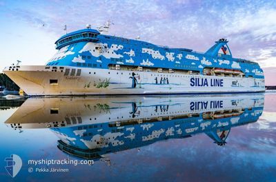
Ro-Ro/Passenger Ship
Current Trip
| Time Travelled | 3 days |
|---|---|
| Remaining Time | --- |
| Distance Travelled | 25.35 nm |
| Remaining Distance | --- |
| AVG Speed | 5.7 Noeuds |
| MAX Speed | 8.8 Noeuds |
| AVG Wind | 8.3 knots |
| MAX Wind | 13 knots |
| MIN Temp | 13.8°C / 56.84°F |
| MAX Temp | 22.8°C / 73.04°F |
| Tirant d eau | 5.2 m |
| Position reçue | 2 m depuis |
Current Position
| Longitude | 23.56076° |
|---|---|
| Latitude | 37.89456° |
| Etat | At anchor |
| Vitesse | 0.2 Noeuds |
| Parcours | 149° |
| Zone | Aegean Sea |
| Station | T-AIS |
| Position reçue | 2 m depuis |
Info
Information
The current position of GALAXY is in Aegean Sea with coordinates 37.89456° / 23.56076° as reported on 2024-04-19 11:07 by AIS to our vessel tracker app. The vessel's current speed is 0.2 Noeuds
The vessel GALAXY (IMO: 7516773, MMSI: 210652000) is a Ro-Ro/Passenger Ship that was built in 1979 ( 45 Age ). It's sailing under the flag of [CY] Cyprus.
In this page you can find informations about the vessels current position, last detected port calls, and current voyage information. If the vessels is not in coverage by AIS you will find the latest position.
The current position of GALAXY is detected by our AIS receivers and we are not responsible for the reliability of the data. The last position was recorded while the vessel was in Coverage by the Ais receivers of our vessel tracking app.
The current draught of GALAXY as reported by AIS is 5.2 meters
Weather
| Temperature | 18.3°C / 64.94°F |
|---|---|
| Wind Speed | 10 knots |
| Direction | 164° SSE |
| Pressure | 1009.1 hPa |
| Humidity | 44.8 % |
| Cloud Coverage | 5 % |
Featured Company
Most Visited Ports (Last year)
| Port | Arrivals | |
|---|---|---|
| 185 | ||
| 129 | ||
| 14 | ||
| 1 |
Last Trips
| Origin | Departure | Destination | Arrival | Distance |
|---|
Events
| Heure | Evenement | Détails | Position/ Destination | Info |
|---|---|---|---|---|
| 2024-04-19 06:51 | Changement d'ETA | 2024/04/16 16:51 2025/01/01 16:51 |
37.89395 / 23.56205
GRPIR ANC
|
Vitesse: 0.2 kn Parcours: 222° |
| 2024-04-19 06:45 | Changement d'ETA | 2025/01/01 16:51 2024/04/16 16:51 |
37.89378 / 23.56241
GRPIR ANC
|
Vitesse: 0.1 kn Parcours: 206° |
| 2024-04-19 06:02 | Changement d'ETA | 2024/04/16 16:51 2025/01/01 16:51 |
37.89369 / 23.56241
GRPIR ANC
|
Vitesse: 0.1 kn Parcours: 242° |
| 2024-04-19 05:57 | Changement d'ETA | 2025/01/01 16:51 2024/04/16 16:51 |
37.89387 / 23.56252
GRPIR ANC
|
Vitesse: Parcours: 269° |
| 2024-04-19 05:38 | Changement d'ETA | 2024/04/16 16:51 2025/01/01 16:51 |
37.89359 / 23.56249
GRPIR ANC
|
Vitesse: 0.1 kn Parcours: 256° |
| 2024-04-19 05:32 | Changement d'ETA | 2025/01/01 16:51 2024/04/16 16:51 |
37.89379 / 23.56258
GRPIR ANC
|
Vitesse: Parcours: 267° |
| 2024-04-19 02:44 | Changement d'ETA | 2024/04/16 16:51 2025/01/01 16:51 |
37.89331 / 23.56220
GRPIR ANC
|
Vitesse: 0.2 kn Parcours: 316° |
| 2024-04-19 02:38 | Changement d'ETA | 2025/01/01 16:51 2024/04/16 16:51 |
37.89338 / 23.56231
GRPIR ANC
|
Vitesse: 0.3 kn Parcours: 251° |
| 2024-04-19 02:26 | Changement d'ETA | 2024/04/16 16:51 2025/01/01 16:51 |
37.89379 / 23.56266
GRPIR ANC
|
Vitesse: 0.1 kn Parcours: 250° |
| 2024-04-19 02:20 | Changement d'ETA | 2025/01/01 16:51 2024/04/16 16:51 |
37.89404 / 23.56263
GRPIR ANC
|
Vitesse: 0.1 kn Parcours: 234° |