
ARBEMA
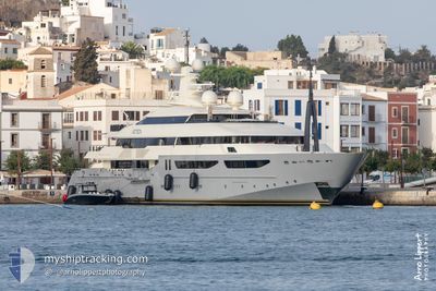
Yacht
Current Trip
| Time Travelled | 3 days |
|---|---|
| Remaining Time | --- |
| Distance Travelled | 710.09 морская миля |
| Remaining Distance | --- |
| AVG Speed | 13.6 Узлы |
| MAX Speed | 17.7 Узлы |
| AVG Wind | 13.2 knots |
| MAX Wind | 22.9 knots |
| MIN Temp | 12.8°C / 55.04°F |
| MAX Temp | 19.5°C / 67.1°F |
| Осадка | 3.4 м |
| Позиция Получена | 1 d тому назад |
Current Position
| Долгота | 5.66804° |
|---|---|
| Широта | 43.16088° |
| Статус | Under way using engine |
| Скорость | 7.8 Узлы |
| Курс | 264.9° |
| Район | Mediterranean Sea - Western Basin |
| Станция | T-AIS |
| Позиция Получена | 1 d тому назад |
Info
Information
The current position of ARBEMA is in Mediterranean Sea - Western Basin with coordinates 43.16088° / 5.66804° as reported on 2024-04-30 16:53 by AIS to our vessel tracker app. The vessel's current speed is 7.8 Узлы
The vessel ARBEMA (IMO: 1009924, MMSI: 538071151) is a Yacht that was built in 2010 ( 14 лет ). It's sailing under the flag of [MH] Marshall Is.
In this page you can find informations about the vessels current position, last detected port calls, and current voyage information. If the vessels is not in coverage by AIS you will find the latest position.
The current position of ARBEMA is detected by our AIS receivers and we are not responsible for the reliability of the data. The last position was recorded while the vessel was in Coverage by the Ais receivers of our vessel tracking app.
The current draught of ARBEMA as reported by AIS is 3.4 meters
Weather
| Temperature | 18.7°C / 65.66°F |
|---|---|
| Wind Speed | 9 knots |
| Direction | 109° ESE |
| Pressure | 1010.3 hPa |
| Humidity | 50.2 % |
| Cloud Coverage | 100 % |
Featured Company
Most Visited Ports (Last year)
| Port | Arrivals | |
|---|---|---|
| 3 | ||
| 3 | ||
| 1 | ||
| 1 |
Events
| Время | Событие | Детали | Позиция / Направление | Информация |
|---|---|---|---|---|
| 2024-04-30 16:53 | Вне покрытия |
43.16088 / 5.66804
Mediterranean Sea - Western Basin
FR LCT
|
Скорость: 7.8 kn Курс: 264.9° |
|
| 2024-04-30 16:51 | Начало движения | 2.68 nm, East of LA CIOTAT |
43.16244 / 5.67341
FR LCT
|
Скорость: 5.3 kn Курс: 217.5° |
| 2024-04-30 16:49 | ETA изменился | 2024/04/30 17:30 2024/04/30 17:00 |
43.16358 / 5.67364
FR LCT
|
Скорость: 0.6 kn Курс: 183° |
| 2024-04-30 16:48 | Статус изменился | Under way using engine At anchor |
43.16368 / 5.67349
FR LCT
|
Скорость: 0.2 kn Курс: 220° |
| 2024-04-30 16:33 | Обнаружено в море | French part of the Mediterranean Sea - Western Basin |
43.16452 / 5.67348
Mediterranean Sea - Western Basin
FR LCT
|
Скорость: 0.2 kn Курс: 112.5° |
| 2024-04-30 16:33 | В покрытии |
43.16452 / 5.67348
Mediterranean Sea - Western Basin
FR LCT
|
Скорость: 0.2 kn Курс: 112.5° |
|
| 2024-04-29 10:45 | Вне покрытия |
38.30850 / .14023
Mediterranean Sea - Western Basin
FR LCT
|
Скорость: 13.9 kn Курс: 35.7° |
|
| 2024-04-29 07:36 | Осадка изменилась | 3.4 3 |
37.69245 / -.39007
FR LCT
|
Скорость: 13.9 kn Курс: 35° |
| 2024-04-29 07:36 | ETA изменился | 2024/04/30 17:00 |
37.69245 / -.39007
FR LCT
|
Скорость: 13.9 kn Курс: 35° |
| 2024-04-29 07:07 | В покрытии |
37.60012 / -.47323
Mediterranean Sea - Western Basin
|
Скорость: 13.9 kn Курс: 39° |