
ARBEMA
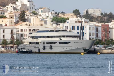
Yacht
Current Trip
| Time Travelled | 3 days |
|---|---|
| Remaining Time | --- |
| Distance Travelled | 710.09 nm |
| Remaining Distance | --- |
| AVG Speed | 13.6 Knots |
| MAX Speed | 17.7 Knots |
| AVG Wind | 13.2 knots |
| MAX Wind | 22.9 knots |
| MIN Temp | 12.8°C / 55.04°F |
| MAX Temp | 19.5°C / 67.1°F |
| Dybgang | 3.4 m |
| Position Modtaget | 21 h, 58 m siden |
Current Position
| Longitude | 5.66804° |
|---|---|
| Latitude | 43.16088° |
| Status | Under way using engine |
| Fart | 7.8 Knots |
| Kurs | 264.9° |
| Område | Mediterranean Sea - Western Basin |
| Station | T-AIS |
| Position Modtaget | 21 h, 58 m siden |
Info
Information
The current position of ARBEMA is in Mediterranean Sea - Western Basin with coordinates 43.16088° / 5.66804° as reported on 2024-04-30 16:53 by AIS to our vessel tracker app. The vessel's current speed is 7.8 Knots
The vessel ARBEMA (IMO: 1009924, MMSI: 538071151) is a Yacht that was built in 2010 ( 14 år gamle ). It's sailing under the flag of [MH] Marshall Is.
In this page you can find informations about the vessels current position, last detected port calls, and current voyage information. If the vessels is not in coverage by AIS you will find the latest position.
The current position of ARBEMA is detected by our AIS receivers and we are not responsible for the reliability of the data. The last position was recorded while the vessel was in Coverage by the Ais receivers of our vessel tracking app.
The current draught of ARBEMA as reported by AIS is 3.4 meters
Weather
| Temperature | 18.7°C / 65.66°F |
|---|---|
| Wind Speed | 9 knots |
| Direction | 109° ESE |
| Pressure | 1010.3 hPa |
| Humidity | 50.2 % |
| Cloud Coverage | 100 % |
Featured Company
Most Visited Ports (Last year)
| Port | Arrivals | |
|---|---|---|
| 3 | ||
| 3 | ||
| 1 | ||
| 1 |
Events
| Tid | Hændelsen | Detaljer | Position / Dest | Info |
|---|---|---|---|---|
| 2024-04-30 16:53 | Udenfor Dækning |
43.16088 / 5.66804
Mediterranean Sea - Western Basin
FR LCT
|
Fart: 7.8 kn Kurs: 264.9° |
|
| 2024-04-30 16:51 | START Sejllads | 2.68 nm, East of LA CIOTAT |
43.16244 / 5.67341
FR LCT
|
Fart: 5.3 kn Kurs: 217.5° |
| 2024-04-30 16:49 | ETA er ændret | 2024/04/30 17:30 2024/04/30 17:00 |
43.16358 / 5.67364
FR LCT
|
Fart: 0.6 kn Kurs: 183° |
| 2024-04-30 16:48 | Status er ændret | Under way using engine At anchor |
43.16368 / 5.67349
FR LCT
|
Fart: 0.2 kn Kurs: 220° |
| 2024-04-30 16:33 | Fundet i havområde | French part of the Mediterranean Sea - Western Basin |
43.16452 / 5.67348
Mediterranean Sea - Western Basin
FR LCT
|
Fart: 0.2 kn Kurs: 112.5° |
| 2024-04-30 16:33 | Indenfor Dækning |
43.16452 / 5.67348
Mediterranean Sea - Western Basin
FR LCT
|
Fart: 0.2 kn Kurs: 112.5° |
|
| 2024-04-29 10:45 | Udenfor Dækning |
38.30850 / .14023
Mediterranean Sea - Western Basin
FR LCT
|
Fart: 13.9 kn Kurs: 35.7° |
|
| 2024-04-29 07:36 | Dybgangen er ændret | 3.4 3 |
37.69245 / -.39007
FR LCT
|
Fart: 13.9 kn Kurs: 35° |
| 2024-04-29 07:36 | ETA er ændret | 2024/04/30 17:00 |
37.69245 / -.39007
FR LCT
|
Fart: 13.9 kn Kurs: 35° |
| 2024-04-29 07:07 | Indenfor Dækning |
37.60012 / -.47323
Mediterranean Sea - Western Basin
|
Fart: 13.9 kn Kurs: 39° |