
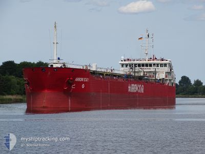
ARROW STAR 1
Oil Products Tanker
Current Trip
| Time Travelled | 58 days |
|---|---|
| Remaining Time | --- |
| Distance Travelled | 1135.82 морская миля |
| Remaining Distance | --- |
| AVG Speed | 6.9 Узлы |
| MAX Speed | 13.2 Узлы |
| AVG Wind | 12.5 knots |
| MAX Wind | 36 knots |
| MIN Temp | 1.7°C / 35.06°F |
| MAX Temp | 14.2°C / 57.56°F |
| Осадка | 4.2 м |
| Позиция Получена | 1 m тому назад |
Current Position
| Долгота | --- |
|---|---|
| Широта | --- |
| Статус | Under way using engine |
| Скорость | 4.9 Узлы |
| Курс | 243° |
| Район | Sea of Marmara |
| Станция | T-AIS |
| Позиция Получена | 1 m тому назад |
Info
Information
The current position of ARROW STAR 1 is in Sea of Marmara with coordinates 40.81900° / 28.93192° as reported on 2026-01-04 02:48 by AIS to our vessel tracker app. The vessel's current speed is 4.9 Узлы and is heading at the port of TERNEUZEN.
The vessel ARROW STAR 1 (IMO: 9435313, MMSI: 256791000) is a Oil Products Tanker that was built in 2007 ( 19 лет ). It's sailing under the flag of [MT] Malta.
In this page you can find informations about the vessels current position, last detected port calls, and current voyage information. If the vessels is not in coverage by AIS you will find the latest position.
The current position of ARROW STAR 1 is detected by our AIS receivers and we are not responsible for the reliability of the data. The last position was recorded while the vessel was in Coverage by the Ais receivers of our vessel tracking app.
The current draught of ARROW STAR 1 as reported by AIS is 4.2 meters
Weather
| Temperature | 13.9°C / 57.02°F |
|---|---|
| Wind Speed | 13 knots |
| Direction | 196° SSW |
| Pressure | 1016.2 hPa |
| Humidity | 69.5 % |
| Cloud Coverage | 40 % |
Featured Company
Most Visited Ports (Last year)
| Port | Arrivals | |
|---|---|---|
| 7 | ||
| 5 | ||
| 2 | ||
| 2 | ||
| 2 | ||
| 2 |
Events
| Время | Событие | Детали | Позиция / Направление | Информация |
|---|---|---|---|---|
| 2026-01-04 02:14 | Начало движения | 9.67 nm, South East of YESILKOY |
40.81131 / 28.92124
FOR ORDER
|
Скорость: 3.2 kn Курс: 327° |
| 2026-01-04 02:09 | Окончание движения | 9.68 nm, South East of YESILKOY |
40.80991 / 28.91799
FOR ORDER
|
Скорость: 0.3 kn Курс: 324° |
| 2026-01-04 00:55 | Начало движения | 10.03 nm, South of YESILKOY |
40.79335 / 28.88003
FOR ORDER
|
Скорость: 3.4 kn Курс: 328° |
| 2026-01-04 00:42 | Окончание движения | 10.14 nm, South of YESILKOY |
40.79040 / 28.87428
FOR ORDER
|
Скорость: 0.2 kn Курс: 335° |
| 2026-01-04 00:36 | Начало движения | 10.18 nm, South of YESILKOY |
40.78925 / 28.87185
FOR ORDER
|
Скорость: 3.4 kn Курс: 333° |
| 2026-01-04 00:29 | Окончание движения | 10.26 nm, South of YESILKOY |
40.78745 / 28.86843
FOR ORDER
|
Скорость: 0.1 kn Курс: 334° |
| 2026-01-04 00:27 | Начало движения | 10.28 nm, South of YESILKOY |
40.78699 / 28.86773
FOR ORDER
|
Скорость: 4 kn Курс: 333° |
| 2026-01-04 00:22 | Окончание движения | 10.35 nm, South of YESILKOY |
40.78543 / 28.86532
FOR ORDER
|
Скорость: 0.3 kn Курс: 328° |
| 2026-01-04 00:16 | Начало движения | 10.41 nm, South of YESILKOY |
40.78403 / 28.86264
FOR ORDER
|
Скорость: 3.4 kn Курс: 330° |
| 2026-01-03 23:45 | Окончание движения | 10.83 nm, South of YESILKOY |
40.77546 / 28.84728
FOR ORDER
|
Скорость: 0.2 kn Курс: 329° |