
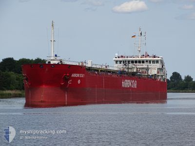
ARROW STAR 1
Oil Products Tanker
Current Trip
| Time Travelled | 5 days |
|---|---|
| Remaining Time | 3 days |
| Distance Travelled | 670.80 nm |
| Remaining Distance | 933.79 nm |
| AVG Speed | 9.2 Knop |
| MAX Speed | 11.7 Knop |
| AVG Wind | 14.4 knots |
| MAX Wind | 32.9 knots |
| MIN Temp | 2.2°C / 35.96°F |
| MAX Temp | 12.7°C / 54.86°F |
| Djupgående | 6.1 m |
| Position mottagen | Nu |
Current Position
| Longitud | 16.54651° |
|---|---|
| Latitude | 56.07928° |
| Status | Under way using engine |
| Fart | 10 Knop |
| Kurs | 236.9° |
| Område | Baltic Sea |
| Station | T-AIS |
| Position mottagen | Nu |
Info
Information
The current position of ARROW STAR 1 is in Baltic Sea with coordinates 56.07928° / 16.54651° as reported on 2024-04-18 03:17 by AIS to our vessel tracker app. The vessel's current speed is 10 Knop and is heading at the port of ROTTERDAM. The estimated time of arrival as calculated by MyShipTracking vessel tracking app is 2024-04-22 02:34 LT
The vessel ARROW STAR 1 (IMO: 9435313, MMSI: 256791000) is a Oil Products Tanker that was built in 2007 ( 17 År gammal ). It's sailing under the flag of [MT] Malta.
In this page you can find informations about the vessels current position, last detected port calls, and current voyage information. If the vessels is not in coverage by AIS you will find the latest position.
The current position of ARROW STAR 1 is detected by our AIS receivers and we are not responsible for the reliability of the data. The last position was recorded while the vessel was in Coverage by the Ais receivers of our vessel tracking app.
The current draught of ARROW STAR 1 as reported by AIS is 6.1 meters
Weather
| Temperature | 3.1°C / 37.58°F |
|---|---|
| Wind Speed | 8 knots |
| Direction | 356° N |
| Pressure | 1012.6 hPa |
| Humidity | 80.3 % |
| Cloud Coverage | 15 % |
Featured Company
Last Port Calls
| Port | Arrival | Departure | Time In Port |
|---|---|---|---|
| 2024-04-12 07:09 | 2024-04-12 23:21 | 16 h | |
| 2024-04-11 01:39 | 2024-04-11 16:11 | 14 h | |
| 2024-04-07 13:02 | 2024-04-08 14:52 | 1 d | |
| 2024-04-06 11:08 | 2024-04-07 11:51 | 1 d | |
| 2024-04-02 02:27 | 2024-04-02 19:35 | 17 h | |
| 2024-03-27 06:02 | 2024-03-28 10:36 | 1 d | |
| 2024-03-18 11:23 | 2024-03-21 13:18 | 3 d | |
| 2024-03-12 11:19 | 2024-03-12 20:30 | 9 h | |
| 2024-03-11 01:49 | 2024-03-11 20:35 | 18 h | |
| 2024-03-07 10:32 | 2024-03-08 13:23 | 1 d |
Last Trips
| Origin | Departure | Destination | Arrival | Distance | |
|---|---|---|---|---|---|
| 2024-04-11 18:11 | 2024-04-12 09:09 | 150.08 nm | |||
| 2024-04-08 16:52 | 2024-04-11 03:39 | 478.71 nm | |||
| 2024-04-07 13:51 | 2024-04-07 15:02 | 9.16 nm | |||
| 2024-04-02 21:35 | 2024-04-06 13:08 | 842.07 nm | |||
| 2024-03-28 11:36 | 2024-04-02 04:27 | 1095.03 nm | |||
| 2024-03-21 15:18 | 2024-03-27 07:02 | 779.50 nm | |||
| 2024-03-12 21:30 | 2024-03-18 13:23 | 788.25 nm | |||
| 2024-03-11 21:35 | 2024-03-12 12:19 | 149.14 nm | |||
| 2024-03-08 14:23 | 2024-03-11 02:49 | 471.21 nm | |||
| 2024-03-07 02:43 | 2024-03-07 11:32 | 65.78 nm |
Events
| Tid | Event | Detaljer | Position / Dest | Information |
|---|---|---|---|---|
| 2024-04-18 01:32 | Status ändrad | Under way using engine Default |
56.27880 / 16.92321
SE NYN > NL RTM
|
Fart: 10 kn Kurs: 198° |
| 2024-04-18 01:17 | I täckningsområde |
56.27801 / 16.92239
Baltic Sea
SE NYN > NL RTM
|
Fart: 9.3 kn Kurs: 217.5° |
|
| 2024-04-17 11:52 | Status ändrad | Default Under way using engine |
58.46545 / 17.83657
SE NYN > NL RTM
|
Fart: 9.8 kn Kurs: 182.7° |
| 2024-04-17 11:46 | UTANFÖR täckningsområde |
58.48229 / 17.83746
Baltic Sea
SE NYN > NL RTM
|
Fart: 9.8 kn Kurs: 182.7° |
|
| 2024-04-17 10:23 | ETA ändrat | 2024/04/19 07:00 2024/04/19 09:00 |
58.71078 / 17.87448
SE NYN > NL RTM
|
Fart: 9.2 kn Kurs: 192.3° |
| 2024-04-17 08:56 | Status ändrad | Under way using engine Moored |
58.91533 / 17.97602
SE NYN > NL RTM
|
Fart: 3.6 kn Kurs: 72° |
| 2024-04-17 08:54 | STARTAR förflyttning | 0.91 nm, North East of NYNASHAMN |
58.91530 / 17.97240
SE NYN > NL RTM
|
Fart: 3.4 kn Kurs: 93° |
| 2024-04-17 02:06 | Djupgående ändrat | 6.1 6.5 |
58.91766 / 17.97132
SE NYN > NL RTM
|
Fart: Kurs: 158° |
| 2024-04-17 00:14 | Status ändrad | Moored Default |
58.91765 / 17.97133
SE NYN > NL RTM
|
Fart: Kurs: 158° |
| 2024-04-17 00:11 | Status ändrad | Default Moored |
58.91765 / 17.97133
SE NYN > NL RTM
|
Fart: Kurs: 158° |