
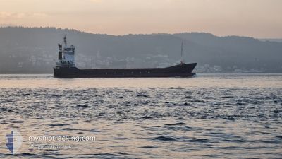
YM ARAL
General Cargo
Current Trip
| Trip Time | 2 days |
|---|---|
| Trip Distance | 235.19 nm |
| AVG Speed | 8.6 Knopen |
| MAX Speed | 13.7 Knopen |
| Diepgang | 3 M |
| AVG Wind | 6.6 knots |
| MAX Wind | 20 knots |
| MIN Temp | 7.3°C / 45.14°F |
| MAX Temp | 16°C / 60.8°F |
| Positie ontvangen | 3 d geleden |
Current Position
| Lengtegraad | --- |
|---|---|
| Breedtegraat | --- |
| Status | Under way using engine |
| Snelheid | 12.3 Knopen |
| Koers | 305.7° |
| Gebied | Adriatic Sea |
| Station | T-AIS |
| Positie ontvangen | 3 d geleden |
Info
Information
The current position of YM ARAL is in Adriatic Sea with coordinates 41.90319° / 18.17009° as reported on 2025-12-05 12:35 by AIS to our vessel tracker app. The vessel's current speed is 12.3 Knopen and is currently inside the port of SIBENIK.
The vessel YM ARAL (IMO: 9103805, MMSI: 271044022) is a General Cargo that was built in 1996 ( 29 Jaar oud ). It's sailing under the flag of [TR] Turkey.
In this page you can find informations about the vessels current position, last detected port calls, and current voyage information. If the vessels is not in coverage by AIS you will find the latest position.
The current position of YM ARAL is detected by our AIS receivers and we are not responsible for the reliability of the data. The last position was recorded while the vessel was in Coverage by the Ais receivers of our vessel tracking app.
The current draught of YM ARAL as reported by AIS is 3 meters
Weather
| Temperature | 11.9°C / 53.42°F |
|---|---|
| Wind Speed | 4 knots |
| Direction | 327° NNW |
| Pressure | 1021.1 hPa |
| Humidity | 65.3 % |
| Cloud Coverage | 31 % |
Featured Company
Last Port Calls
| Port | Arrival | Departure | Time In Port |
|---|---|---|---|
| 2025-12-07 09:52 | |||
| 2025-12-02 09:11 | 2025-12-04 16:08 | 2 d | |
| 2025-11-24 22:15 | 2025-11-25 21:26 | 23 h | |
| 2025-11-24 05:13 | 2025-11-24 17:12 | 11 h | |
| 2025-11-17 17:00 | 2025-11-18 23:52 | 1 d | |
| 2025-11-16 18:52 | 2025-11-17 11:52 | 16 h | |
| 2025-11-12 00:24 | 2025-11-13 01:12 | 1 d | |
| 2025-11-07 16:16 | 2025-11-08 10:24 | 18 h | |
| 2025-11-03 16:51 | 2025-11-04 09:30 | 16 h | |
| 2025-10-30 08:31 | 2025-11-02 09:12 | 3 d |
Last Trips
| Origin | Departure | Destination | Arrival | Distance | |
|---|---|---|---|---|---|
| 2025-12-04 16:08 | 2025-12-07 09:52 | 235.19 nm | |||
| 2025-11-25 21:26 | 2025-12-02 09:11 | 912.13 nm | |||
| 2025-11-24 17:12 | 2025-11-24 22:15 | 58.75 nm | |||
| 2025-11-18 23:52 | 2025-11-24 05:13 | 872.37 nm | |||
| 2025-11-17 11:52 | 2025-11-17 17:00 | 6.07 nm | |||
| 2025-11-13 01:12 | 2025-11-16 18:52 | 861.03 nm | |||
| 2025-11-08 10:24 | 2025-11-12 00:24 | 830.30 nm | |||
| 2025-11-04 09:30 | 2025-11-07 16:16 | 828.58 nm | |||
| 2025-11-02 09:12 | 2025-11-03 16:51 | 314.15 nm | |||
| 2025-10-24 11:15 | 2025-10-30 08:31 | 1308.70 nm |
Events
| Tijd | Evenement | Details | Positie / Bestemming | Info |
|---|---|---|---|---|
| 2025-12-07 08:52 | Aankomsthaven |
|
43.72500 / 15.89833
[HR] SIBENIK
|
Snelheid: 9 kn Koers: 351° |
| 2025-12-07 08:23 | Start beweging | 3.29 nm, South East of ZLARIN |
43.65333 / 15.87167
HR SIB
|
Snelheid: 9 kn Koers: 351° |
| 2025-12-06 01:05 | Stop beweging | 4.95 nm, South East of ZLARIN |
43.63667 / 15.90500
HR SIB
|
Snelheid: Koers: -1° |
| 2025-12-05 12:35 | Buitenbereik |
41.90319 / 18.17009
Adriatic Sea
HR SIB
|
Snelheid: 12.3 kn Koers: 305.7° |
|
| 2025-12-05 12:19 | Wijzig zee gebeid | Croatian part of the Adriatic Sea Montenegrin part of the Adriatic Sea |
41.87091 / 18.22932
Adriatic Sea
HR SIB
|
Snelheid: 12.7 kn Koers: 306.2° |
| 2025-12-05 11:53 | ETA Changed | 2025/12/06 01:00 2025/12/06 07:00 |
41.81715 / 18.33001
HR SIB
|
Snelheid: 12.3 kn Koers: 304.6° |
| 2025-12-05 09:19 | Wijzig zee gebeid | Montenegrin part of the Adriatic Sea Albanian part of the Adriatic Sea |
41.50780 / 18.90469
Adriatic Sea
HR SIB
|
Snelheid: 10.4 kn Koers: 300.1° |
| 2025-12-05 09:05 | Binnenbereik |
41.49050 / 18.94173
Adriatic Sea
HR SIB
|
Snelheid: 10 kn Koers: 303.3° |
|
| 2025-12-05 07:17 | Status Changed | Default Under way using engine |
41.30798 / 19.26646
HR SIB
|
Snelheid: 12.2 kn Koers: 300.8° |
| 2025-12-05 07:12 | Buitenbereik |
41.29915 / 19.28487
Adriatic Sea
HR SIB
|
Snelheid: 12.2 kn Koers: 300.8° |