
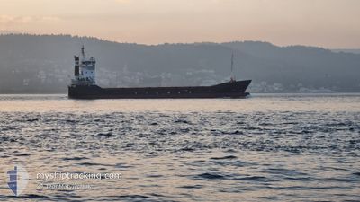
YM ARAL
General Cargo
Current Trip
HR SIB
| Time Travelled | 14 h, 8 mins |
|---|---|
| Remaining Time | --- |
| Distance Travelled | 135.29 nm |
| Remaining Distance | --- |
| AVG Speed | 10.5 Noeuds |
| MAX Speed | 11.2 Noeuds |
| AVG Wind | 6.7 knots |
| MAX Wind | 11.8 knots |
| MIN Temp | 12.3°C / 54.14°F |
| MAX Temp | 15.7°C / 60.26°F |
| Tirant d eau | 3 m |
| Position reçue | 1 h, 36 m depuis |
Current Position
| Longitude | --- |
|---|---|
| Latitude | --- |
| Etat | Under way using engine |
| Vitesse | 11.2 Noeuds |
| Parcours | 146.3° |
| Zone | Adriatic Sea |
| Station | T-AIS |
| Position reçue | 1 h, 36 m depuis |
Info
Information
The current position of YM ARAL is in Adriatic Sea with coordinates 41.91494° / 17.51866° as reported on 2025-12-09 03:32 by AIS to our vessel tracker app. The vessel's current speed is 11.2 Noeuds
The vessel YM ARAL (IMO: 9103805, MMSI: 271044022) is a General Cargo that was built in 1996 ( 29 Age ). It's sailing under the flag of [TR] Turkey.
In this page you can find informations about the vessels current position, last detected port calls, and current voyage information. If the vessels is not in coverage by AIS you will find the latest position.
The current position of YM ARAL is detected by our AIS receivers and we are not responsible for the reliability of the data. The last position was recorded while the vessel was in Coverage by the Ais receivers of our vessel tracking app.
The current draught of YM ARAL as reported by AIS is 3 meters
Weather
| Temperature | 14.9°C / 58.82°F |
|---|---|
| Wind Speed | 3 knots |
| Direction | 341° NNW |
| Pressure | 1023.2 hPa |
| Humidity | 65.7 % |
| Cloud Coverage | 8 % |
Featured Company
Last Port Calls
| Port | Arrival | Departure | Time In Port |
|---|---|---|---|
| 2025-12-07 09:52 | 2025-12-08 16:01 | 1 d | |
| 2025-12-02 09:11 | 2025-12-04 16:08 | 2 d | |
| 2025-11-24 22:15 | 2025-11-25 21:26 | 23 h | |
| 2025-11-24 05:13 | 2025-11-24 17:12 | 11 h | |
| 2025-11-17 17:00 | 2025-11-18 23:52 | 1 d | |
| 2025-11-16 18:52 | 2025-11-17 11:52 | 16 h | |
| 2025-11-12 00:24 | 2025-11-13 01:12 | 1 d | |
| 2025-11-07 16:16 | 2025-11-08 10:24 | 18 h | |
| 2025-11-03 16:51 | 2025-11-04 09:30 | 16 h | |
| 2025-10-30 08:31 | 2025-11-02 09:12 | 3 d |
Last Trips
| Origin | Departure | Destination | Arrival | Distance | |
|---|---|---|---|---|---|
| 2025-12-04 16:08 | 2025-12-07 09:52 | 235.19 nm | |||
| 2025-11-25 21:26 | 2025-12-02 09:11 | 912.13 nm | |||
| 2025-11-24 17:12 | 2025-11-24 22:15 | 58.75 nm | |||
| 2025-11-18 23:52 | 2025-11-24 05:13 | 872.37 nm | |||
| 2025-11-17 11:52 | 2025-11-17 17:00 | 6.07 nm | |||
| 2025-11-13 01:12 | 2025-11-16 18:52 | 861.03 nm | |||
| 2025-11-08 10:24 | 2025-11-12 00:24 | 830.30 nm | |||
| 2025-11-04 09:30 | 2025-11-07 16:16 | 828.58 nm | |||
| 2025-11-02 09:12 | 2025-11-03 16:51 | 314.15 nm | |||
| 2025-10-24 11:15 | 2025-10-30 08:31 | 1308.70 nm |
Events
| Heure | Evenement | Détails | Position/ Destination | Info |
|---|---|---|---|---|
| 2025-12-09 03:44 | Etat Changé | Default Under way using engine |
41.88500 / 17.54833
HR SIB
|
Vitesse: 11.2 kn Parcours: 146.3° |
| 2025-12-09 03:32 | Etat Changé | Under way using engine Default |
41.91494 / 17.51866
HR SIB
|
Vitesse: 11 kn Parcours: 147° |
| 2025-12-09 03:32 | Hors de la zone couverte |
41.91494 / 17.51866
Adriatic Sea
|
Vitesse: 11.2 kn Parcours: 146.3° |
|
| 2025-12-09 03:23 | Etat Changé | Default Under way using engine |
41.93833 / 17.49667
HR SIB
|
Vitesse: 11 kn Parcours: 145.3° |
| 2025-12-09 03:15 | Etat Changé | Under way using engine Default |
41.95770 / 17.47997
HR SIB
|
Vitesse: 11 kn Parcours: 145° |
| 2025-12-09 03:15 | Dans la zone couverte |
41.95647 / 17.48112
Adriatic Sea
|
Vitesse: 11.1 kn Parcours: 144.6° |
|
| 2025-12-08 15:01 | PORT DE DEPART |
|
43.52833 / 15.85167
HR SIB
|
Vitesse: 7 kn Parcours: -1° |
| 2025-12-08 14:47 | Démarrage |
43.72833 / 15.89167
[HR] SIBENIK
|
Vitesse: 7 kn Parcours: -1° |
|
| 2025-12-07 08:52 | Port d'arrivée |
|
43.72500 / 15.89833
[HR] SIBENIK
|
Vitesse: 9 kn Parcours: 351° |
| 2025-12-07 08:23 | Démarrage | 3.29 nm, South East of ZLARIN |
43.65333 / 15.87167
HR SIB
|
Vitesse: 9 kn Parcours: 351° |