
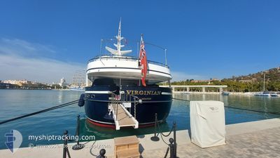
VIRGINIAN
Yacht
Current Trip
| Trip Time | --- |
|---|---|
| Trip Distance | --- |
| AVG Speed | --- |
| MAX Speed | --- |
| Diepgang | --- |
| AVG Wind | --- |
| MAX Wind | --- |
| MIN Temp | --- |
| MAX Temp | --- |
| Positie ontvangen | 4 d geleden |
Current Position
| Lengtegraad | 8.02864° |
|---|---|
| Breedtegraat | 43.87763° |
| Status | Moored |
| Snelheid | |
| Koers | 233° |
| Gebied | Ligurian Sea |
| Station | T-AIS |
| Positie ontvangen | 4 d geleden |
Info
Information
The current position of VIRGINIAN is in Ligurian Sea with coordinates 43.87763° / 8.02864° as reported on 2024-05-05 23:50 by AIS to our vessel tracker app. The vessel's current speed is 0 Knopen and is currently inside the port of IMPERIA.
The vessel VIRGINIAN (IMO: 1004493, MMSI: 310181000) is a Yacht that was built in 1990 ( 34 Jaar oud ). It's sailing under the flag of [BM] Bermuda.
In this page you can find informations about the vessels current position, last detected port calls, and current voyage information. If the vessels is not in coverage by AIS you will find the latest position.
The current position of VIRGINIAN is detected by our AIS receivers and we are not responsible for the reliability of the data. The last position was recorded while the vessel was in Coverage by the Ais receivers of our vessel tracking app.
The current draught of VIRGINIAN as reported by AIS is 3.3 meters
Weather
| Temperature | 9.9°C / 49.82°F |
|---|---|
| Wind Speed | 3 knots |
| Direction | 308° NW |
| Pressure | 1015.4 hPa |
| Humidity | 94.6 % |
| Cloud Coverage | 100 % |
Featured Company
Last Port Calls
| Port | Arrival | Departure | Time In Port |
|---|---|---|---|
| 2024-04-26 11:33 | 2024-05-01 10:19 | 4 d | |
| 2024-04-15 04:44 | 2024-04-15 14:46 | 10 h | |
| 2024-03-25 15:52 | 2024-04-10 04:29 | 15 d | |
| 2024-03-25 04:29 |
Last Trips
| Origin | Departure | Destination | Arrival | Distance | |
|---|---|---|---|---|---|
| 2024-04-15 16:46 | 2024-04-26 13:33 | 908.26 nm | |||
| 2024-04-10 06:29 | 2024-04-15 06:44 | 1029.62 nm | |||
| 2024-03-25 05:29 | 2024-03-25 16:52 | 72.03 nm |
Events
| Tijd | Evenement | Details | Positie / Bestemming | Info |
|---|---|---|---|---|
| 2024-05-05 23:50 | Buitenbereik |
43.87763 / 8.02864
Ligurian Sea
[IT] IMPERIA
|
Snelheid: Koers: 60.6° |
|
| 2024-05-05 22:56 | Binnenbereik |
43.87762 / 8.02866
Ligurian Sea
[IT] IMPERIA
|
Snelheid: Koers: 60.6° |
|
| 2024-05-01 17:14 | Buitenbereik |
43.87295 / 8.03791
Ligurian Sea
IT IMP
|
Snelheid: 4.2 kn Koers: 290.1° |
|
| 2024-05-01 17:14 | Binnenbereik |
43.87295 / 8.03791
Ligurian Sea
IT IMP
|
Snelheid: 4.2 kn Koers: 290.1° |
|
| 2024-05-01 16:05 | Buitenbereik |
43.75332 / 7.81572
Ligurian Sea
IT IMP
|
Snelheid: 13.7 kn Koers: 59.5° |
|
| 2024-05-01 15:44 | Wijzig zee gebeid | Italian part of the Ligurian Sea Italian part of the Mediterranean Sea - Western Basin |
43.71198 / 7.72117
Ligurian Sea
IT IMP
|
Snelheid: 13.5 kn Koers: 58.3° |
| 2024-05-01 15:17 | Gevonden in zee | Italian part of the Mediterranean Sea - Western Basin |
43.66235 / 7.60575
Mediterranean Sea - Western Basin
IT IMP
|
Snelheid: 12.5 kn Koers: 61.9° |
| 2024-05-01 14:53 | Gevonden in zee | French part of the Mediterranean Sea - Western Basin |
43.62265 / 7.50758
Mediterranean Sea - Western Basin
IT IMP
|
Snelheid: 12.5 kn Koers: 61.1° |
| 2024-05-01 14:44 | Wijzig zee gebeid | Mon�gasque part of the Mediterranean Sea - Western Basin French part of the Mediterranean Sea - Western Basin |
43.60767 / 7.47009
Mediterranean Sea - Western Basin
IT IMP
|
Snelheid: 12.7 kn Koers: 61.1° |
| 2024-05-01 11:48 | ETA Changed | 2024/05/01 18:30 2025/04/26 13:30 |
43.35141 / 6.81161
IT IMP
|
Snelheid: 9.3 kn Koers: 61° |