
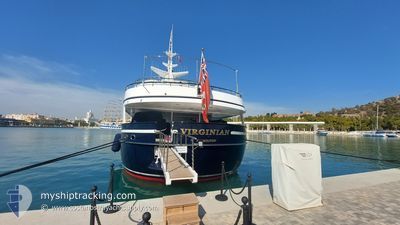
VIRGINIAN
Yacht
Current Trip
| Time Travelled | 10 days |
|---|---|
| Remaining Time | --- |
| Distance Travelled | 907.35 nm |
| Remaining Distance | --- |
| AVG Speed | 10.2 Knots |
| MAX Speed | 15.4 Knots |
| AVG Wind | 8.2 knots |
| MAX Wind | 35.8 knots |
| MIN Temp | 10.7°C / 51.26°F |
| MAX Temp | 24.9°C / 76.82°F |
| Draught | 3.3 m |
| Position Received | 1 h, 56 m ago |
Current Position
| Longitude | 6.62413° |
|---|---|
| Latitude | 43.27372° |
| Status | Under way using engine |
| Speed | 0.1 Knots |
| Course | 119° |
| Area | Mediterranean Sea - Western Basin |
| Station | T-AIS |
| Position Received | 1 h, 56 m ago |
Info
Information
The current position of VIRGINIAN is in Mediterranean Sea - Western Basin with coordinates 43.27372° / 6.62413° as reported on 2024-04-25 14:14 by AIS to our vessel tracker app. The vessel's current speed is 0.1 Knots
The vessel VIRGINIAN (IMO: 1004493, MMSI: 310181000) is a Yacht that was built in 1990 ( 34 years old ). It's sailing under the flag of [BM] Bermuda.
In this page you can find informations about the vessels current position, last detected port calls, and current voyage information. If the vessels is not in coverage by AIS you will find the latest position.
The current position of VIRGINIAN is detected by our AIS receivers and we are not responsible for the reliability of the data. The last position was recorded while the vessel was in Coverage by the Ais receivers of our vessel tracking app.
The current draught of VIRGINIAN as reported by AIS is 3.3 meters
Weather
| Temperature | 15.4°C / 59.72°F |
|---|---|
| Wind Speed | 8 knots |
| Direction | 138° SE |
| Pressure | 1006.9 hPa |
| Humidity | 42.1 % |
| Cloud Coverage | 55 % |
Featured Company
Last Port Calls
| Port | Arrival | Departure | Time In Port |
|---|---|---|---|
| 2024-04-15 04:44 | 2024-04-15 14:46 | 10 h | |
| 2024-03-25 15:52 | 2024-04-10 04:29 | 15 d | |
| 2024-03-25 04:29 |
Last Trips
| Origin | Departure | Destination | Arrival | Distance | |
|---|---|---|---|---|---|
| 2024-04-10 06:29 | 2024-04-15 06:44 | 1029.62 nm | |||
| 2024-03-25 05:29 | 2024-03-25 16:52 | 72.03 nm |
Events
| Time | Event | Details | Position / Dest | Info |
|---|---|---|---|---|
| 2024-04-25 14:14 | OUT of Coverage |
43.27372 / 6.62413
Mediterranean Sea - Western Basin
FR STP
|
Speed: 0.1 kn Course: 73.9° |
|
| 2024-04-25 14:14 | STOP Moving | 0.46 nm, West of SAINT TROPEZ |
43.27372 / 6.62413
FR STP
|
Speed: 0.1 kn Course: 119° |
| 2024-04-25 12:35 | Destination Changed | FR STP FR VNO |
43.31392 / 6.81844
FR STP
|
Speed: 7.7 kn Course: 264.3° |
| 2024-04-25 12:35 | ETA Changed | 2024/04/25 14:00 2024/04/25 18:00 |
43.31392 / 6.81844
FR STP
|
Speed: 7.7 kn Course: 264.3° |
| 2024-04-25 09:26 | Change Sea Area | French part of the Mediterranean Sea - Western Basin Mon�gasque part of the Mediterranean Sea - Western Basin |
43.56100 / 7.46648
Mediterranean Sea - Western Basin
FR VNO
|
Speed: 14.5 kn Course: 230.1° |
| 2024-04-25 09:16 | Change Sea Area | Mon�gasque part of the Mediterranean Sea - Western Basin French part of the Mediterranean Sea - Western Basin |
43.58498 / 7.51083
Mediterranean Sea - Western Basin
FR VNO
|
Speed: 14.8 kn Course: 233.8° |
| 2024-04-25 08:56 | Change Sea Area | French part of the Mediterranean Sea - Western Basin Italian part of the Mediterranean Sea - Western Basin |
43.63043 / 7.60697
Mediterranean Sea - Western Basin
FR VNO
|
Speed: 15 kn Course: 233.7° |
| 2024-04-25 08:29 | Change Sea Area | Italian part of the Mediterranean Sea - Western Basin Italian part of the Ligurian Sea |
43.69170 / 7.72656
Mediterranean Sea - Western Basin
FR VNO
|
Speed: 13.2 kn Course: 232.9° |
| 2024-04-25 07:28 | IN Coverage |
43.81553 / 7.95819
Ligurian Sea
FR VNO
|
Speed: 10.1 kn Course: 229.5° |
|
| 2024-04-25 07:11 | Destination Changed | FR VNO IT IMP |
43.79467 / 7.93907
FR VNO
|
Speed: 13.2 kn Course: 44.3° |