
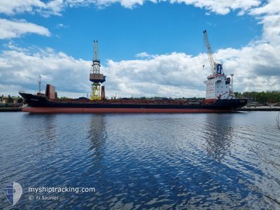
TEVFIK BEY
General Cargo
Current Trip
| Time Travelled | 7 days |
|---|---|
| Remaining Time | 6 days |
| Distance Travelled | 874.01 nm |
| Remaining Distance | 1385.80 nm |
| AVG Speed | 9.1 Knopen |
| MAX Speed | 12.9 Knopen |
| AVG Wind | 9.6 knots |
| MAX Wind | 25.1 knots |
| MIN Temp | 9.4°C / 48.92°F |
| MAX Temp | 19.8°C / 67.64°F |
| Diepgang | 6.8 M |
| Positie ontvangen | 1 d geleden |
Current Position
| Lengtegraad | 23.28241° |
|---|---|
| Breedtegraat | 36.47467° |
| Status | Under way using engine |
| Snelheid | 9.1 Knopen |
| Koers | 214.5° |
| Gebied | Aegean Sea |
| Station | T-AIS |
| Positie ontvangen | 1 d geleden |
Info
Information
The current position of TEVFIK BEY is in Aegean Sea with coordinates 36.47467° / 23.28241° as reported on 2024-05-13 04:24 by AIS to our vessel tracker app. The vessel's current speed is 9.1 Knopen and is heading at the port of CASABLANCA. The estimated time of arrival as calculated by MyShipTracking vessel tracking app is 2024-05-21 13:32 LT
The vessel TEVFIK BEY (IMO: 9383326, MMSI: 249392000) is a General Cargo that was built in 2007 ( 17 Jaar oud ). It's sailing under the flag of [MT] Malta.
In this page you can find informations about the vessels current position, last detected port calls, and current voyage information. If the vessels is not in coverage by AIS you will find the latest position.
The current position of TEVFIK BEY is detected by our AIS receivers and we are not responsible for the reliability of the data. The last position was recorded while the vessel was in Coverage by the Ais receivers of our vessel tracking app.
The current draught of TEVFIK BEY as reported by AIS is 6.8 meters
Weather
| Temperature | 19.7°C / 67.46°F |
|---|---|
| Wind Speed | 20 knots |
| Direction | 165° SSE |
| Pressure | 1011.5 hPa |
| Humidity | 83.8 % |
| Cloud Coverage | 92 % |
Featured Company
Most Visited Ports (Last year)
| Port | Arrivals | |
|---|---|---|
| 4 | ||
| 3 | ||
| 2 | ||
| 2 | ||
| 2 | ||
| 2 |
Last Trips
| Origin | Departure | Destination | Arrival | Distance | |
|---|---|---|---|---|---|
| 2024-04-15 21:39 | 2024-05-01 09:58 | 2113.03 nm | |||
| 2024-04-09 19:15 | 2024-04-12 09:10 | 524.01 nm | |||
| 2024-03-27 04:20 | 2024-04-06 14:39 | 1793.52 nm | |||
| 2024-03-10 14:27 | 2024-03-24 08:20 | 21.06 nm |
Events
| Tijd | Evenement | Details | Positie / Bestemming | Info |
|---|---|---|---|---|
| 2024-05-13 04:32 | Status Changed | Default Under way using engine |
36.45878 / 23.26781
MA CAS
|
Snelheid: 9.1 kn Koers: 214.5° |
| 2024-05-13 04:24 | Buitenbereik |
36.47467 / 23.28241
Aegean Sea
MA CAS
|
Snelheid: 9.1 kn Koers: 214.5° |
|
| 2024-05-13 03:29 | Status Changed | Under way using engine Default |
36.58763 / 23.38830
MA CAS
|
Snelheid: 9 kn Koers: 218° |
| 2024-05-13 02:48 | Status Changed | Default Under way using engine |
36.66500 / 23.47167
MA CAS
|
Snelheid: 9.2 kn Koers: 216.4° |
| 2024-05-12 22:34 | Status Changed | Under way using engine Default |
37.16295 / 23.98368
MA CAS
|
Snelheid: 9.1 kn Koers: 220° |
| 2024-05-12 21:57 | Status Changed | Default Under way using engine |
37.23604 / 24.06061
MA CAS
|
Snelheid: 9.2 kn Koers: 219.5° |
| 2024-05-12 21:52 | Status Changed | Under way using engine Default |
37.24573 / 24.07055
MA CAS
|
Snelheid: 9.1 kn Koers: 222° |
| 2024-05-12 21:40 | Status Changed | Default Under way using engine |
37.26930 / 24.09610
MA CAS
|
Snelheid: 9.1 kn Koers: 222° |
| 2024-05-12 21:34 | Status Changed | Under way using engine Default |
37.28131 / 24.10961
MA CAS
|
Snelheid: 9.1 kn Koers: 223° |
| 2024-05-12 21:25 | Status Changed | Default Under way using engine |
37.29740 / 24.12771
MA CAS
|
Snelheid: 9.1 kn Koers: 221.7° |