
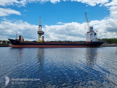
TEVFIK BEY
General Cargo
Current Trip
| Time Travelled | 9 days |
|---|---|
| Remaining Time | 19 mins |
| Distance Travelled | 1878.30 nm |
| Remaining Distance | 35.52 nm |
| AVG Speed | 8.6 Knots |
| MAX Speed | 10.5 Knots |
| AVG Wind | 14.4 knots |
| MAX Wind | 42.8 knots |
| MIN Temp | 10.4°C / 50.72°F |
| MAX Temp | 21.2°C / 70.16°F |
| Draught | 6.4 m |
| Position Received | 1 d ago |
Current Position
| Longitude | 29.25264° |
|---|---|
| Latitude | 41.30992° |
| Status | Under way using engine |
| Speed | 8.5 Knots |
| Course | 65° |
| Area | Black Sea |
| Station | T-AIS |
| Position Received | 1 d ago |
Info
Information
The current position of TEVFIK BEY is in Black Sea with coordinates 41.30992° / 29.25264° as reported on 2024-04-23 13:43 by AIS to our vessel tracker app. The vessel's current speed is 8.5 Knots and is heading at the port of SAMSUN. The estimated time of arrival as calculated by MyShipTracking vessel tracking app is 2024-04-25 04:33 LT
The vessel TEVFIK BEY (IMO: 9383326, MMSI: 249392000) is a General Cargo that was built in 2007 ( 17 years old ). It's sailing under the flag of [MT] Malta.
In this page you can find informations about the vessels current position, last detected port calls, and current voyage information. If the vessels is not in coverage by AIS you will find the latest position.
The current position of TEVFIK BEY is detected by our AIS receivers and we are not responsible for the reliability of the data. The last position was recorded while the vessel was in Coverage by the Ais receivers of our vessel tracking app.
The current draught of TEVFIK BEY as reported by AIS is 6.4 meters
Weather
| Temperature | 21.1°C / 69.98°F |
|---|---|
| Wind Speed | 9 knots |
| Direction | 224° SW |
| Pressure | 1006.6 hPa |
| Humidity | 40.6 % |
| Cloud Coverage | 100 % |
Featured Company
Last Port Calls
| Port | Arrival | Departure | Time In Port |
|---|---|---|---|
| 2024-04-12 07:10 | 2024-04-15 19:39 | 3 d | |
| 2024-04-06 12:39 | 2024-04-09 17:15 | 3 d | |
| 2024-03-24 06:20 | 2024-03-27 02:20 | 2 d | |
| 2024-03-10 12:27 | |||
| 2024-02-06 23:03 | 2024-02-09 18:41 | 2 d | |
| 2024-02-02 08:26 |
Most Visited Ports (Last year)
| Port | Arrivals | |
|---|---|---|
| 4 | ||
| 3 | ||
| 2 | ||
| 2 | ||
| 2 | ||
| 2 |
Last Trips
| Origin | Departure | Destination | Arrival | Distance | |
|---|---|---|---|---|---|
| 2024-04-09 19:15 | 2024-04-12 09:10 | 524.01 nm | |||
| 2024-03-27 04:20 | 2024-04-06 14:39 | 1793.52 nm | |||
| 2024-03-10 14:27 | 2024-03-24 08:20 | 21.06 nm | |||
| 2024-02-02 10:26 | 2024-02-07 01:03 | 18.44 nm |
Events
| Time | Event | Details | Position / Dest | Info |
|---|---|---|---|---|
| 2024-04-23 18:01 | START Moving | 20.28 nm, North of KEFKEN |
41.49371 / 30.08838
TRSSX
|
Speed: 9.5 kn Course: 77° |
| 2024-04-23 17:42 | STOP Moving | 20.74 nm, North West of KEFKEN |
41.48149 / 30.02050
TRSSX
|
Speed: Course: 76° |
| 2024-04-23 13:44 | Status Changed | Default Under way using engine |
41.31023 / 29.25355
TRSSX
|
Speed: 8.5 kn Course: 65° |
| 2024-04-23 13:43 | OUT of Coverage |
41.30992 / 29.25264
Black Sea
TRSSX
|
Speed: 8.5 kn Course: 65° |
|
| 2024-04-23 12:55 | Change Sea Area | Turkish part of the Black Sea Turkish part of the Sea of Marmara |
41.23184 / 29.14580
Black Sea
TRSSX
|
Speed: 8.2 kn Course: 37.1° |
| 2024-04-23 07:11 | START Moving | 12.98 nm, South of YESILKOY |
40.74519 / 28.75765
TRSSX
|
Speed: 3.2 kn Course: 336° |
| 2024-04-22 19:53 | STOP Moving | 11.95 nm, South of YESILKOY |
40.76206 / 28.88887
TRSSX
|
Speed: 0.3 kn Course: 119° |
| 2024-04-22 18:18 | Status Changed | Under way using engine At anchor |
40.94183 / 28.86706
TRSSX
|
Speed: 5.3 kn Course: 193.7° |
| 2024-04-22 18:15 | START Moving | 1.72 nm, South of BAKIRKOY |
40.94573 / 28.86825
TRSSX
|
Speed: 3.2 kn Course: 187° |
| 2024-04-22 08:40 | STOP Moving | 1.69 nm, South of BAKIRKOY |
40.94570 / 28.87206
TRSSX
|
Speed: 0.3 kn Course: 283° |