
TAO MARINER
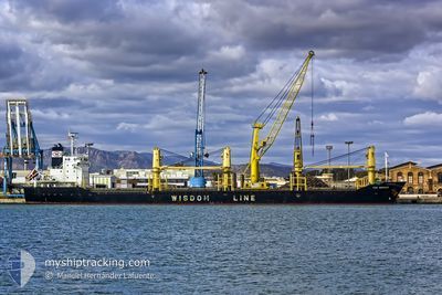
Bulk Carrier
Current Trip
| Time Travelled | 5 days |
|---|---|
| Remaining Time | 4 days |
| Distance Travelled | 1503.67 nm |
| Remaining Distance | 1417.55 nm |
| AVG Speed | 10.9 Knopen |
| MAX Speed | 13.2 Knopen |
| AVG Wind | 6.6 knots |
| MAX Wind | 17.8 knots |
| MIN Temp | 27.8°C / 82.04°F |
| MAX Temp | 30.9°C / 87.62°F |
| Diepgang | 10.2 M |
| Positie ontvangen | 19 d geleden |
Current Position
| Lengtegraad | 103.53522° |
|---|---|
| Breedtegraat | 1.21130° |
| Status | Under way using engine |
| Snelheid | 13.6 Knopen |
| Koers | 283.7° |
| Gebied | Singapore Strait |
| Station | T-AIS |
| Positie ontvangen | 19 d geleden |
Info
Information
The current position of TAO MARINER is in Singapore Strait with coordinates 1.21130° / 103.53522° as reported on 2024-04-26 11:19 by AIS to our vessel tracker app. The vessel's current speed is 13.6 Knopen and is heading at the port of CHENNAI. The estimated time of arrival as calculated by MyShipTracking vessel tracking app is 2024-05-20 14:47 LT
The vessel TAO MARINER (IMO: 9487574, MMSI: 356158000) is a Bulk Carrier that was built in 2010 ( 14 Jaar oud ). It's sailing under the flag of [PA] Panama.
In this page you can find informations about the vessels current position, last detected port calls, and current voyage information. If the vessels is not in coverage by AIS you will find the latest position.
The current position of TAO MARINER is detected by our AIS receivers and we are not responsible for the reliability of the data. The last position was recorded while the vessel was in Coverage by the Ais receivers of our vessel tracking app.
The current draught of TAO MARINER as reported by AIS is 10.2 meters
Weather
| Temperature | 28.6°C / 83.48°F |
|---|---|
| Wind Speed | 8 knots |
| Direction | 96° E |
| Pressure | 1009.2 hPa |
| Humidity | 78.5 % |
| Cloud Coverage | 100 % |
Featured Company
Last Port Calls
| Port | Arrival | Departure | Time In Port |
|---|---|---|---|
| 2024-05-06 15:04 | 2024-05-09 21:00 | 3 d | |
| 2024-05-02 03:40 | 2024-05-04 07:20 | 2 d | |
| 2024-04-15 20:55 | 2024-04-17 08:12 | 1 d | |
| 2024-04-12 08:16 | 2024-04-14 07:18 | 1 d | |
| 2024-03-26 01:09 | 2024-03-30 00:25 | 3 d | |
| 2024-03-13 22:22 |
Most Visited Ports (Last year)
| Port | Arrivals | |
|---|---|---|
| 2 | ||
| 1 | ||
| 1 | ||
| 1 | ||
| 1 | ||
| 1 |
Last Trips
| Origin | Departure | Destination | Arrival | Distance | |
|---|---|---|---|---|---|
| 2024-05-04 12:50 | 2024-05-06 20:34 | 124.83 nm | |||
| 2024-04-17 17:12 | 2024-05-02 09:10 | 4062.15 nm | |||
| 2024-04-14 16:18 | 2024-04-16 05:55 | 364.38 nm | |||
| 2024-03-30 09:25 | 2024-04-12 17:16 | 1425.89 nm | |||
| 2024-02-28 22:25 | 2024-03-14 06:22 | 3320.88 nm |
Events
| Tijd | Evenement | Details | Positie / Bestemming | Info |
|---|---|---|---|---|
| 2024-05-15 14:01 | Start beweging | 12.95 nm, South of PORT KLANG |
2.78389 / 101.32007
IN MAA
|
Snelheid: 3.5 kn Koers: 255° |
| 2024-05-15 04:16 | Stop beweging | 12.61 nm, South of PORT KLANG |
2.78898 / 101.32584
IN MAA
|
Snelheid: 0.1 kn Koers: 146° |
| 2024-05-09 21:00 | Vertrekhaven |
|
14.24959 / 80.15646
IN MAA
|
Snelheid: 7.9 kn Koers: 86° |
| 2024-05-09 20:48 | Start beweging |
14.24716 / 80.13150
[IN] KRISHNAPATNAM
|
Snelheid: 4.8 kn Koers: 92° |
|
| 2024-05-06 15:28 | Stop beweging |
14.24658 / 80.12527
[IN] KRISHNAPATNAM
|
Snelheid: 0.1 kn Koers: 280° |
|
| 2024-05-06 15:04 | Aankomsthaven |
|
14.24794 / 80.14213
[IN] KRISHNAPATNAM
|
Snelheid: 8.4 kn Koers: 263° |
| 2024-05-06 14:13 | Start beweging | 3.6 nm, South East of KRISHNAPATNAM |
14.22197 / 80.19789
IN MAA
|
Snelheid: 5.2 kn Koers: 308° |