
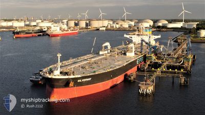
SILVERWAY
Tanker
Current Trip
| Time Travelled | 30 days |
|---|---|
| Remaining Time | --- |
| Distance Travelled | 7892.76 nm |
| Remaining Distance | --- |
| AVG Speed | 11.1 Knopen |
| MAX Speed | 16.3 Knopen |
| AVG Wind | 16.7 knots |
| MAX Wind | 38 knots |
| MIN Temp | 5.4°C / 41.72°F |
| MAX Temp | 26.4°C / 79.52°F |
| Diepgang | 9.6 M |
| Positie ontvangen | 3 d geleden |
Current Position
| Lengtegraad | --- |
|---|---|
| Breedtegraat | --- |
| Status | Under way using engine |
| Snelheid | 11.4 Knopen |
| Koers | 237.3° |
| Gebied | English Channel |
| Station | T-AIS |
| Positie ontvangen | 3 d geleden |
Info
Information
The current position of SILVERWAY is in English Channel with coordinates 49.43259° / -4.77587° as reported on 2025-12-12 20:19 by AIS to our vessel tracker app. The vessel's current speed is 11.4 Knopen and is heading at the port of TERNEUZEN. The estimated time of arrival as calculated by MyShipTracking vessel tracking app is 2025-12-11 16:00 LT
The vessel SILVERWAY (IMO: 9742912, MMSI: 636017059) is a Tanker It's sailing under the flag of [LR] Liberia.
In this page you can find informations about the vessels current position, last detected port calls, and current voyage information. If the vessels is not in coverage by AIS you will find the latest position.
The current position of SILVERWAY is detected by our AIS receivers and we are not responsible for the reliability of the data. The last position was recorded while the vessel was in Coverage by the Ais receivers of our vessel tracking app.
The current draught of SILVERWAY as reported by AIS is 9.6 meters
Weather
| Temperature | 18°C / 64.4°F |
|---|---|
| Wind Speed | 7 knots |
| Direction | 321° NW |
| Pressure | 1029.2 hPa |
| Humidity | 64.3 % |
| Cloud Coverage | 81 % |
Featured Company
Events
| Tijd | Evenement | Details | Positie / Bestemming | Info |
|---|---|---|---|---|
| 2025-12-12 20:27 | Status Changed | Default Under way using engine |
49.41909 / -4.80671
FOR ORDERS
|
Snelheid: 11.4 kn Koers: 237.3° |
| 2025-12-12 20:19 | Buitenbereik |
49.43259 / -4.77587
English Channel
|
Snelheid: 11.4 kn Koers: 237.3° |
|
| 2025-12-12 20:19 | Status Changed | Under way using engine Default |
49.43280 / -4.77540
FOR ORDERS
|
Snelheid: 11.3 kn Koers: 233° |
| 2025-12-12 20:07 | Binnenbereik |
49.43259 / -4.77587
English Channel
|
Snelheid: 11.4 kn Koers: 237.3° |
|
| 2025-12-12 13:23 | Status Changed | Default Under way using engine |
50.19417 / -2.95057
FOR ORDERS
|
Snelheid: 11.3 kn Koers: 235° |
| 2025-12-12 13:16 | Status Changed | Under way using engine Default |
50.20690 / -2.92217
FOR ORDERS
|
Snelheid: 11.2 kn Koers: 235° |
| 2025-12-12 13:16 | Binnenbereik |
50.20690 / -2.92217
English Channel
|
Snelheid: 11.3 kn Koers: 235° |
|
| 2025-12-12 13:16 | Buitenbereik |
50.20690 / -2.92217
English Channel
|
Snelheid: 11.3 kn Koers: 235° |
|
| 2025-12-12 12:23 | Status Changed | Default Under way using engine |
50.26520 / -2.79345
FOR ORDERS
|
Snelheid: 2.6 kn Koers: 341° |
| 2025-12-12 12:22 | Status Changed | Under way using engine Default |
50.26498 / -2.79386
FOR ORDERS
|
Snelheid: 2.7 kn Koers: 347° |