
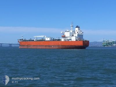
SILVER MANOORA
Tanker
Current Trip
| Time Travelled | 3 days |
|---|---|
| Remaining Time | 1 h, 18 mins |
| Distance Travelled | 656.75 nm |
| Remaining Distance | 22.05 nm |
| AVG Speed | 11.9 Knopen |
| MAX Speed | 17.6 Knopen |
| AVG Wind | 7.1 knots |
| MAX Wind | 15 knots |
| MIN Temp | 21.4°C / 70.52°F |
| MAX Temp | 28.9°C / 84.02°F |
| Diepgang | 9.6 M |
| Positie ontvangen | 9 m geleden |
Current Position
| Lengtegraad | --- |
|---|---|
| Breedtegraat | --- |
| Status | Under way using engine |
| Snelheid | 10.6 Knopen |
| Koers | 27.2° |
| Gebied | North Pacific Ocean |
| Station | T-AIS |
| Positie ontvangen | 9 m geleden |
Info
Information
The current position of SILVER MANOORA is in North Pacific Ocean with coordinates 22.95025° / -106.53460° as reported on 2026-01-07 14:02 by AIS to our vessel tracker app. The vessel's current speed is 10.6 Knopen and is heading at the port of MAZATLAN. The estimated time of arrival as calculated by MyShipTracking vessel tracking app is 2026-01-07 08:29 LT
The vessel SILVER MANOORA (IMO: 9718844, MMSI: 477129100) is a Tanker It's sailing under the flag of [HK] Hong Kong.
In this page you can find informations about the vessels current position, last detected port calls, and current voyage information. If the vessels is not in coverage by AIS you will find the latest position.
The current position of SILVER MANOORA is detected by our AIS receivers and we are not responsible for the reliability of the data. The last position was recorded while the vessel was in Coverage by the Ais receivers of our vessel tracking app.
The current draught of SILVER MANOORA as reported by AIS is 9.6 meters
Weather
| Temperature | 22.2°C / 71.96°F |
|---|---|
| Wind Speed | 4 knots |
| Direction | 29° NNE |
| Pressure | 1011.5 hPa |
| Humidity | 70.5 % |
| Cloud Coverage | --- |
Featured Company
Last Port Calls
| Port | Arrival | Departure | Time In Port |
|---|---|---|---|
| 2026-01-02 16:22 | 2026-01-03 10:54 | 18 h | |
| 2026-01-01 00:50 | 2026-01-02 01:27 | 1 d | |
| 2025-12-09 03:14 | 2025-12-13 04:14 | 4 d | |
| 2025-11-11 22:10 | 2025-11-15 15:46 | 3 d |
Most Visited Ports (Last year)
| Port | Arrivals | |
|---|---|---|
| 4 | ||
| 4 | ||
| 3 | ||
| 2 | ||
| 2 | ||
| 2 |
Last Trips
| Origin | Departure | Destination | Arrival | Distance | |
|---|---|---|---|---|---|
| 2026-01-02 01:27 | 2026-01-02 16:22 | 167.39 nm | |||
| 2025-12-13 04:14 | 2026-01-01 00:50 | 3333.77 nm | |||
| 2025-11-15 15:46 | 2025-12-09 03:14 | 5658.05 nm | |||
| 2025-10-17 17:34 | 2025-11-11 22:10 | 5759.39 nm |
Events
| Tijd | Evenement | Details | Positie / Bestemming | Info |
|---|---|---|---|---|
| 2026-01-07 14:02 | Status Changed | Under way using engine Default |
22.95025 / -106.53460
MAZATLAN
|
Snelheid: 10.4 kn Koers: 27° |
| 2026-01-07 13:39 | Status Changed | Default Under way using engine |
22.89157 / -106.56626
MAZATLAN
|
Snelheid: 10.4 kn Koers: 26.6° |
| 2026-01-07 13:38 | Status Changed | Under way using engine Default |
22.88708 / -106.56866
MAZATLAN
|
Snelheid: 10.3 kn Koers: 26° |
| 2026-01-07 13:27 | Status Changed | Default Under way using engine |
22.86007 / -106.58340
MAZATLAN
|
Snelheid: 10.2 kn Koers: 22.7° |
| 2026-01-07 13:22 | Status Changed | Under way using engine Default |
22.84704 / -106.58970
MAZATLAN
|
Snelheid: 10.2 kn Koers: 23° |
| 2026-01-07 12:53 | Status Changed | Default Under way using engine |
22.77208 / -106.62476
MAZATLAN
|
Snelheid: 10.2 kn Koers: 27.8° |
| 2026-01-07 12:48 | Status Changed | Under way using engine Default |
22.75687 / -106.63210
MAZATLAN
|
Snelheid: 10.2 kn Koers: 22° |
| 2026-01-07 12:10 | Status Changed | Default Under way using engine |
22.65710 / -106.67857
MAZATLAN
|
Snelheid: 10.2 kn Koers: 22.8° |
| 2026-01-07 12:02 | Status Changed | Under way using engine Default |
22.63740 / -106.68754
MAZATLAN
|
Snelheid: 10.2 kn Koers: 23° |
| 2026-01-07 11:42 | Status Changed | Default Under way using engine |
22.58310 / -106.71246
MAZATLAN
|
Snelheid: 10.4 kn Koers: 23.2° |