
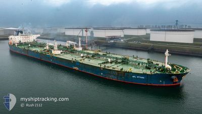
SFL OTTAWA
Tanker
Current Trip
| Time Travelled | 28 days |
|---|---|
| Remaining Time | 3 h, 24 mins |
| Distance Travelled | 7494.03 nm |
| Remaining Distance | 37.31 nm |
| AVG Speed | 11.4 Knopen |
| MAX Speed | 15.4 Knopen |
| AVG Wind | 10 knots |
| MAX Wind | 23 knots |
| MIN Temp | 11.9°C / 53.42°F |
| MAX Temp | 29.8°C / 85.64°F |
| Diepgang | 16.3 M |
| Positie ontvangen | 10 m geleden |
Current Position
| Lengtegraad | 3.15577° |
|---|---|
| Breedtegraat | 52.00142° |
| Status | At anchor |
| Snelheid | 0.1 Knopen |
| Koers | 41° |
| Gebied | North Sea |
| Station | T-AIS |
| Positie ontvangen | 10 m geleden |
Info
Information
The current position of SFL OTTAWA is in North Sea with coordinates 52.00142° / 3.15577° as reported on 2024-05-11 11:18 by AIS to our vessel tracker app. The vessel's current speed is 0.1 Knopen and is heading at the port of ROTTERDAM. The estimated time of arrival as calculated by MyShipTracking vessel tracking app is 2024-05-11 14:53 LT
The vessel SFL OTTAWA (IMO: 9593012, MMSI: 538010185) is a Tanker It's sailing under the flag of [MH] Marshall Is.
In this page you can find informations about the vessels current position, last detected port calls, and current voyage information. If the vessels is not in coverage by AIS you will find the latest position.
The current position of SFL OTTAWA is detected by our AIS receivers and we are not responsible for the reliability of the data. The last position was recorded while the vessel was in Coverage by the Ais receivers of our vessel tracking app.
The current draught of SFL OTTAWA as reported by AIS is 16.3 meters
Weather
| Temperature | 12.8°C / 55.04°F |
|---|---|
| Wind Speed | 11 knots |
| Direction | 59° ENE |
| Pressure | 1022.5 hPa |
| Humidity | 90 % |
| Cloud Coverage | 100 % |
Featured Company
Last Port Calls
| Port | Arrival | Departure | Time In Port |
|---|---|---|---|
| 2024-04-12 03:03 | 2024-04-12 21:26 | 18 h | |
| 2024-04-05 10:56 | 2024-04-06 21:41 | 1 d | |
| 2024-03-10 20:44 | 2024-03-13 15:27 | 2 d |
Most Visited Ports (Last year)
| Port | Arrivals | |
|---|---|---|
| 2 | ||
| 1 | ||
| 1 | ||
| 1 | ||
| 1 | ||
| 1 |
Events
| Tijd | Evenement | Details | Positie / Bestemming | Info |
|---|---|---|---|---|
| 2024-05-11 11:06 | Status Changed | At anchor Default |
52.00153 / 3.15560
ROTTERDAM
|
Snelheid: 0.1 kn Koers: 46° |
| 2024-05-11 11:00 | Status Changed | Default At anchor |
52.00138 / 3.15506
ROTTERDAM
|
Snelheid: 0.2 kn Koers: 33° |
| 2024-05-11 10:51 | Status Changed | At anchor Default |
52.00112 / 3.15546
ROTTERDAM
|
Snelheid: 0.2 kn Koers: 38° |
| 2024-05-11 10:42 | Status Changed | Default At anchor |
52.00148 / 3.15608
ROTTERDAM
|
Snelheid: 0.2 kn Koers: 42° |
| 2024-05-11 10:36 | Status Changed | At anchor Default |
52.00154 / 3.15598
ROTTERDAM
|
Snelheid: 0.6 kn Koers: 56° |
| 2024-05-11 10:28 | Status Changed | Default At anchor |
52.00168 / 3.15415
ROTTERDAM
|
Snelheid: 0.2 kn Koers: 60° |
| 2024-05-11 10:24 | Status Changed | At anchor Default |
52.00200 / 3.15357
ROTTERDAM
|
Snelheid: 0.3 kn Koers: 31° |
| 2024-05-11 10:15 | Status Changed | Default At anchor |
52.00162 / 3.15416
ROTTERDAM
|
Snelheid: 0.2 kn Koers: 13° |
| 2024-05-11 10:09 | Status Changed | At anchor Default |
52.00118 / 3.15519
ROTTERDAM
|
Snelheid: Koers: 27° |
| 2024-05-11 10:01 | Status Changed | Default At anchor |
52.00133 / 3.15549
ROTTERDAM
|
Snelheid: 0.3 kn Koers: 41° |