
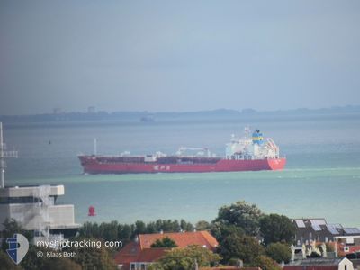
SCARLET RAY
Tanker
Current Trip
| Time Travelled | 8 days |
|---|---|
| Remaining Time | --- |
| Distance Travelled | 2694.61 nm |
| Remaining Distance | --- |
| AVG Speed | 11.9 Knopen |
| MAX Speed | 16.7 Knopen |
| AVG Wind | 9.4 knots |
| MAX Wind | 24 knots |
| MIN Temp | 10.5°C / 50.9°F |
| MAX Temp | 20.1°C / 68.18°F |
| Diepgang | 9.8 M |
| Positie ontvangen | 3 d geleden |
Current Position
| Lengtegraad | -30.77934° |
|---|---|
| Breedtegraat | 38.73909° |
| Status | Under way using engine |
| Snelheid | 12.6 Knopen |
| Koers | 261.4° |
| Gebied | North Atlantic Ocean |
| Station | T-AIS |
| Positie ontvangen | 3 d geleden |
Info
Information
The current position of SCARLET RAY is in North Atlantic Ocean with coordinates 38.73909° / -30.77934° as reported on 2024-05-10 21:35 by AIS to our vessel tracker app. The vessel's current speed is 12.6 Knopen and is heading at the port of SAVANNAH. The estimated time of arrival as calculated by MyShipTracking vessel tracking app is 2024-05-19 15:00 LT
The vessel SCARLET RAY (IMO: 9799654, MMSI: 636017260) is a Tanker It's sailing under the flag of [LR] Liberia.
In this page you can find informations about the vessels current position, last detected port calls, and current voyage information. If the vessels is not in coverage by AIS you will find the latest position.
The current position of SCARLET RAY is detected by our AIS receivers and we are not responsible for the reliability of the data. The last position was recorded while the vessel was in Coverage by the Ais receivers of our vessel tracking app.
The current draught of SCARLET RAY as reported by AIS is 9.8 meters
Weather
| Temperature | 19.8°C / 67.64°F |
|---|---|
| Wind Speed | 22 knots |
| Direction | 162° SSE |
| Pressure | 1015.7 hPa |
| Humidity | 89.2 % |
| Cloud Coverage | 100 % |
Featured Company
Last Port Calls
| Port | Arrival | Departure | Time In Port |
|---|---|---|---|
| 2024-05-04 03:09 | 2024-05-05 14:29 | 1 d | |
| 2024-05-03 21:46 | 2024-05-03 22:01 | 15 m | |
| 2024-04-30 12:03 | 2024-05-01 08:40 | 20 h | |
| 2024-04-26 17:18 | 2024-04-27 12:41 | 19 h | |
| 2024-04-26 02:37 | 2024-04-26 15:03 | 12 h | |
| 2024-04-25 08:08 | 2024-04-26 01:04 | 16 h | |
| 2024-04-24 05:40 | 2024-04-25 07:48 | 1 d | |
| 2024-04-19 05:20 | 2024-04-23 19:36 | 4 d | |
| 2024-04-01 10:42 | 2024-04-02 06:50 | 20 h | |
| 2024-03-30 00:18 | 2024-03-30 17:51 | 17 h |
Most Visited Ports (Last year)
| Port | Arrivals | |
|---|---|---|
| 8 | ||
| 6 | ||
| 5 | ||
| 4 | ||
| 3 | ||
| 2 |
Last Trips
| Origin | Departure | Destination | Arrival | Distance | |
|---|---|---|---|---|---|
| 2024-05-03 22:01 | 2024-05-04 03:09 | 8.46 nm | |||
| 2024-05-01 08:40 | 2024-05-03 21:46 | 458.57 nm | |||
| 2024-04-27 12:41 | 2024-04-30 12:03 | 432.31 nm | |||
| 2024-04-26 15:03 | 2024-04-26 17:18 | 17.18 nm | |||
| 2024-04-26 01:04 | 2024-04-26 02:37 | 17.12 nm | |||
| 2024-04-25 07:48 | 2024-04-25 08:08 | 1.04 nm | |||
| 2024-04-23 19:36 | 2024-04-24 05:40 | 105.84 nm | |||
| 2024-04-02 06:50 | 2024-04-19 05:20 | 5183.25 nm | |||
| 2024-03-30 17:51 | 2024-04-01 10:42 | 29.10 nm | |||
| 2024-03-24 10:06 | 2024-03-30 00:18 | 65.71 nm |
Events
| Tijd | Evenement | Details | Positie / Bestemming | Info |
|---|---|---|---|---|
| 2024-05-10 21:41 | Status Changed | Default Under way using engine |
38.73616 / -30.80283
US SAVANNAH
|
Snelheid: 12.6 kn Koers: 261.4° |
| 2024-05-10 21:35 | Buitenbereik |
38.73909 / -30.77934
North Atlantic Ocean
US SAVANNAH
|
Snelheid: 12.6 kn Koers: 261.4° |
|
| 2024-05-10 09:09 | Wijzig zee gebeid | Portuguese (Azores) part of the North Atlantic Ocean United Kingdom part of the Celtic Sea |
39.89322 / -27.80500
North Atlantic Ocean
US SAVANNAH
|
Snelheid: 12.4 kn Koers: 241.7° |
| 2024-05-10 09:09 | Status Changed | Under way using engine Default |
39.89322 / -27.80500
US SAVANNAH
|
Snelheid: 12.6 kn Koers: 242° |
| 2024-05-10 08:53 | Binnenbereik |
39.89322 / -27.80500
North Atlantic Ocean
US SAVANNAH
|
Snelheid: 12.4 kn Koers: 241.7° |
|
| 2024-05-06 23:10 | Status Changed | Default Under way using engine |
49.12584 / -6.13449
US SAVANNAH
|
Snelheid: 13.9 kn Koers: 247.7° |
| 2024-05-06 23:07 | Status Changed | Under way using engine Default |
49.12276 / -6.14595
US SAVANNAH
|
Snelheid: 14 kn Koers: 247° |
| 2024-05-06 23:07 | Buitenbereik |
49.12276 / -6.14595
Celtic Sea
US SAVANNAH
|
Snelheid: 13.9 kn Koers: 247.7° |
|
| 2024-05-06 23:05 | Status Changed | Default Under way using engine |
49.12697 / -6.13019
US SAVANNAH
|
Snelheid: 14 kn Koers: 248° |
| 2024-05-06 21:56 | Status Changed | Under way using engine Default |
49.22169 / -5.73805
US SAVANNAH
|
Snelheid: 14.7 kn Koers: 248° |