
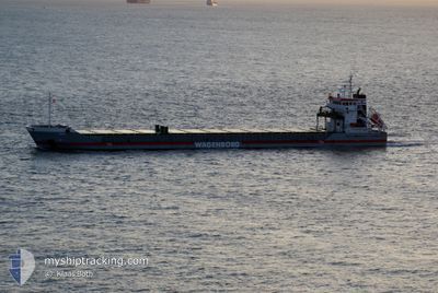
NEUSEBORG
General Cargo
Current Trip
SEHAH
| Time Travelled | 15 h, 53 mins |
|---|---|
| Remaining Time | --- |
| Distance Travelled | 164.61 nm |
| Remaining Distance | --- |
| AVG Speed | 10.4 Knopen |
| MAX Speed | 11.2 Knopen |
| AVG Wind | 14.8 knots |
| MAX Wind | 20.7 knots |
| MIN Temp | -4.6°C / 23.72°F |
| MAX Temp | 4.3°C / 39.74°F |
| Diepgang | 4.1 M |
| Positie ontvangen | 7 d geleden |
Current Position
| Lengtegraad | --- |
|---|---|
| Breedtegraat | --- |
| Status | Under way using engine |
| Snelheid | 12.5 Knopen |
| Koers | 12.1° |
| Gebied | Gulf of Bothnia |
| Station | T-AIS |
| Positie ontvangen | 7 d geleden |
Info
Information
The current position of NEUSEBORG is in Gulf of Bothnia with coordinates 60.49458° / 19.06739° as reported on 2025-11-29 07:55 by AIS to our vessel tracker app. The vessel's current speed is 12.5 Knopen
The vessel NEUSEBORG (IMO: 9341756, MMSI: 246535000) is a General Cargo that was built in 2006 ( 19 Jaar oud ). It's sailing under the flag of [NL] Netherlands.
In this page you can find informations about the vessels current position, last detected port calls, and current voyage information. If the vessels is not in coverage by AIS you will find the latest position.
The current position of NEUSEBORG is detected by our AIS receivers and we are not responsible for the reliability of the data. The last position was recorded while the vessel was in Coverage by the Ais receivers of our vessel tracking app.
The current draught of NEUSEBORG as reported by AIS is 4.1 meters
Weather
| Temperature | 4.3°C / 39.74°F |
|---|---|
| Wind Speed | 20 knots |
| Direction | 112° ESE |
| Pressure | 1013.6 hPa |
| Humidity | 96.7 % |
| Cloud Coverage | 100 % |
Featured Company
Last Port Calls
| Port | Arrival | Departure | Time In Port |
|---|---|---|---|
| 2025-11-30 12:25 | 2025-12-06 07:17 | 5 d | |
| 2025-10-23 23:52 | 2025-10-29 08:19 | 5 d | |
| 2025-10-11 23:28 | 2025-10-13 21:55 | 1 d | |
| 2025-10-03 03:30 | 2025-10-07 17:25 | 4 d |
Most Visited Ports (Last year)
| Port | Arrivals | |
|---|---|---|
| 8 | ||
| 5 | ||
| 4 | ||
| 4 | ||
| 4 | ||
| 3 |
Last Trips
| Origin | Departure | Destination | Arrival | Distance | |
|---|---|---|---|---|---|
| 2025-10-29 08:19 | 2025-11-30 12:25 | 1216.78 nm | |||
| 2025-10-13 21:55 | 2025-10-23 23:52 | 1279.05 nm | |||
| 2025-10-07 17:25 | 2025-10-11 23:28 | 223.02 nm | |||
| 2025-10-01 00:14 | 2025-10-03 03:30 | 486.15 nm |
Events
| Tijd | Evenement | Details | Positie / Bestemming | Info |
|---|---|---|---|---|
| 2025-12-06 06:17 | Start beweging | 0.17 nm, South West of HARAHOLMEN |
65.23524 / 21.61544
SEHAH
|
Snelheid: 5.6 kn Koers: 242° |
| 2025-12-06 06:17 | Vertrekhaven |
|
65.23524 / 21.61544
SEHAH
|
Snelheid: 2.4 kn Koers: 295° |
| 2025-11-30 11:33 | Stop beweging |
65.23449 / 21.62788
[SE] HARAHOLMEN
|
Snelheid: 0.2 kn Koers: 331° |
|
| 2025-11-30 11:25 | Aankomsthaven |
|
65.23219 / 21.63095
[SE] HARAHOLMEN
|
Snelheid: 3.3 kn Koers: 319° |
| 2025-11-30 10:37 | Start beweging | 6.51 nm, South of HARAHOLMEN |
65.12917 / 21.64780
SEHAH
|
Snelheid: 5.9 kn Koers: 336° |
| 2025-11-30 10:21 | Stop beweging | 7.09 nm, South of HARAHOLMEN |
65.11977 / 21.65295
SEHAH
|
Snelheid: 0.1 kn Koers: 258° |
| 2025-11-29 08:01 | Status Changed | Default Under way using engine |
60.51391 / 19.07571
SEHAH
|
Snelheid: 12.5 kn Koers: 12.1° |
| 2025-11-29 07:55 | Buitenbereik |
60.49458 / 19.06739
Gulf of Bothnia
SEHAH
|
Snelheid: 12.5 kn Koers: 12.1° |
|
| 2025-11-29 06:32 | Wijzig zee gebeid | Swedish part of the Gulf of Bothnia Finnish part of the Gulf of Bothnia |
60.20880 / 19.08822
Gulf of Bothnia
SEHAH
|
Snelheid: 12.3 kn Koers: 333.2° |
| 2025-11-29 05:48 | Status Changed | Under way using engine Default |
60.09243 / 19.27624
SEHAH
|
Snelheid: 12 kn Koers: 324° |