
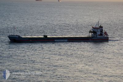
NEUSEBORG
General Cargo
Current Trip
| Time Travelled | 1 day |
|---|---|
| Remaining Time | 4 days |
| Distance Travelled | 387.54 nm |
| Remaining Distance | 1037.97 nm |
| AVG Speed | 10.5 Knop |
| MAX Speed | 11.2 Knop |
| AVG Wind | 12.9 knots |
| MAX Wind | 21.7 knots |
| MIN Temp | -4.6°C / 23.72°F |
| MAX Temp | 6.6°C / 43.88°F |
| Djupgående | 6.2 m |
| Position mottagen | 1 h, 58 m sen |
Current Position
| Longitud | --- |
|---|---|
| Latitude | --- |
| Status | Under way using engine |
| Fart | 10.4 Knop |
| Kurs | 148.3° |
| Område | Baltic Sea |
| Station | T-AIS |
| Position mottagen | 1 h, 58 m sen |
Info
Information
The current position of NEUSEBORG is in Baltic Sea with coordinates 59.58736° / 19.96314° as reported on 2025-12-07 17:13 by AIS to our vessel tracker app. The vessel's current speed is 10.4 Knop and is heading at the port of TERNEUZEN. The estimated time of arrival as calculated by MyShipTracking vessel tracking app is 2025-12-11 22:28 LT
The vessel NEUSEBORG (IMO: 9341756, MMSI: 246535000) is a General Cargo that was built in 2006 ( 19 År gammal ). It's sailing under the flag of [NL] Netherlands.
In this page you can find informations about the vessels current position, last detected port calls, and current voyage information. If the vessels is not in coverage by AIS you will find the latest position.
The current position of NEUSEBORG is detected by our AIS receivers and we are not responsible for the reliability of the data. The last position was recorded while the vessel was in Coverage by the Ais receivers of our vessel tracking app.
The current draught of NEUSEBORG as reported by AIS is 6.2 meters
Weather
| Temperature | 6.5°C / 43.7°F |
|---|---|
| Wind Speed | 12 knots |
| Direction | 202° SSW |
| Pressure | 1010.4 hPa |
| Humidity | 92.8 % |
| Cloud Coverage | 100 % |
Featured Company
Last Port Calls
| Port | Arrival | Departure | Time In Port |
|---|---|---|---|
| 2025-11-30 12:25 | 2025-12-06 07:17 | 5 d | |
| 2025-10-23 23:52 | 2025-10-29 08:19 | 5 d | |
| 2025-10-11 23:28 | 2025-10-13 21:55 | 1 d | |
| 2025-10-03 03:30 | 2025-10-07 17:25 | 4 d |
Most Visited Ports (Last year)
| Port | Arrivals | |
|---|---|---|
| 8 | ||
| 5 | ||
| 4 | ||
| 4 | ||
| 4 | ||
| 3 |
Last Trips
| Origin | Departure | Destination | Arrival | Distance | |
|---|---|---|---|---|---|
| 2025-10-29 08:19 | 2025-11-30 12:25 | 1216.78 nm | |||
| 2025-10-13 21:55 | 2025-10-23 23:52 | 1279.05 nm | |||
| 2025-10-07 17:25 | 2025-10-11 23:28 | 223.02 nm | |||
| 2025-10-01 00:14 | 2025-10-03 03:30 | 486.15 nm |
Events
| Tid | Event | Detaljer | Position / Dest | Information |
|---|---|---|---|---|
| 2025-12-07 17:21 | Status ändrad | Default Under way using engine |
59.56634 / 19.96111
NLTNZ
|
Fart: 10.4 kn Kurs: 148.3° |
| 2025-12-07 17:13 | UTANFÖR täckningsområde |
59.58736 / 19.96314
Baltic Sea
NLTNZ
|
Fart: 10.4 kn Kurs: 148.3° |
|
| 2025-12-07 16:59 | Status ändrad | Under way using engine Default |
59.62428 / 19.92022
NLTNZ
|
Fart: 10.5 kn Kurs: 150° |
| 2025-12-07 16:53 | Status ändrad | Default Under way using engine |
59.63859 / 19.90352
NLTNZ
|
Fart: 10.5 kn Kurs: 139.7° |
| 2025-12-07 15:43 | Upptäckt i hav | Finnish part of the Baltic Sea |
59.79908 / 19.65056
Baltic Sea
NLTNZ
|
Fart: 10.6 kn Kurs: 141.9° |
| 2025-12-07 15:34 | Upptäckt i hav | Finnish part of the Gulf of Bothnia |
59.82043 / 19.61719
Gulf of Bothnia
NLTNZ
|
Fart: 10.5 kn Kurs: 141.6° |
| 2025-12-07 14:36 | Status ändrad | Under way using engine Default |
59.95618 / 19.40142
NLTNZ
|
Fart: 10.9 kn Kurs: 142° |
| 2025-12-07 13:45 | Status ändrad | Default Under way using engine |
60.07426 / 19.20501
NLTNZ
|
Fart: 10.7 kn Kurs: 138.6° |
| 2025-12-07 11:32 | Djupgående ändrat | 6.2 4.1 |
60.44463 / 18.99470
NLTNZ
|
Fart: 10.9 kn Kurs: 178° |
| 2025-12-07 11:32 | Destination ändrad | NLTNZ SEHAH |
60.44463 / 18.99470
NLTNZ
|
Fart: 10.9 kn Kurs: 178° |