
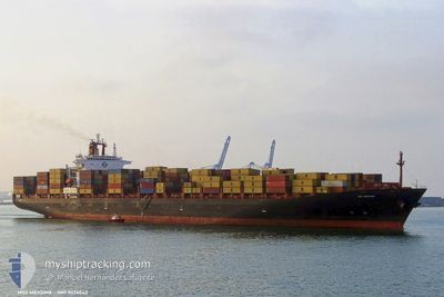
MSC POLARIS
Container Ship
Current Trip
| Time Travelled | 21 h, 38 mins |
|---|---|
| Remaining Time | 3 days |
| Distance Travelled | 366.16 nm |
| Remaining Distance | 1442.21 nm |
| AVG Speed | 16.9 Knopen |
| MAX Speed | 18 Knopen |
| AVG Wind | 7.3 knots |
| MAX Wind | 11.9 knots |
| MIN Temp | 21.5°C / 70.7°F |
| MAX Temp | 23.1°C / 73.58°F |
| Diepgang | 12.4 M |
| Positie ontvangen | 1 m geleden |
Current Position
| Lengtegraad | 28.96591° |
|---|---|
| Breedtegraat | 35.24277° |
| Status | Under way using engine |
| Snelheid | 17.9 Knopen |
| Koers | 269.9° |
| Gebied | Mediterranean Sea - Eastern Basin |
| Station | T-AIS |
| Positie ontvangen | 1 m geleden |
Info
Information
The current position of MSC POLARIS is in Mediterranean Sea - Eastern Basin with coordinates 35.24277° / 28.96591° as reported on 2024-05-22 02:13 by AIS to our vessel tracker app. The vessel's current speed is 17.9 Knopen and is heading at the port of VALENCIA. The estimated time of arrival as calculated by MyShipTracking vessel tracking app is 2024-05-25 12:09 LT
The vessel MSC POLARIS (IMO: 9074042, MMSI: 636016066) is a Container Ship that was built in 1995 ( 29 Jaar oud ). It's sailing under the flag of [LR] Liberia.
In this page you can find informations about the vessels current position, last detected port calls, and current voyage information. If the vessels is not in coverage by AIS you will find the latest position.
The current position of MSC POLARIS is detected by our AIS receivers and we are not responsible for the reliability of the data. The last position was recorded while the vessel was in Coverage by the Ais receivers of our vessel tracking app.
The current draught of MSC POLARIS as reported by AIS is 12.4 meters
Weather
| Temperature | 21.5°C / 70.7°F |
|---|---|
| Wind Speed | 10 knots |
| Direction | 276° W |
| Pressure | 1009.5 hPa |
| Humidity | 82.2 % |
| Cloud Coverage | 100 % |
Featured Company
Last Port Calls
| Port | Arrival | Departure | Time In Port |
|---|---|---|---|
| 2024-05-19 16:23 | 2024-05-21 04:36 | 1 d | |
| 2024-05-18 14:44 | 2024-05-19 09:52 | 19 h | |
| 2024-05-17 13:48 | 2024-05-17 17:12 | 3 h | |
| 2024-05-17 11:18 | 2024-05-17 12:01 | 43 m | |
| 2024-05-17 10:47 | 2024-05-17 11:10 | 23 m | |
| 2024-05-16 06:21 | 2024-05-17 08:29 | 1 d | |
| 2024-05-12 11:53 | 2024-05-13 13:55 | 1 d | |
| 2024-05-09 13:09 | 2024-05-10 00:40 | 11 h | |
| 2024-04-30 01:22 | 2024-04-30 15:54 | 14 h | |
| 2024-04-27 03:16 | 2024-04-28 07:44 | 1 d |
Most Visited Ports (Last year)
| Port | Arrivals | |
|---|---|---|
| 5 | ||
| 4 | ||
| 3 | ||
| 2 | ||
| 2 | ||
| 2 |
Last Trips
| Origin | Departure | Destination | Arrival | Distance | |
|---|---|---|---|---|---|
| 2024-05-19 12:52 | 2024-05-19 19:23 | 97.51 nm | |||
| 2024-05-17 19:12 | 2024-05-18 17:44 | 848.40 nm | |||
| 2024-05-17 14:01 | 2024-05-17 15:48 | 22.10 nm | |||
| 2024-05-17 13:10 | 2024-05-17 13:18 | 2.78 nm | |||
| 2024-05-17 10:29 | 2024-05-17 12:47 | 58.34 nm | |||
| 2024-05-13 15:55 | 2024-05-16 08:21 | 947.33 nm | |||
| 2024-05-10 02:40 | 2024-05-12 13:53 | 632.82 nm | |||
| 2024-04-30 15:54 | 2024-05-09 15:09 | 3478.43 nm | |||
| 2024-04-28 07:44 | 2024-04-30 01:22 | 391.32 nm | |||
| 2024-04-10 08:01 | 2024-04-27 03:16 | 5379.36 nm |
Events
| Tijd | Evenement | Details | Positie / Bestemming | Info |
|---|---|---|---|---|
| 2024-05-21 23:02 | Wijzig zee gebeid | Greek part of the Mediterranean Sea - Eastern Basin Turkish part of the Mediterranean Sea - Eastern Basin |
35.24730 / 30.10536
Mediterranean Sea - Eastern Basin
ESVLC
|
Snelheid: 17.9 kn Koers: 270.6° |
| 2024-05-21 20:41 | Wijzig zee gebeid | Turkish part of the Mediterranean Sea - Eastern Basin Cypriote part of the Mediterranean Sea - Eastern Basin |
35.23695 / 30.95645
Mediterranean Sea - Eastern Basin
ESVLC
|
Snelheid: 17.2 kn Koers: 270° |
| 2024-05-21 17:22 | Status Changed | Under way using engine Default |
35.39337 / 32.09674
ESVLC
|
Snelheid: 17 kn Koers: 250° |
| 2024-05-21 17:19 | Status Changed | Default Under way using engine |
35.39667 / 32.11167
ESVLC
|
Snelheid: 17.2 kn Koers: 250.4° |
| 2024-05-21 13:56 | Wijzig zee gebeid | Cypriote part of the Mediterranean Sea - Eastern Basin Turkish part of the Mediterranean Sea - Eastern Basin |
35.71713 / 33.23040
Mediterranean Sea - Eastern Basin
ESVLC
|
Snelheid: 17.2 kn Koers: 250° |
| 2024-05-21 12:32 | ETA Changed | 2024/05/25 14:00 2024/05/26 04:00 |
35.85439 / 33.69340
ESVLC
|
Snelheid: 17.3 kn Koers: 251.5° |
| 2024-05-21 10:17 | Wijzig zee gebeid | Turkish part of the Mediterranean Sea - Eastern Basin Cypriote part of the Mediterranean Sea - Eastern Basin |
36.06008 / 34.43655
Mediterranean Sea - Eastern Basin
ESVLC
|
Snelheid: 16.4 kn Koers: 262.5° |
| 2024-05-21 09:02 | Gevonden in zee | Cypriote part of the Mediterranean Sea - Eastern Basin |
36.18153 / 34.83073
Mediterranean Sea - Eastern Basin
ESVLC
|
Snelheid: 16.7 kn Koers: 249.7° |
| 2024-05-21 05:58 | Draught Changed | 12.4 10.8 |
36.51110 / 35.76721
ESVLC
|
Snelheid: 16.3 kn Koers: 230.5° |
| 2024-05-21 05:39 | Status Changed | Under way using engine Default |
36.56553 / 35.85149
ESVLC
|
Snelheid: 16.5 kn Koers: 232° |