
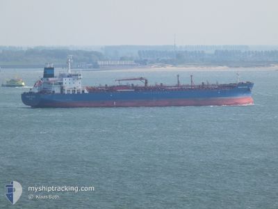
SUNNY APATITE
Tanker
Current Trip
| Time Travelled | 16 days |
|---|---|
| Remaining Time | --- |
| Distance Travelled | 3428.75 nm |
| Remaining Distance | 3.59 nm |
| AVG Speed | 11.3 Knopen |
| MAX Speed | 15.1 Knopen |
| AVG Wind | 10.6 knots |
| MAX Wind | 31.9 knots |
| MIN Temp | 14.8°C / 58.64°F |
| MAX Temp | 30.5°C / 86.9°F |
| Diepgang | 8.6 M |
| Positie ontvangen | Nu |
Current Position
| Lengtegraad | 103.90105° |
|---|---|
| Breedtegraat | 1.25945° |
| Status | At anchor |
| Snelheid | 0.1 Knopen |
| Koers | 132° |
| Gebied | Singapore Strait |
| Station | T-AIS |
| Positie ontvangen | Nu |
Info
Information
The current position of SUNNY APATITE is in Singapore Strait with coordinates 1.25945° / 103.90105° as reported on 2024-05-19 01:02 by AIS to our vessel tracker app. The vessel's current speed is 0.1 Knopen and is heading at the port of SINGAPORE. The estimated time of arrival as calculated by MyShipTracking vessel tracking app is 2024-05-18 21:00 LT
The vessel SUNNY APATITE (IMO: 9721891, MMSI: 538005806) is a Tanker It's sailing under the flag of [MH] Marshall Is.
In this page you can find informations about the vessels current position, last detected port calls, and current voyage information. If the vessels is not in coverage by AIS you will find the latest position.
The current position of SUNNY APATITE is detected by our AIS receivers and we are not responsible for the reliability of the data. The last position was recorded while the vessel was in Coverage by the Ais receivers of our vessel tracking app.
The current draught of SUNNY APATITE as reported by AIS is 8.6 meters
Weather
| Temperature | 29.2°C / 84.56°F |
|---|---|
| Wind Speed | 7 knots |
| Direction | 161° SSE |
| Pressure | 1007.8 hPa |
| Humidity | 76.6 % |
| Cloud Coverage | 99 % |
Featured Company
Last Port Calls
| Port | Arrival | Departure | Time In Port |
|---|---|---|---|
| 2024-05-01 09:50 | 2024-05-03 09:15 | 1 d | |
| 2024-04-23 15:58 | 2024-04-25 04:54 | 1 d | |
| 2024-04-12 21:39 | 2024-04-15 04:22 | 2 d | |
| 2024-03-01 19:44 |
Most Visited Ports (Last year)
| Port | Arrivals | |
|---|---|---|
| 3 | ||
| 2 | ||
| 1 | ||
| 1 | ||
| 1 | ||
| 1 |
Last Trips
| Origin | Departure | Destination | Arrival | Distance | |
|---|---|---|---|---|---|
| 2024-04-25 04:54 | 2024-05-01 09:50 | 1139.97 nm | |||
| 2024-04-15 04:22 | 2024-04-23 15:58 | 2673.92 nm | |||
| 2024-03-01 19:44 | 2024-04-12 21:39 | 7170.17 nm |
Events
| Tijd | Evenement | Details | Positie / Bestemming | Info |
|---|---|---|---|---|
| 2024-05-18 16:05 | Stop beweging | 2.82 nm, East of SINGAPORE |
1.25897 / 103.90147
SINGAPORE
|
Snelheid: 0.2 kn Koers: 159° |
| 2024-05-18 16:01 | Status Changed | At anchor Under way using engine |
1.25959 / 103.90169
SINGAPORE
|
Snelheid: 1 kn Koers: 176° |
| 2024-05-18 16:00 | Status Changed | Under way using engine At anchor |
1.25985 / 103.90179
SINGAPORE
|
Snelheid: 0.7 kn Koers: 173° |
| 2024-05-18 16:00 | Status Changed | At anchor Under way using engine |
1.25956 / 103.90169
SINGAPORE
|
Snelheid: 1 kn Koers: 178° |
| 2024-05-18 16:00 | Status Changed | Under way using engine At anchor |
1.25994 / 103.90182
SINGAPORE
|
Snelheid: 0.9 kn Koers: 173° |
| 2024-05-18 16:00 | Status Changed | At anchor Under way using engine |
1.25967 / 103.90172
SINGAPORE
|
Snelheid: 1 kn Koers: 176° |
| 2024-05-18 14:07 | Wijzig zee gebeid | Singaporean part of the Singapore Strait Malaysian part of the Singapore Strait |
1.27672 / 104.05981
Singapore Strait
SINGAPORE
|
Snelheid: 5 kn Koers: 263.1° |
| 2024-05-18 13:17 | Draught Changed | 8.6 8 |
1.28453 / 104.18340
SINGAPORE
|
Snelheid: 7.2 kn Koers: 268.7° |
| 2024-05-18 13:17 | Destination Changed | SINGAPORE ZINGJIAGANG |
1.28453 / 104.18340
SINGAPORE
|
Snelheid: 7.2 kn Koers: 268.7° |
| 2024-05-18 13:17 | ETA Changed | 2024/05/18 13:00 2024/05/07 03:00 |
1.28453 / 104.18340
SINGAPORE
|
Snelheid: 7.2 kn Koers: 268.7° |